Opeongo River Provincial Park
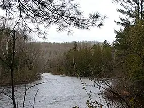
Opeongo River Provincial Park is a waterway park in Nipissing District in northeastern Ontario, Canada.[1] It incorporates those portions of the Opeongo River from its exit from Algonquin Provincial Park to the river's mouth at the Madawaska River, except for a small portion around Victoria Lake. The park has two access points: from Ontario Highway 60 west of the community of Madawaska; and the Shall Lake access point, north of Victoria Lake, in Algonquin Provincial Park.
| Opeongo River Provincial Park | |
|---|---|
 | |
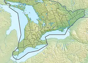
 Location of Opeongo River Provincial Park in Ontario | |
| Location | Nipissing District, Ontario, Canada |
| Nearest town | Barry's Bay |
| Coordinates | 45°34′54″N 77°53′39″W[1] |
| Area | 955.00 ha (2,359.9 acres)[2] |
| Designation | Waterway |
| Established | 1985 |
| Governing body | Ontario Parks |
| Website | www |
As a non-operating park, there are no facilities or services. The park can be used for recreational activities such as canoeing, hiking, swimming, and hunting.[2]
References
- "Opeongo River Provincial Park". Geographical Names Data Base. Natural Resources Canada. Retrieved 2011-08-08.
- "Opeongo River". www.ontarioparks.com. Ontario Parks. Retrieved 16 October 2022.
Sources
- McMurtrie, Jeffrey (2008). "Algonquin Provincial Park and the Haliburton Highlands". Wikimedia Commons. Archived from the original on 2011-06-29. Retrieved 2011-08-08.
- Map 9 (PDF) (Map). 1 : 700,000. Official road map of Ontario. Ministry of Transportation of Ontario. 2010-01-01. Retrieved 2011-08-08.
This article is issued from Wikipedia. The text is licensed under Creative Commons - Attribution - Sharealike. Additional terms may apply for the media files.
