Oud-Aa
Oud-Aa is a hamlet in the Dutch province of Utrecht (province). It is a part of the municipality of Stichtse Vecht, and lies about 13 km northeast of Woerden.
Oud-Aa | |
|---|---|
Hamlet | |
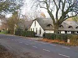 Farm in Oud-AA | |
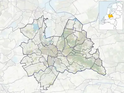 Oud-Aa Location in the Netherlands  Oud-Aa Oud-Aa (Netherlands) | |
| Coordinates: 52°10′48″N 4°58′19″E | |
| Country | Netherlands |
| Province | Utrecht |
| Municipality | Stichtse Vecht |
| Area | |
| • Total | 3.24 km2 (1.25 sq mi) |
| Population (2021)[1] | |
| • Total | 135 |
| • Density | 42/km2 (110/sq mi) |
| Time zone | UTC+1 (CET) |
| • Summer (DST) | UTC+2 (CEST) |
| Postal code | 3621[1] |
| Dialing code | 0346 |
The hamlet was first mentioned in 1138 as "juxta lacum qui vocatur A" (translation: Next to the lake called A), and refers to the Aa River which is a tributary of the Angstel River. Oud (old) has been added to distinguish from Nieuwer-Ter-Aa.[2] The postal authorities have placed it under Breukelen,[3] and there are no place name signs. The castle Ruwiel was located in Oud-Aa, however it was destroyed in 1673 by the French, and now contains a farm. In 1840, it was home to 315 people.[4] There also was a local former municipality called Ruwiel.
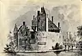 Former Ruwiel Castle seen from the east, 1646-1647
_-_Breukelerwaardsche_Polder_met_kasteelrestant_Ruwiel_en_Klein_Ruwiel.jpg.webp) 1865 map of Oud Aa with castle remains
1865 map of Oud Aa with castle remains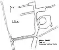 Sketch map of the former Ruwiel Castle islet, 2022
 Former Ruwiel Castle islet seen from the southwest, 2022
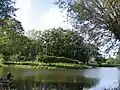 Former Ruwiel Castle islet seen from the southeast, 2022
References
- "Kerncijfers wijken en buurten 2021". Central Bureau of Statistics. Retrieved 27 March 2022.
- "Oud-Aa - (geografische naam)". Etymologiebank (in Dutch). Retrieved 27 March 2022.
- "Postcode 3621 in Breukelen". Postcode bij adres (in Dutch). Retrieved 27 March 2022.
- "Oud-Aa". Plaatsengids (in Dutch). Retrieved 27 March 2022.
Wikimedia Commons has media related to Oud-Aa.
This article is issued from Wikipedia. The text is licensed under Creative Commons - Attribution - Sharealike. Additional terms may apply for the media files.