Oviston
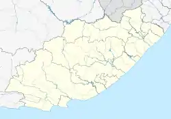
Oviston is a settlement in Walter Sisulu Local Municipality in Joe Gqabi District Municipality in the Eastern Cape province of South Africa.
Oviston | |
|---|---|
 Oviston  Oviston | |
| Coordinates: 30.683°S 25.766°E | |
| Country | South Africa |
| Province | Eastern Cape |
| District | Joe Gqabi |
| Municipality | Walter Sisulu |
| Area | |
| • Total | 4.15 km2 (1.60 sq mi) |
| Elevation | 1,300 m (4,300 ft) |
| Population (2011)[1] | |
| • Total | 636 |
| • Density | 150/km2 (400/sq mi) |
| Racial makeup (2011) | |
| • Black African | 14.6% |
| • Coloured | 46.7% |
| • White | 38.7% |
| First languages (2011) | |
| • Afrikaans | 72.8% |
| • English | 15.6% |
| • Xhosa | 7.6% |
| • Sotho | 2.2% |
| • Other | 1.9% |
| Time zone | UTC+2 (SAST) |
| Postal code (street) | 9798 |
Township 8 km north of Venterstad, on the southern bank of the Gariep Dam. It was established in 1964-65 to accommodate workers on the Orange-Fish River Tunnel. The name is derived from the Afrikaans Oranje-Vis-tonnel, ‘Orange-Fish Tunnel’, near the entrance to which it is situated.[2]
See also
References
- "Sub Place Oviston". Census 2011.
- Raper, Peter E. (1989). Dictionary of Southern African Place Names (2nd ed.). Johannesburg, South Africa: Jonathan Ball Publishers. p. 356. ISBN 0947042067.
This article is issued from Wikipedia. The text is licensed under Creative Commons - Attribution - Sharealike. Additional terms may apply for the media files.
.svg.png.webp)