Papaioea
Papaioea is a suburb of Palmerston North on New Zealand's North Island.
Papaioea | |
|---|---|
 Palmerston North Hospital | |
| Coordinates: 40.3479°S 175.622°E | |
| Country | New Zealand |
| City | Palmerston North |
| Local authority | Palmerston North City Council |
| Electoral ward |
|
| Area | |
| • Land | 248 ha (613 acres) |
| Population (June 2022)[2] | |
| • Total | 7,500 |
| Hospital(s) | Palmerston North Hospital |
| Cloverlea | Milson | Roslyn |
| Takaro |
|
Terrace End |
| Palmerston North Central | Hokowhitu |
Its name comes from the name of the original settlement in a clearing in forest which was purchased from local Māori (Ngāti Rangitāne) in 1864. The name was used to describe Palmerston North also. Somewhat later, the name had become forgotten with the transliteration of Pamutana being preferred (especially by the Native Land Court).[3]
The name Papaioea did not resurface until the 1920s, and is sometimes used to refer to Palmerston North as a whole.
Papaioea has many shops, food outlets and supermarkets, including Terrace End Shopping Centre (Broadtop) on Broadway Avenue. There are real estate agencies, a veterinarian clinic, medical clinics and several churches, including Broadway Methodist Church.
Aorangi Hospital, formerly known as Mercy Hospital, was a private hospital in the northwest of the suburb. It has since been demolished, with services moved to Crest Hospital in nearby Carroll Street. The site is now occupied by Broadway Radiology who occupy a new, modern building.
Horizons Regional Council office is also located in Papaioea.
Papaioea Park is located in the north of the suburb.[4] It is used as a football ground and cricket ground by lower club grades, and is walled on the Featherston Street and Ruahine Street boundary.[5]
Palmerston North Borough Council decided to reserve land for the park in the 1920s They chose the name Papaioea to commemorate the original settlement in the area. There was a spelling mistake and the name was spelt "Papaeoia". This was not corrected until the 1970s.[6]
The first stage of a new social housing development opened in the area in 2019.[7] Palmerston North City Council applied for Government funding for a second stage of the project during the coronavirus pandemic in 2020.[8]
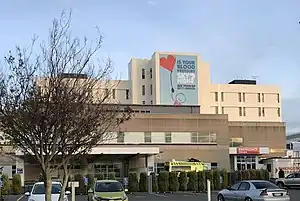
The Palmerston North Hospital area is identified as a separate area by Statistics New Zealand. On the southern side of Tremaine Avenue is a predominantly suburban area, with tree lined streets and avenues. The north side of Tremaine Avenue is dominated by commercial and industrial businesses. Features in the area include Arohanui Hospice, the Northern Bowling Club, Rimu Lodge Rest Home, Willard Rest Home, and Wahikoa Park.[9]
Demographics
Papaioea covers 2.48 km2 (0.96 sq mi)[1] and had an estimated population of 7,500 as of June 2022,[2] with a population density of 3,024 people per km2.
| Year | Pop. | ±% p.a. |
|---|---|---|
| 2006 | 6,783 | — |
| 2013 | 6,579 | −0.44% |
| 2018 | 7,020 | +1.31% |
| Source: [10] | ||
Papaioea had a population of 7,020 at the 2018 New Zealand census, an increase of 441 people (6.7%) since the 2013 census, and an increase of 237 people (3.5%) since the 2006 census. There were 2,913 households, comprising 3,348 males and 3,678 females, giving a sex ratio of 0.91 males per female, with 1,107 people (15.8%) aged under 15 years, 1,842 (26.2%) aged 15 to 29, 2,838 (40.4%) aged 30 to 64, and 1,236 (17.6%) aged 65 or older.
Ethnicities were 74.2% European/Pākehā, 15.5% Māori, 3.4% Pacific peoples, 16.1% Asian, and 2.9% other ethnicities. People may identify with more than one ethnicity.
The percentage of people born overseas was 23.2, compared with 27.1% nationally.
Although some people chose not to answer the census's question about religious affiliation, 47.0% had no religion, 36.0% were Christian, 1.0% had Māori religious beliefs, 2.5% were Hindu, 2.0% were Muslim, 1.2% were Buddhist and 3.0% had other religions.
Of those at least 15 years old, 1,500 (25.4%) people had a bachelor's or higher degree, and 1,011 (17.1%) people had no formal qualifications. 810 people (13.7%) earned over $70,000 compared to 17.2% nationally. The employment status of those at least 15 was that 2,667 (45.1%) people were employed full-time, 831 (14.1%) were part-time, and 306 (5.2%) were unemployed.[10]
| Name | Area (km2) | Population | Density (per km2) | Households | Median age | Median income |
|---|---|---|---|---|---|---|
| Palmerston North Hospital | 1.07 | 2,562 | 2,394 | 975 | 37.0 years | $35,000[11] |
| Papaioea North | 0.80 | 2,511 | 3,139 | 1,053 | 37.7 years | $24,400[12] |
| Papaioea South | 0.60 | 1,947 | 3,245 | 885 | 33.0 years | $24,400[13] |
| New Zealand | 37.4 years | $31,800 |
Education
Russell Street School is a co-educational state primary school for Year 1 to 6 students,[14][15] with a roll of 330 as of April 2023.[16]
Palmerston North Boys' High School and Queen Elizabeth College are also located in the area.
References
- "ArcGIS Web Application". statsnz.maps.arcgis.com. Retrieved 20 April 2023.
- "Population estimate tables - NZ.Stat". Statistics New Zealand. Retrieved 25 October 2022.
- "Palmerston North". nzhistory.govt.nz. Ministry for Culture and Heritage.
- "Papaioea". pncc.govt.nz. Palmerston North City Council.
- "Papaioea Park". pncc.govt.nz. Palmerston North City Council.
- "Papaioea Park".
- "Thirty new social housing units for Papaioea Place tenants". Palmerston North City Council. 1 March 2019.
- Rankin, James (19 April 2020). "Palmerston North applies for nearly $125m for projects". stuff.co.nz. Manawatu Standard.
- "Palmerston North Hospital Community Profile(published)". Archived from the original on 4 March 2016. Retrieved 18 March 2021.
- "Statistical area 1 dataset for 2018 Census". Statistics New Zealand. March 2020. Palmerston North Hospital (229800), Papaioea North (230500) and Papaioea South (231000).
- 2018 Census place summary: Palmerston North Hospital
- 2018 Census place summary: Papaioea North
- 2018 Census place summary: Papaioea South
- "Russell Street School Official School Website". russellst.school.nz.
- "Russell Street School Ministry of Education School Profile". educationcounts.govt.nz. Ministry of Education.
- "Russell Street School Education Review Office Report". ero.govt.nz. Education Review Office.