Palsana, Rajasthan
Palsana is a Town located in the Sikar District region of Rajasthan state in India. It is 84 km away from Jaipur, 350 km from Jodhpur 245 km from Bikaner and 250 km from Delhi.
Palsana | |
|---|---|
Town | |
| Nickname: Palsana | |
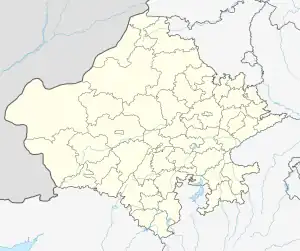 Palsana Location in Rajasthan, India  Palsana Palsana (India) | |
| Coordinates: 27.5121433°N 75.3260324°E | |
| Country | |
| State | Rajasthan |
| District | Sikar |
| Named for | Bijarniya's |
| Population (2011) | |
| • Total | 13,186 |
| Languages | |
| • Official | Hindi |
| • Regional | Rajasthani |
| • Other | Rajasthani, Hindi |
| Religion | |
| Time zone | UTC+5:30 (IST) |
| PIN | 332402 |
| Telephone code | 91-1576 |
| Vehicle registration | RJ-23 |
| Climate | Köppen climate classification (Köppen) |
Geography and Climate
Geography
Palsana is the Panchayat Samiti of Dantaramgarh Tahsil of Sikar district which is situated in the eastern part of Rajasthan. It is located at 27.5121433°N 75.3260324°E.[1] It has an average elevation of 427 metres (1401 feet).
Climate
Palsana has a hot semi-arid climate (Köppen climate classification BSh) climate, rains occur in the monsoon months between June and September. Temperatures remain relatively high throughout the year, with the summer months of April to July having average daily temperatures of around 30 °C (86 °F). The maximum temperatures during the months of May & June can reach close to 50 °C (122 °F) with little to no humidity. During the monsoon there are frequent, heavy rains and thunderstorms, but flooding is not common. The winter months of November to February are mild and pleasant, with average temperatures ranging from 15–18 °C (59–64 °F) and with little or no humidity. There are however occasional cold fronts that lead to temperatures near freezing.
| Palsana | ||||||||||||||||||||||||||||||||||||||||||||||||||||||||||||
|---|---|---|---|---|---|---|---|---|---|---|---|---|---|---|---|---|---|---|---|---|---|---|---|---|---|---|---|---|---|---|---|---|---|---|---|---|---|---|---|---|---|---|---|---|---|---|---|---|---|---|---|---|---|---|---|---|---|---|---|---|
| Climate chart (explanation) | ||||||||||||||||||||||||||||||||||||||||||||||||||||||||||||
| ||||||||||||||||||||||||||||||||||||||||||||||||||||||||||||
| ||||||||||||||||||||||||||||||||||||||||||||||||||||||||||||
Place of Interest
- SURAJ Smart School, Palsana
- Sri Digamber Jain Bada Mandir, Bawari Gate
- Shakambhari Mata Hills and Temple
- Khandela Vaishya Dham
- Madho Niwas Kothi
- Diwan Ji ki Haveli
- Shobhagyavati mandir
- Saras Dairy
- Mata Mansa Devi Temple, Hasampur
- Desi Tatt Bhojnalay,
Administration
Palsana city is governed by Municipal Corporation which comes under Sikar Rural Agglomeration.
Transport
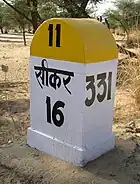 Kilometre sign „Sikar 16 km“ |
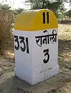 Kilometre sign „Ranoli 3 km" |
Rail
Palsana comes under the territory of Northern Western Railway, and is served by Palsana railway station. As of now Palsana city is well connected through broad gauge railway line section to, Jaipur, Loharu, Rewari, Churu, Jhunjhunu.
Road
Palsana is well connected by roads from all the major cities of Rajasthan. One National highway NH-52 passes through center of city. NH-52 connects Sikar to Jaipur, Kaithal and Bikaner. The western freight corridor will also pass from sikar. which the main project of central government. Kotputali Kuchaman Megahighway is also passing through Palsana.
Air
The nearest airport to Palsana town is Jaipur International Airport, which operate daily flights to Delhi, Mumbai, Hyderabad, Bangalore, Pune, Indore, Ahmedabad, Chennai, Guwahati, Kolkata, Udaipur, Dubai, Sharjah, Muscat. A new airport is proposed at Shahpura (a town in Jaipur district) that is very near to Sikar. Beside that, a small Air strip at Tarpura village is also available for Small Private Planes Landing (against payment).
References
- "Falling Rain Genomics, Inc – Palsana". Fallingrain.com. Retrieved 29 December 2011.