Patuxent Wildlife Research Center
The Patuxent Wildlife Research Center is a biological research center in Maryland. It is one of 17 research centers in the United States run by the U.S. Geological Survey (USGS). The center is located on the grounds of the 12,841-acre (51.97 km2) Patuxent Research Refuge, managed by the U.S. Fish and Wildlife Service. This is the only National Wildlife Refuge in the United States that has an objective of supporting wildlife research.[1]
| Patuxent Wildlife Research Center | |
|---|---|
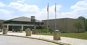 National Wildlife Visitor Center
10901 Scarlet Tanager Loop Laurel, MD 20708 | |
 Map of the United States 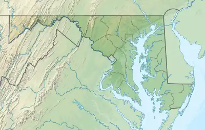 Map of Maryland | |
| Location | Prince George's County, Maryland, United States |
| Nearest city | Laurel, Maryland |
| Coordinates | 39°01′35″N 76°47′56″W |
| Governing body | U.S. Geological Survey |
| Website | Patuxent Wildlife Research Center |
Mission
Since its establishment in 1936 as the first wildlife experiment station[2] in the United States, the Patuxent Wildlife Research Center has been responsible for wildlife and applied environmental research, for transmitting research findings to those responsible for managing the United States' natural resources, and for providing technical assistance in implementing research findings to improve natural resource management.
Patuxent's scientists have been responsible for advances in natural resource conservation, especially in such areas as migratory birds, national monitoring programs for amphibians and birds, wildlife population analysis, waterfowl harvest, habitat management, wetlands, coastal zone and flood plain management, contaminants, endangered species, urban wildlife, ecosystem management and management of national parks and national wildlife refuges.
The Center develops and manages national inventory and monitoring programs[3] and is responsible for the North American Bird Banding Program and leadership of other national bird monitoring programs.[3] The Center's scientific and technical assistance publications, wildlife databases, and electronic media are used nationally and worldwide in managing biological resources.
The center is a federal research facility which supports programs in the United States Department of the Interior. The USGS Biological Resources Division, which the Center is a part of, works with others to provide the information needed to manage the United States' biological resources.
The center also receives funds directly from agencies benefiting from its research and from other partner organizations, such as those co-located at its Laurel headquarters.
History

The land that now comprises the 12,841 acres (51.97 km2) of the Patuxent Research Refuge was mostly farmland from the colonial period through at least World War I. Landholders such as the Snowden and Duvall families owned substantial amounts of land during the colonial period and well through the 19th century. The legacy of the Snowden family[4] can still be found in two historic homes of the area, one of which (Snowden Hall) is on Patuxent Research Refuge property. In addition to these dwellings, there still exists 19 cemeteries between the center and Fort Meade whose headstones bear the inscriptions of both the Snowdens and Duvalls, in addition to lesser-known surnames such as the Woodwards, Donaldsons, and Waters families.[5]
Almost all of the 8,100 acres (33 km2) that makes up what is now called the "North Tract" area (the Patuxent River bisects the refuge into the North and Central/South Tracts) were transferred in 1991 from the Defense Department's Fort Meade landholdings. Long before the area became a densely wooded haven for wildlife amidst a heavily populated urban corridor, the old Duvall and Lemons Bridges linked Prince Georges and Anne Arundel Counties. The former still exists as a newer bridge rebuilt in the 1940s, whereas only cement posts along either side of the river offer any vestige Lemon's Bridge. Perhaps the most historic old road of all, which utilized Duvall Bridge, was the old Telegraph Road. It once linked Baltimore and Washington, and today it is still possible to see century-old telegraph poles along the road in both the Central and South Tracts.
In 1946, scientists found that DDT tests were killing wildlife in tree canopies and causing significant fish kills in the Patuxent River.[6]
In 1996, three women were murdered near the Patuxent Wildlife Research Center. One of the men involved, Dustin Higgs, was executed for the crime.[7]
In 2017, the Patuxent Wildlife Research Center ended its 51-year effort to breed and train whooping cranes for release, due to budget cuts by the administration of President Donald Trump. The flock of 75 birds moved to the International Crane Foundation and the Calgary Zoo for continued breeding.[8]
Fort Meade
Fort George G. Meade, an active Army base, is near the research center. In October 1991, 7,600 acres (31 km2) were transferred from the base to the Patuxent National Research Refuge; in January 1993, another 500 were transferred, as part of Defense Appropriation Bills for 1991 and 1992, respectively.[9]
A September 2007 environmental impact report described the expansion of Fort Meade, and particularly the proposed two additional 18-hole golf courses, as a "significant threat to the biological and territorial integrity of the Patuxent Research Refuge, a unique national interest in the forefront of scientific research and protection." In response, the Army said that it was taking steps to limit the environmental damage but that the golf courses were needed for "maintaining the quality of life for soldiers and their families."[10]
The historic golf course that had served as the centerpiece of Fort Meade since 1950 closed on May 1, 2012, and, as of June 2022, no new golf courses were under construction.[11][12]
References
- "Patuxent Research Refuge". United States Fish and Wildlife Service. Retrieved March 31, 2012.
- "Patuxent Wildlife Research Center - Science". U.S. Geological Survey. Retrieved December 13, 2022.
- "Patuxent Wildlife Research Center (PWRC)". Landscape Partnership. Retrieved December 13, 2022.
- "Snowden Hall | Laurel, MD 20708". Experience Prince George's. Prince George’s County, MD Conference & Visitors Bureau. Retrieved December 13, 2022.
- Schumacher, Mary L. (November 27, 1997). "Marking History's Sentiment: Search Reveals Patuxent Graveyards". The Washington Post.
- "D.D.T. TESTS HARMING FISH: Cause Heavy Mortality In Patuxent Refuge Area". The Baltimore Sun. June 25, 1946. ProQuest 542839907 – via ProQuest.
- Haynes, Danielle (January 16, 2021). "Trump administration executes its last death row inmate". United Press International. Retrieved January 16, 2021.
- Bulliard, Karin (September 18, 2017). "A 50-year effort to raise endangered whooping cranes comes to an end". The Washington Post. Archived from the original on December 5, 2022. Retrieved October 1, 2017.
- "Fort George G. Meade: Current Site Information". Environmental Protection Agency. Archived from the original on September 4, 2008. Retrieved January 24, 2008.
- Vogel, Steve (September 22, 2007). "U.S. Agency Assails Ft. Meade Plan: Impact Report Cites Concerns About Traffic and Environment". The Washington Post. Retrieved January 23, 2008.
- Brown, Matthew (March 1, 2012). "Fort Meade to close golf course after more than six decades of play". The Baltimore Sun. Archived from the original on June 25, 2021. Retrieved June 7, 2022.
- "Fort Meade's historic golf course set to close". Fort Meade Public Affairs Office. March 2, 2012. Retrieved June 7, 2022.