Paulinet
Paulinet (French pronunciation: [polinɛ]) is a commune in the Tarn department in southern France.
Paulinet | |
|---|---|
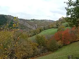 Gorge of Oulas and Castle Paulin | |
.svg.png.webp) Coat of arms | |
Location of Paulinet | |
 Paulinet  Paulinet | |
| Coordinates: 43°50′58″N 2°25′50″E | |
| Country | France |
| Region | Occitania |
| Department | Tarn |
| Arrondissement | Albi |
| Canton | Le Haut Dadou |
| Intercommunality | CC Monts d'Alban et Villefranchois |
| Government | |
| • Mayor (2020–2026) | Marie-José Escanez[1] |
| Area 1 | 73.75 km2 (28.48 sq mi) |
| Population | 541 |
| • Density | 7.3/km2 (19/sq mi) |
| Time zone | UTC+01:00 (CET) |
| • Summer (DST) | UTC+02:00 (CEST) |
| INSEE/Postal code | 81203 /81250 |
| Elevation | 360–704 m (1,181–2,310 ft) (avg. 654 m or 2,146 ft) |
| 1 French Land Register data, which excludes lakes, ponds, glaciers > 1 km2 (0.386 sq mi or 247 acres) and river estuaries. | |
Geography
The commune is traversed by the river Dadou. It is made of seven parishes and many smaller hamlets, eg. Connac, Le Masnau, Notre-Dame d'Ourtiguet, Paulin, Paulinet, Pommardelle, Ruèges, Saint-Jean-de-Jeannes, Terrabusset.
History
The commune was created as Paulin in 1790. It inherited the pre-Revolution community of Paulin boundaries. Many territorial adjustments occurred during the 19th century to remove enclaves and exclaves. In 1833, the westernmost part of the commune became an independent commune as Teillet. In 1897, the commune was renamed Paulinet.
See also
References
- "Répertoire national des élus: les maires" (in French). data.gouv.fr, Plateforme ouverte des données publiques françaises. 13 September 2022.
- "Populations légales 2020". The National Institute of Statistics and Economic Studies. 29 December 2022.
Wikimedia Commons has media related to Paulinet.
This article is issued from Wikipedia. The text is licensed under Creative Commons - Attribution - Sharealike. Additional terms may apply for the media files.