Pengyang County
Pengyang County (simplified Chinese: 彭阳县; traditional Chinese: 彭陽縣; pinyin: Péngyáng Xiàn, Xiao'erjing:پٍْيَانْ ثِيًا) is a county under the administration of the prefecture-level city of Guyuan in Ningxia Hui Autonomous Region of the People's Republic of China, bordering Gansu province to the due north, east, and south. It has a total area of 3,241 km2 (1,251 sq mi), and a population of approximately 250,000 people.
Pengyang
彭阳县 پٍْيَانْ ثِيًا | |
|---|---|
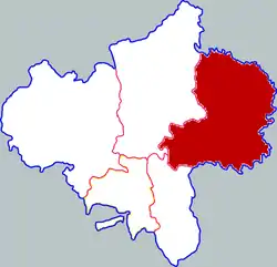 Pengyang in Guyuan | |
.png.webp) Guyuan in Ningxia | |
| Coordinates: 35°51′32″N 106°37′54″E | |
| Country | People's Republic of China |
| Autonomous region | Ningxia |
| Prefecture-level city | Guyuan |
| Area | |
| • Total | 2,533.49 km2 (978.19 sq mi) |
| Population | |
| • Total | 200,201 |
| • Density | 79/km2 (200/sq mi) |
| Time zone | UTC+8 (China Standard) |
Characteristics
Pengyang County is an agricultural county. Its primary agricultural product is wheat, but in recent years the county has also developed forestry. In this it is a model county for Ningxia Hui Autonomous Region. The county government is located in the town of Baiyang, and the county's postal code is 756500. There are Hui people and Han people living together in this county. The population in the whole county is about 250,000. The Hui Chinese Muslim population is 80,000. The average temperature is between 7.4°C to 8.5°C. It is a dry area and also one of the State poverty counties where some people are still in poverty. Because of the bad weather and inconvenient location, it always gets financial aid from government. Most of the local people are farmers. As a small county, Pengyang is famous for Red plum apricots, ChaoNa chicken, Linseed oil, and dry apricot. there is a different living style from other places because of Hui Chinese Muslim and Han Chinese life styles.
Administrative divisions
Pengyang County has 3 towns and 7 townships.
- 3 towns
- Baiyang (白阳镇, بَيْيَانْ)
- Gucheng (古城镇, قُچٍْ جٍ)
- Wangwa (王洼镇, وَانْوَا جٍ)
- 7 townships
- Jiaocha (交岔乡, ڭِيَوْچَا ثِيَانْ)
- Luowa (罗洼乡, لُوَوَا ثِيَانْ)
- Mengyuan (孟塬乡, مٍْيُوًا ثِيَانْ)
- Xiaocha (小岔乡, ثِيَوُچَا ثِيَانْ)
- Fengzhuang (冯庄乡, فٍْجُوَانْ ثِيَانْ)
- Chengyang (城阳乡, چٍْيَانْ ثِيَانْ)
- Xinji (新集乡, ثٍڭِ ثِيَانْ)
Climate
| Climate data for Pengyang (2007–2020 normals) | |||||||||||||
|---|---|---|---|---|---|---|---|---|---|---|---|---|---|
| Month | Jan | Feb | Mar | Apr | May | Jun | Jul | Aug | Sep | Oct | Nov | Dec | Year |
| Average high °C (°F) | 1.8 (35.2) |
5.5 (41.9) |
12.0 (53.6) |
18.4 (65.1) |
22.6 (72.7) |
26.0 (78.8) |
27.3 (81.1) |
25.6 (78.1) |
20.0 (68.0) |
15.2 (59.4) |
9.1 (48.4) |
3.6 (38.5) |
15.6 (60.1) |
| Daily mean °C (°F) | −6.4 (20.5) |
−2.5 (27.5) |
4.2 (39.6) |
10.5 (50.9) |
15.1 (59.2) |
19.2 (66.6) |
21.0 (69.8) |
19.6 (67.3) |
14.3 (57.7) |
8.3 (46.9) |
1.6 (34.9) |
−4.6 (23.7) |
8.4 (47.1) |
| Average low °C (°F) | −12.2 (10.0) |
−8.4 (16.9) |
−2.2 (28.0) |
3.2 (37.8) |
7.8 (46.0) |
12.4 (54.3) |
15.5 (59.9) |
14.8 (58.6) |
10.1 (50.2) |
3.4 (38.1) |
−3.5 (25.7) |
−10.2 (13.6) |
2.6 (36.6) |
| Average precipitation mm (inches) | 4.6 (0.18) |
7.6 (0.30) |
13.1 (0.52) |
30.9 (1.22) |
52.6 (2.07) |
58.1 (2.29) |
94.7 (3.73) |
108.2 (4.26) |
85.5 (3.37) |
37.2 (1.46) |
11.1 (0.44) |
1.6 (0.06) |
505.2 (19.9) |
| Average precipitation days (≥ 0.1 mm) | 4.4 | 4.9 | 6.2 | 6.9 | 8.4 | 9.4 | 11.9 | 12.0 | 12.2 | 9.6 | 5.0 | 1.8 | 92.7 |
| Average snowy days | 6.7 | 5.8 | 3.6 | 0.6 | 0 | 0 | 0 | 0 | 0 | 0.9 | 3.4 | 3.6 | 24.6 |
| Average relative humidity (%) | 56 | 58 | 55 | 51 | 55 | 61 | 69 | 74 | 79 | 75 | 67 | 59 | 63 |
| Mean monthly sunshine hours | 177.2 | 165.8 | 196.1 | 221.8 | 233.5 | 224.5 | 214.0 | 198.4 | 142.0 | 159.6 | 167.0 | 187.1 | 2,287 |
| Percent possible sunshine | 57 | 54 | 52 | 56 | 53 | 52 | 49 | 48 | 39 | 46 | 55 | 62 | 52 |
| Source: China Meteorological Administration[1][2] | |||||||||||||
References
- 中国气象数据网 – WeatherBk Data (in Simplified Chinese). China Meteorological Administration. Retrieved 26 August 2023.
- 中国气象数据网 (in Simplified Chinese). China Meteorological Administration. Retrieved 26 August 2023.