Pesisir Barat Regency
Pesisir Barat Regency (Indonesian: Kabupaten Pesisir Barat, literally West Coast Regency) is a regency in Lampung Province of Indonesia. It was created on 25 October 2012 from the eight western districts of West Lampung Regency.[2] It covers an area of 2,907.23 km2, and had a population of 141,741 at the 2010 Census[3] and 162,697 at the 2020 Census;[4] the official estimate as of mid-2022 was 164,816.[1] The administrative center is the town of Krui. The majority group in the Pesisir Barat Regency is the Lampung people.
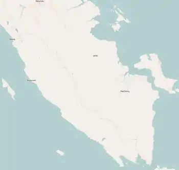
Pesisir Barat Regency
Kabupaten Pesisir Barat | |
|---|---|
 Coat of arms | |
| Motto(s): Helauni Kibaghong (Better together) | |
 Location within Lampung | |
| Coordinates: 5.1932°S 103.9398°E | |
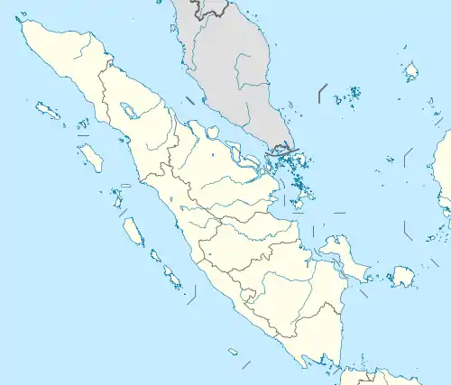
| Country | Indonesia |
| Region | Sumatra |
| Province | Lampung |
| Regency seat | Krui |
| Government | |
| • Regent | Agus Istiqlal |
| • Vice Regent | Zulqoini Syarif |
| Area | |
| • Total | 2,907.23 km2 (1,122.49 sq mi) |
| Population (mid 2022 estimate)[1] | |
| • Total | 164,816 |
| • Density | 57/km2 (150/sq mi) |
| Time zone | UTC+7 (IWST) |
| Area code | (+62) 728 |
| Website | pesisirbaratkab |

Administrative districts
In 2012 the new regency comprised eight districts (kecamatan) which until 2012 were part of the West Lampung Regency, but since 2012 three additional districts have been created in the northern half of the new regency out of parts of the existing districts - Krui Selatan (South Krui), Pulau Pisang (Pisang Island) and Way Krui. These are all listed below (from northwest to southeast) with their areas and their populations at the 2010 Census[3] and the 2020 Census,[4] together with the official estimates as of mid-2022.[1] The table also includes the locations of the district administrative centers, the number of villages in each section (a total of 116 rural desa and two urban kelurahan - both of the latter in Pesisir Tengah District), and its postcode.
| Name of District (kecamatan) | Area in km2 | Pop'n 2010 Census | Pop'n 2020 Census | Pop'n mid 2022 estimate | Admin centre | No. of villages | Post code |
|---|---|---|---|---|---|---|---|
| Lemong | 454.97 | 14,089 | 12,874 | 13,040 | Rata Agung | 15 | 34877 |
| Pesisir Utara (North Pesisir) | 84.27 | 9,332 | 8,463 | 8,570 | Pugung Tampak | 6 | 34876 |
| Pulau Pisang (Pisang Island) | 64.00 | (a) | 1,554 | 1,570 | Pekon Pasat | 12 | 34896 |
| Karya Penggawa | 62.46 | 13,986 | 15,651 | 15,860 | Way Nukak | 12 | 34878 |
| Way Krui | 40.92 | (b) | 8,775 | 8,890 | Gunung Kemala | 13 | 34898 |
| Pesisir Tengah (Central Pesisir) | 120.64 | 34,437 | 19,787 | 20,040 | Pasar Krui | 9 | 34894 |
| Krui Selatan (South Krui) | 36.25 | (b) | 10,583 | 10,720 | Way Napal | 9 | 34874 |
| Pesisir Selatan (South Pesisir) | 409.17 | 21,346 | 26,504 | 26,850 | Biha | 14 | 34875 |
| Ngambur | 110.01 | 17,580 | 21,809 | 22,090 | Negeri Ratu Ngambur | 10 | 34883 |
| Ngaras | 215.03 | 7,443 | 9,550 | 9,670 | Ngaras | 10 | 34888 |
| Bangkunat | 943.70 | 23,528 | 27,147 | 27,500 | Kota Jawa | 6 | 34887 |
| Totals | 2,907.23 | 141,741 | 162,697 | 164,816 | Pasar Krui | 118 |
Notes: (a) the 2010 population of the new Pulau Pisang District is included in the figure for Pesisir Utara District. The new Pulau Pisang District comprises the offshore island of the same name, adjacent to the coast of Karya Penggawa District. (b) the 2010 populations of the new Way Krui District and Krui Selatan District are included in the figure for Pesisir Tengah District.
History
Umpu Ratu Selalau Sanghyang Sangun Gukhu 21 Ramadhan 828 Mujarrad Rasulullah SAW up to 962 Hij, he was the figure of Mujahid Spreader of Islam Sultan Kepaksian Pernong Sekala Brak in Istana Gedung Dalom Batu Brak.[5]
Queen Umpu Selalau Shangyang Sangun Gukhu was buried in the cemetery of Tambak Bata; in one proof in the Krui Pesisir Barat Regency, the footprints were printed on a stone named Maqom Selalau and the boat during the meeting and conquered the ruler of Bunian Matu, Maqom then became a benchmark for the region, starting from always to the sugar cane bordering the Limau River Kingdom, which was a Kepaksian Nyerupa area, when starting from Maqom, it continued Suwoh, Tanggamus Regency, Lampung Selatan Regency and Batu Brak, which is the area of Kepaksian Pernong Sekala Brak.[6]
Pesisir Barat Regency was officially established in 2012 based on the Law of the Republik of Indonesia Number 22 of 2012 concerning the Establishment of West Coastal Regency in Lampung Province (State Gazette of the Republik of Indonesia 2012 Number 231 Supplement to State Gazette Number 5364).[7]
Before the birth of the West Coastal Regency based on the above law, the West Coastal Regency was still a region of the West Lampung Regency Government whose district capital was in Liwa.[7]
Airport
In early October 2011, the runway test was done, and the testers concluded that the airport was ready for operation. The airport is laid on 50 hectares of land with a 974-meter-long runway, an apron, taxiway, an administration building, and a 1,800-meter road leading to the airport. It is located at Seray village, Pesisir Tengah district. It hopes to boost tourism and precaution in cases of natural disasters.[8]
Dolphin conservation
In line with traditional wisdom, which prohibits people from catching dolphins, hundreds of dolphins surround Betuah Island and Banana Island, with a tendency to increase in number year by year.[9]
Tanjung Setia Beach
Tanjung Setia Beach faces the Indian Ocean, 273 kilometers from Bandar Lampung, and takes around 6 to 7 hours to drive. The waves are 6 to 7 meters high and 200 meters long from June to August every year, suitable for world surfers, and are categorized the same as Hawaii. Several kilometers from the beach are found blue marlin up to 70 kilograms (170 centimeters).[10]
References
- Badan Pusat Statistik, Jakarta, 2023, Kabupaten Pesisir Barat Dalam Angka 2023 (Katalog-BPS 1102001.1813)
- "Kumpulan Berita Harian News `Sabtu, 16 Januari 2016` | razia". Metrotvnews.com. 2014-09-29. Retrieved 2016-01-16.
- Biro Pusat Statistik, Jakarta, 2011.
- Badan Pusat Statistik, Jakarta, 2021.
- https://www.tribunnews.com/dpd-ri/2021/09/06/sampai-di-lampung-barat-ketua-dpd-ziarah-ke-makam-raja-raja-sekala-brak-kepaksian-pernong
- https://www.medianasional.id/sejarah-umpu-ratu-selalau-shangyang-sangun-gukhu/
- https://pesisirbaratkab.go.id/profil/sejarah-pesisir-barat
- "Island in focus: New airport ready to serve West Lampung". October 10, 2011.
- "SUARA MERDEKA CETAK - Pesona Ratusan Lumba-Lumba Lampung Barat". suaramerdeka.com. Archived from the original on 2011-07-18.
- "Pantai Tanjung Setia, Mutiara Tersembunyi di Lampung". March 9, 2012.
Regencies and cities of Lampung | ||
|---|---|---|
Capital: Bandar Lampung | ||
| Regencies | ||
| Cities | ||