Pettibone, Texas
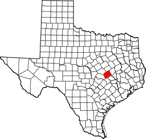
Pettibone is an unincorporated community in Milam County, Texas, United States.[1] According to the Handbook of Texas, the community had a population of 25 in 2000.
Pettibone, Texas | |
|---|---|
 Pettibone, Texas  Pettibone, Texas | |
| Coordinates: 30°51′00″N 97°04′51″W | |
| Country | United States |
| State | Texas |
| County | Milam |
| Elevation | 502 ft (153 m) |
| Time zone | UTC-6 (Central (CST)) |
| • Summer (DST) | UTC-5 (CDT) |
| Area code | 254 |
| GNIS feature ID | 1380348[1] |
History
Pettibone was a flag stop on the Gulf, Colorado and Santa Fe Railway, which built a track through the area in 1881. It was subsequently named for a railroad official. Its population was 30 in 1933 then went down to 25 from 1990 through 2000.[2]
Geography
Pettibone is located on U.S. Highway 190, 5 mi (8.0 km) west of Cameron, 20 mi (32 km) northwest of Rockdale, and 27 mi (43 km) southeast of Temple in west-central Milam County.[3]
It is also on Texas State Highway 36 and Farm to Market Road 486.
Education
Today, the community is served by the Cameron Independent School District.
References
- U.S. Geological Survey Geographic Names Information System: Pettibone, Texas
- Pettibone, TX from the Handbook of Texas Online
- "Pettibone, Texas". Texas Escapes Online Magazine. Retrieved September 18, 2023.
This article is issued from Wikipedia. The text is licensed under Creative Commons - Attribution - Sharealike. Additional terms may apply for the media files.
