Philpot, Kentucky
Philpot is an unincorporated community in Daviess County, in the U.S. state of Kentucky.
Philpot | |
|---|---|
| Country | United States |
| State | Kentucky |
| County | Daviess |
| Area | |
| • Total | 3.31 sq mi (8.57 km2) |
| • Land | 3.28 sq mi (8.51 km2) |
| • Water | 0.02 sq mi (0.06 km2) |
| Population (2020) | |
| • Total | 991 |
| • Density | 301.77/sq mi (116.51/km2) |
| Time zone | UTC-6 (Central (CST)) |
| • Summer (DST) | UTC-5 (CST) |
| FIPS code | 21-60654 |
| GNIS feature ID | 500543[2] |
History
A post office has been in operation under the name Philpot since the 1870s.[4] Philpot was named for Augustus J. Philpot, an early settler.[5]
Education
Philpot used to have an elementary school until it closed down in 2005. Since then, elementary school students from Philpot attend Country Heights Elementary School, which is located on Kentucky Route 54 at the easternmost reaches of Owensboro.
References
- "2020 U.S. Gazetteer Files". United States Census Bureau. Retrieved March 18, 2022.
- U.S. Geological Survey Geographic Names Information System: Philpot, Kentucky
- "Census of Population and Housing". Census.gov. Retrieved June 4, 2016.
- "Daviess County". Jim Forte Postal History. Retrieved January 25, 2015.
- Rennick, Robert M. (August 28, 2013). Kentucky Place Names. University Press of Kentucky. p. 409. ISBN 0-8131-4401-9.
Municipalities and communities of Daviess County, Kentucky, United States | ||
|---|---|---|
| Cities | 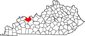 Location of Daviess County, Kentucky | |
| CDPs | ||
| Other communities | ||
| Footnotes | ‡This populated place also has portions in an adjacent county or counties | |
This article is issued from Wikipedia. The text is licensed under Creative Commons - Attribution - Sharealike. Additional terms may apply for the media files.