Phlapphla Chai district
Phlapphla Chai (Thai: พลับพลาชัย, pronounced [pʰláp.pʰlāː t͡ɕʰāj]) is a district (amphoe) of Buriram province, northeastern Thailand.
Phlapphla Chai
พลับพลาชัย | |
|---|---|
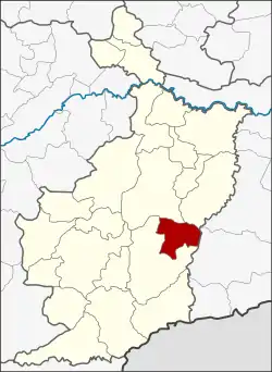
 District location in Buriram province | |
| Coordinates: 14°43′48″N 103°10′6″E | |
| Country | Thailand |
| Province | Buriram |
| Seat | Sadao |
| Area | |
| • Total | 320.1 km2 (123.6 sq mi) |
| Population (2005) | |
| • Total | 42,773 |
| • Density | 122.3/km2 (317/sq mi) |
| Time zone | UTC+7 (ICT) |
| Postal code | 31250 |
| Geocode | 3115 |
Geography
Neighbouring districts are (from the south clockwise) Prakhon Chai, Mueang Buriram, Krasang of Buriram Province and Prasat of Surin province.
History
The minor district (king amphoe) was created on 1 April 1989, when five tambons were split off from Prakhon Chai district.[1] It was upgraded to a full district on 4 July 1994.[2]
Administration
The district is divided into five sub-districts (tambons), which are further subdivided into 67 villages (mubans). Phlapphla Chai is a township (thesaban tambon) which covers parts of tambon Sadao. There are also five tambon administrative organizations (TAO).
| No. | Name | Thai name | Villages | Pop. | |
|---|---|---|---|---|---|
| 1. | Chan Dum | จันดุม | 18 | 10,421 | |
| 2. | Khok Khamin | โคกขมิ้น | 15 | 9,266 | |
| 3. | Pa Chan | ป่าชัน | 10 | 5,852 | |
| 4. | Sadao | สะเดา | 13 | 9,158 | |
| 5. | Samrong | สำโรง | 11 | 8,076 |
References
- ประกาศกระทรวงมหาดไทย เรื่อง แบ่งท้องที่อำเภอประโคนชัย จังหวัดบุรีรัมย์ ตั้งเป็นกิ่งอำเภอพลับพลาชัย (PDF). Royal Gazette (in Thai). 106 (40 ง): 1887. March 14, 1989. Archived from the original (PDF) on April 6, 2012.
- พระราชกฤษฎีกาตั้งอำเภอเปือยน้อย ... และอำเภอศรีวิไล พ.ศ. ๒๕๓๗ (PDF). Royal Gazette (in Thai). 111 (21 ก): 32–35. June 3, 1994. Archived from the original (PDF) on September 30, 2007.
This article is issued from Wikipedia. The text is licensed under Creative Commons - Attribution - Sharealike. Additional terms may apply for the media files.