Pind Dadan Khan
Pind Dadan Khan (P.D. Khan) is a historic city in Jhelum District, Punjab, Pakistan. It serves as the capital of Pind Dadan Khan Tehsil, an administrative subdivision within the district. The city is Founded by Raja Dadan Khan, a Khokhar Rajput.[1]
Pind Dadan Khan
پنڈ دادن خان | |
|---|---|
City | |
| Pind Dadan Khan | |
 Pind Dadan Khan  Pind Dadan Khan | |
| Coordinates: 32°35′18″N 73°2′41″E | |
| Country | Pakistan |
| Province | Punjab |
| District | Jhelum District |
| Government | |
| Population (2017 Census) | |
| • Total | 29,935 |
| Time zone | UTC+5 (PST) |
| Postal code | 49040 |
| Number of Union councils | 1 |
Location
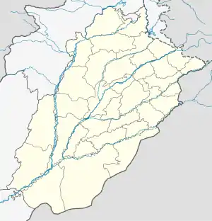
Pind Dadan Khan is situated at 32°35'16N 73°2'44E,[2] along the banks of the River Jhelum. It is approximately 24 kilometers east of the M2 motorway and 85 kilometers from the city of Jhelum. The city is also in close proximity to the famous Khewra Salt Mine and shares its borders with Khushab, Chakwal, Sargodha, and Mandi Bahauddin.
History
Pind Dadan Khan boasts a rich history that can be traced back to 326 BC when Alexander the Great and his troops camped in the vicinity of Jalalpur Sharif before their momentous battle with Raja Porus. During the reign of Maharaja Ranjit Singh, Pind Dadan Khan held significant importance, ranking as the second most important town after Amritsar and serving as the largest grain market in Western Punjab. However, the town gradually lost its former glory due to neglect and natural disasters.
During the British colonial period, Pind Dadan Khan served as the headquarters of the subdivision and tehsil of the same name within the Jhelum District of British Punjab. The municipality was established in 1867.[3] The city's income during this period was primarily derived from octroi.
In more recent history, the construction of the Mangla Dam to bolster the region's irrigation system, as part of the Indus Basin Project, has resulted in reduced water flow in the Jhelum River, except during the flood season.
Nandana, a village near Pind Dadan Khan, holds historical significance as the place where the renowned scholar Abu Rayhan Muhammad ibn Ahmad Al-Biruni established a laboratory. In this laboratory, Al-Biruni calculated the diameter of the Earth during his lifetime. However, this historic laboratory now requires attention from the government to preserve its legacy.
Education
Pind Dadan Khan has a significant educational presence, with government degree colleges for both boys and girls, a College of Technology offering three-year diploma courses, and various private colleges and schools. The literacy rate in the area is high, with almost 80% of the population being educated.
Healthcare
The city is home to a Tehsil Headquarter Hospital maintained by the Ministry of National Health Services, Regulation and Coordination. Additionally, several private hospitals provide a wide range of healthcare services to the community.
Economic Activities
Pind Dadan Khan's economy primarily relies on agriculture and salt production. The city is also home to two cement factories that play a pivotal role in the local economy.
Languages
The predominant language spoken in Pind Dadan Khan Tehsil is a Lahnda-based Punjabi dialect, influenced by various regional dialects such as Saraiki, Wanhari, Pothohari, and Lunhari.
Railway Station
Pind Dadan Khan railway station The city has its own railway station, offering affordable travel options. The railway passes over the iconic Victoria Bridge, traversing three districts in just one to two minutes.
