Orielton Lagoon
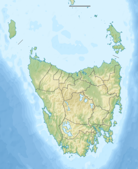
The Orielton Lagoon is a shallow dystrophic lagoon located west of Sorell in south east Tasmania, Australia.
| Orielton Lagoon | |
|---|---|
 Part of a flock of bar-tailed godwit at Orielton Lagoon | |
 Orielton Lagoon Location in Tasmania | |
| Location | South east Tasmania, Australia |
| Coordinates | 42°47′24″S 147°31′48″E |
| Type | Dystrophic lagoon |
| Basin countries | Australia |
| Designation |
|
| Surface area | 265 hectares (650 acres)[1] |
| Average depth | 1.3 metres (4 ft 3 in) |
| Official name | Pittwater-Orielton Lagoon |
| Designated | 16 November 1982 |
| Reference no. | 254[2] |
Description
The lagoon is 265 hectares (650 acres; 1.02 sq mi) in area and averages 1.3 metres (4 ft 3 in) in depth, separated from Pitt Water by the Sorell Causeway.[3] It is a Ramsar[4] Wetland, providing habitat for migratory shorebirds and regionally significant flora and fauna.[5] The lagoon is part of the South Arm Important Bird Area (IBA), identified as such by BirdLife International because of its importance for the conservation of pied oystercatchers and of the migratory waders, or shorebirds, of the East Asian – Australasian Flyway.[6]
See also
References
- "Australia's Ramsar Sites" (PDF). Department of the Environment. Australian Government. Retrieved 12 August 2015.
- "Pittwater-Orielton Lagoon". Ramsar Sites Information Service. Retrieved 25 April 2018.
- Davies, P. E.; Cook, L. S. J.; Sloane, T. (2006). "Orielton Lagoon: Changes in the benthic macroinvertebrate community between 1999 and 2005". University of Tasmania. Retrieved 31 July 2007.
- "Mosaic Map: NRM funded projects". Australian government. 2005. Retrieved 31 July 2007.
- "Tasmanian Coasts and Clean Seas Projects for 2000-2001" (PDF). Tasmanian Government. 2001. Archived from the original (PDF) on 29 September 2007. Retrieved 31 July 2007.
- "IBA: South Arm". Birdata. Birds Australia. Archived from the original on 19 July 2011. Retrieved 11 October 2011.
This article is issued from Wikipedia. The text is licensed under Creative Commons - Attribution - Sharealike. Additional terms may apply for the media files.