Platanorrevma
Platanorrevma (Greek: Πλατανόρρευμα) or even Platanórema is a village located alongside the Pierian Mountains and Polifytos artficial lake in Servia municipality, Kozani regional unit, in the Greek region of Macedonia. It was named Platanorevma because of the existence of plane trees and streams that crosses the village.
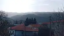
It is one of the biggest villages by population in the Servia Municipality and is 3 km (1.9 mi) away from Servia, 11 km (6.8 mi) from Velvendos and 31 km (19 mi) from the regional capital, Kozani. It situated at an altitude of 490 m (1,610 ft). It was created by the unification of three settlements, Ortaki that was in the same area and Palaiogratsano, Moschohori mountainous settlements of Pieria.[1]
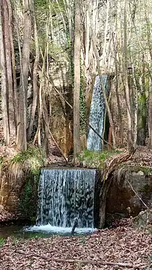
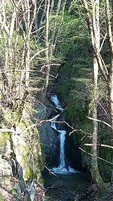
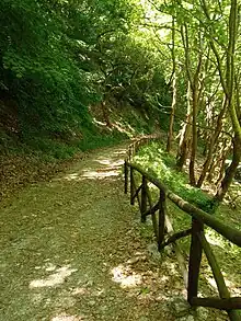
Platanorevma have today many clubs in fuction like Sport Club "Ermis", Mountaineering club "Krya", Women club "Olympia" and Cultural club of Platanorrevma. Also, Platanorrevma is known for the hiking Path "Tranos Lakkos" 9.5 km (5.9 mi) length which passes through a beautiful natural landscape of stream and waterfalls. In The postal code is 50500, while the telephone code is +30 24640.[2] At the 2011 census the population was 1,004.[3]
References
- "Πλατανόρρευμα |" (in Greek). Retrieved 2023-06-04.
- "PLATANOREMA (SRV), Small town, SERVIA". gtp.gr. Retrieved 2008-07-17.
- "Απογραφή Πληθυσμού - Κατοικιών 2011. ΜΟΝΙΜΟΣ Πληθυσμός" (in Greek). Hellenic Statistical Authority.