Pockau
Pockau is a village and a former municipality in the district of Erzgebirgskreis in Saxony, Germany. On 1 January 2014 it was merged with the town Lengefeld to form the town Pockau-Lengefeld. Pockau is on the Silver Road (Silberstraße).
Pockau | |
|---|---|
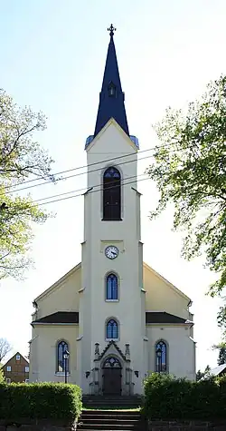 Church | |
 Coat of arms | |
Location of Pockau | |
 Pockau 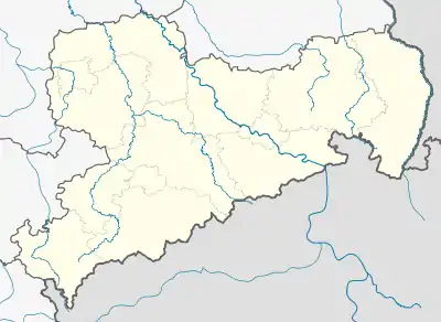 Pockau | |
| Coordinates: 50°42′N 13°13′E | |
| Country | Germany |
| State | Saxony |
| District | Erzgebirgskreis |
| Town | Pockau-Lengefeld |
| Area | |
| • Total | 36.04 km2 (13.92 sq mi) |
| Elevation | 428 m (1,404 ft) |
| Population (2012-12-31) | |
| • Total | 3,867 |
| • Density | 110/km2 (280/sq mi) |
| Time zone | UTC+01:00 (CET) |
| • Summer (DST) | UTC+02:00 (CEST) |
| Postal codes | 09509 |
| Dialling codes | 037367 |
| Vehicle registration | ERZ |
| Website | www.pockau.de |
Geography
Originally a forest village (Waldhufendorf), Pockau is located in the valley of the Flöha at its confluence with the Black Pockau. To the north lie the one-time forest villages of Görsdorf und Forchheim, the latter in the valley of the Haselbach. To the east, in the Flöha valley, lie Wernsdorf and the settlement of Nennigmühle. To the west is the settlement of Marterbüschel. The highest point in the former municipality of Pockau is the Brandhübel, at a height of 610 metres (2,000 ft); the lowest point is the Flöha valley at around 400 metres (1,300 ft). The Saidenbach Dam is northeast of Pockau.
Subdivisions
- Forchheim
- Görsdorf
- Nennigmühle
- Wernsdorf
- Marterbüschel
References