Podmoklany
Podmoklany is a municipality and village in Havlíčkův Brod District in the Vysočina Region of the Czech Republic. It has about 100 inhabitants.
Podmoklany | |
|---|---|
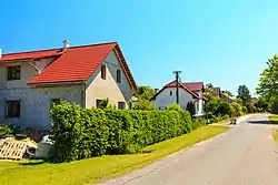 Main street | |
 Flag  Coat of arms | |
 Podmoklany Location in the Czech Republic | |
| Coordinates: 49°43′18″N 15°46′4″E | |
| Country | |
| Region | Vysočina |
| District | Havlíčkův Brod |
| First mentioned | 1242 |
| Area | |
| • Total | 4.22 km2 (1.63 sq mi) |
| Elevation | 473 m (1,552 ft) |
| Population (2023-01-01)[1] | |
| • Total | 136 |
| • Density | 32/km2 (83/sq mi) |
| Time zone | UTC+1 (CET) |
| • Summer (DST) | UTC+2 (CEST) |
| Postal code | 582 64 |
| Website | www |
Podmoklany lies approximately 19 kilometres (12 mi) north-east of Havlíčkův Brod, 39 km (24 mi) north of Jihlava, and 105 km (65 mi) south-east of Prague.
Administrative parts
Hamlets of Branišov and Hudeč are administrative parts of Podmoklany.
This article is issued from Wikipedia. The text is licensed under Creative Commons - Attribution - Sharealike. Additional terms may apply for the media files.