Portal:Devon
The Devon Portal
.jpg.webp)
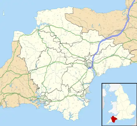
Devon (/ˈdɛvən/ DEV-ən, historically also known as Devonshire /-ʃɪər, -ʃər/ -sheer, -shər) is a ceremonial county in South West England. It is bordered by the Bristol Channel to the north, Somerset and Dorset to the east, the English Channel to the south, and Cornwall to the west. The city of Plymouth is the largest settlement, and the city of Exeter is the county town.
Devon has a varied and attractive geography; it contains two national parks and parts of five areas of outstanding natural beauty. Dartmoor and a part of Exmoor are within the county. They are the source of most of the county's rivers, including the Taw, Dart, and Exe. The longest river is the Tamar, which forms most of the border with Cornwall and rises in the Devon's northwest hills. The southeast coast is part of the Jurassic Coast World Heritage Site, and characterised by tall cliffs which reveal the Triassic, Jurassic and Cretaceous geology of the region. The county gives its name to the Devonian geologic period, which includes the slates and sandstones of the north coast.
During the Iron Age, Roman and the early medieval periods the county was the homeland of the Dumnonii Celtic Britons. The Anglo-Saxon settlement of Britain resulted in the partial assimilation of Dumnonia into the kingdom of Wessex during the eighth and ninth centuries, and the western boundary with Cornwall was set at the Tamar by king Æthelstan in 936. (Full article...)
Selected article -
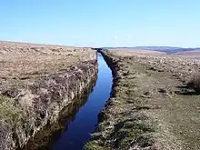
The Grand Western Canal ran between Taunton in Somerset and Tiverton in Devon in the United Kingdom. The canal had its origins in various plans, going back to 1796, to link the Bristol Channel and the English Channel by a canal, bypassing Lands End. An additional purpose of the canal was the supply of limestone and coal to lime kilns along with the removal of the resulting quicklime, which was used as a fertiliser and for building houses. This intended canal-link was never completed as planned, as the coming of the railways removed the need for its existence.
Construction was in two phases. A level section, from Tiverton to Lowdwells on the Devon/Somerset border, opened in 1814, and was capable of carrying broad-beam barges, carrying up to 40 tons. The Somerset section, suitable for tub boats (which were about 20 feet (6 m) long and capable of carrying eight tons) opened in 1839. It included an inclined plane and seven boat lifts, the earliest lifts to see commercial service in the UK. The lifts predated the Anderton Boat Lift by nearly 40 years.
The 11 miles of Devon section remains open, despite various threats to its future, and is now a designated country park and local nature reserve, and allows navigation. The Somerset section was closed in 1867, and is gradually disappearing from the landscape, although sections are now used as a footpath. It maintains a historical interest and has been subject to some archaeological excavations. (Full article...)General images
Selected image
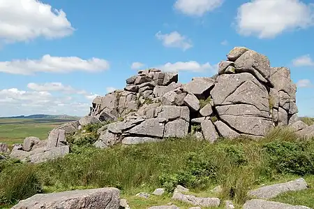
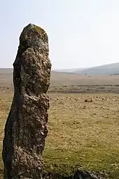
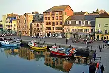
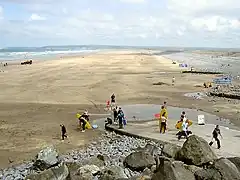
Recently featured: Bigbury sea tractor - Crazywell cross - South Devon Cattle - Dartmoor tors – Plymouth harbour – Westward Ho! beach
Subcategories
Map
Related portals
Did you know...

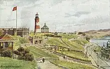
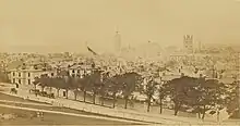
- ... that Plymouth's lighthouse, Smeaton's Tower (pictured), was dismantled and then rebuilt on Plymouth Hoe as a memorial?
- ... that Devon is the third largest of the English counties and has a population of 1,109,900?
- ... that the name Devon derives from the name of the Celtic people who inhabited the southwestern peninsula of Britain at the time of the Roman invasion?
- ... that Devon was one of the first areas of England settled following the end of the last ice age?
- ... that the St Nicholas Priory in Exeter is being restored with the same methods that were used 500 years ago?
- ... that Devon is the only county in England to have two separate coastlines?
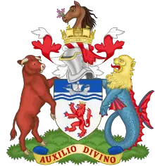
- ... that there was no established coat of arms for Devon until 1926?
- ... that the English Riviera Geopark in Torbay is the world's only urban Geopark?
Topics
WikiProjects
- Devon WikiProject
- Cornwall WikiProject
- England WikiProject
- Somerset WikiProject
- UK geography WikiProject
Associated Wikimedia
The following Wikimedia Foundation sister projects provide more on this subject:
-
 Commons
Free media repository -
 Wikibooks
Free textbooks and manuals -
 Wikidata
Free knowledge base -
 Wikinews
Free-content news -
 Wikiquote
Collection of quotations -
 Wikisource
Free-content library -
 Wikiversity
Free learning tools -
 Wikivoyage
Free travel guide -
 Wiktionary
Dictionary and thesaurus
-
 List of all portalsList of all portals
 -
 The arts portal
 -
 Biography portal
 -
 Current events portal
 -
 Geography portal
 -
 History portal
 -
 Mathematics portal
 -
 Science portal
 -
 Society portal
 -
 Technology portal
 -
 Random portalRandom portal
 -
 WikiProject PortalsWikiProject Portals
.jpg.webp)






.jpg.webp)

.jpg.webp)
.jpg.webp)









.jpg.webp)
