Prairie Hill, Missouri
Prairie Hill is an unincorporated community in eastern Chariton County, Missouri, United States.[3] The community is located at the intersection of Missouri routes W and HH approximately seven miles north-northeast of Salisbury. The Thomas Hill Reservoir dam is seven miles to the northeast in adjacent Randolph County.[4]
Prairie Hill, Missouri | |
|---|---|
 Location of Prairie Hill in Missouri | |
| Coordinates: 39°31′15″N 92°44′10″W | |
| Country | United States |
| State | Missouri |
| County | Chariton |
| Area | |
| • Total | 0.46 sq mi (1.19 km2) |
| • Land | 0.46 sq mi (1.19 km2) |
| • Water | 0.00 sq mi (0.00 km2) |
| Elevation | 725 ft (221 m) |
| Population (2020) | |
| • Total | 50 |
| • Density | 109.17/sq mi (42.12/km2) |
| FIPS code | 29-59708 |
| GNIS feature ID | 2806390[2] |
A post office called Prairie Hill was established in 1869, and remained in operation until 1966.[5] The community was named for its elevated location upon a prairie.[6]
References
- "ArcGIS REST Services Directory". United States Census Bureau. Retrieved September 5, 2022.
- U.S. Geological Survey Geographic Names Information System: Prairie Hill, Missouri
- U.S. Geological Survey Geographic Names Information System: Prairie Hill, Missouri
- Missouri Atlas & Gazetteer, DeLorme, 1998, First edition, p. 30, ISBN 0-89933-224-2
- "Post Offices". Jim Forte Postal History. Retrieved September 17, 2016.
- "Chariton County Place Names, 1928–1945 (archived)". The State Historical Society of Missouri. Archived from the original on June 24, 2016. Retrieved September 17, 2016.
{{cite web}}: CS1 maint: bot: original URL status unknown (link) - "Census of Population and Housing". Census.gov. Retrieved June 4, 2016.
Municipalities and communities of Chariton County, Missouri, United States | ||
|---|---|---|
| Cities | 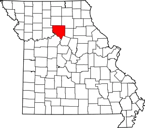 Map of Missouri highlighting Chariton County | |
| Villages | ||
| Townships | ||
| CDP | ||
| Other communities | ||
| Footnotes | ‡This populated place also has portions in an adjacent county or counties | |
This article is issued from Wikipedia. The text is licensed under Creative Commons - Attribution - Sharealike. Additional terms may apply for the media files.