Pravenec
Pravenec (Hungarian: Kispróna) is a village and municipality in Prievidza District in the Trenčín Region of western Slovakia.
Pravenec | |
|---|---|
Village | |
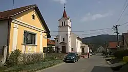
 St. Catherine's Church | |
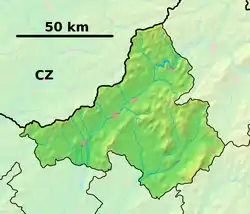
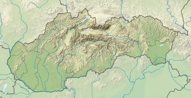
 Pravenec Location of Pravenec in the Trenčín Region  Pravenec Location of Pravenec in Slovakia | |
| Coordinates: 48°51′N 18°39′E | |
| Country | |
| Region | Trenčín |
| District | Prievidza |
| First mentioned | 1267 |
| Area | |
| • Total | 10.79[1] km2 (4.17[1] sq mi) |
| Elevation | 324[2] m (1,063[2] ft) |
| Population (2021) | |
| • Total | 1,298[3] |
| Postal code | 972 16[2] |
| Area code | +421 46[2] |
| Car plate | PD |
| Website | www.obecpravenec.sk |
History
In historical records the village was first mentioned in 1267. Pravenec is thus one of the oldest settlements in the region and dates back to Great Moravia.[4] Today it is composed of two parts separated by approximately 800 meters of grassland and forest. Located further north is the historical part with a renaissance manor-house protected by certificate of immunity[5] as well as a baroque mansion.[6] In the time period around 1640 Pravenec was part of the Bojnice lordship.
The new part of Pravenec was founded in the 1940s shortly after the Baťa woodworking factory was established.
Geography
The municipality lies at an altitude of 325 metres and covers an area of 10.794 km2. It has a population of about 1,241 people.[7]
References
- "Hustota obyvateľstva - obce [om7014rr_ukaz: Rozloha (Štvorcový meter)]". www.statistics.sk (in Slovak). Statistical Office of the Slovak Republic. 2022-03-31. Retrieved 2022-03-31.
- "Základná charakteristika". www.statistics.sk (in Slovak). Statistical Office of the Slovak Republic. 2015-04-17. Retrieved 2022-03-31.
- "Počet obyvateľov podľa pohlavia - obce (ročne)". www.statistics.sk (in Slovak). Statistical Office of the Slovak Republic. 2022-03-31. Retrieved 2022-03-31.
- "História - Obec Pravenec".
- "Pamiatkový objekt - podrobnosti".
- "Pamiatkový objekt - podrobnosti".
- http://portal.statistics.sk/files/ev-v5-obyvatelstvo-podla-vzdelania.pdf