Proserpine River
The Proserpine River is a river in Whitsunday Region of Queensland, Australia.
| Proserpine | |
|---|---|
 Boat approaching the wharf on Proserpine River, Queensland, ca. 1899 | |
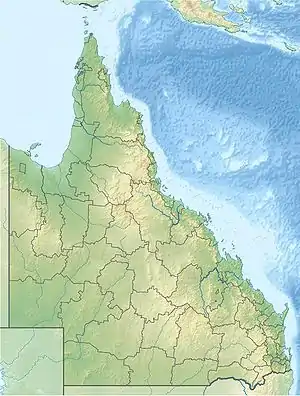
 Location of Proserpine river mouth in Queensland | |
| Location | |
| Country | Australia |
| Territory | Queensland |
| Region | Whitsunday Region |
| Physical characteristics | |
| Source | Mount Quandong |
| • location | Great Dividing Range, Whitsunday Region, Australia |
| • elevation | 110 m (360 ft) |
| Mouth | Repulse Bay |
• location | Coral Sea, Australia |
• coordinates | 20°26′25″S 148°40′41″E |
• elevation | 0 m (0 ft) |
| Length | 69 km (43 mi) |
| Basin size | 1,006.9 km2 (388.8 sq mi)[1] |
| Discharge | |
| • location | Near mouth |
| • average | 13 m3/s (410 GL/a)[1] |
| [2] | |
Course
The headwaters of the river rise below Mount Quandong in the Great Dividing Range and initially flow northwards while being fed by numerous creeks running from the Clarke Range to the west and the Normanby Range to the south. The river enters Lake Proserpine then exits in an easterly direction and flowing past to the south of Foxdale, then to the north of Proserpine. It continues east crossing the Bruce Highway then veers south through Melaleuca forests and discharges through estuarine wetlands and mangrove ecosystems[3] into Repulse Bay near Conway Beach and then onto the Coral Sea.[2]
Catchment
The river has a catchment area of 2,494 square kilometres (963 sq mi) of which an area of 127 square kilometres (49 sq mi) is composed of estuarine wetlands.[4] The area is predominantly used for grazing cattle with extensive areas also used for sugar cane production.
The estuary functions as a result of river energy with a tide dominated delta. It is in a modified condition as a result of agriculture. It contains 34.7 square kilometres (13 sq mi) of mangroves and 8.1 square kilometres (3 sq mi) of intertidal flats.[5]
The Proserpine River is one of two major rivers whose catchment influences the coral reefs of the Whitsunday Islands.[6]
History
The traditional owners of the area are the Gia[7] and Ngaro[8] peoples, who have inhabited the area for thousands of years.
The name of the Proserpine first appeared in 1861 when the Emmerson family acquired the lease for a cattle station which they are thought to have named the Proserpine Creek Run near the river mouth.[9] It is generally believed that the explorer George Dalrymple named the river although it is likely that he would never have traversed the river. The name of the river is an anglicised version of the Roman Proserpina, a goddess of fertility.[10]
The Proserpine was rated as the river in Queensland where people were most likely to see a saltwater crocodile from 2000 to 2012, with 151 sightings recorded over the period.[11] In 2015 a nest of up to 30 baby crocodiles were thought to have been stolen from the river, despite crocodiles being a protected species in Queensland.[12] According to a survey conducted from 2016 to 2019, the Proserpine River had the highest density of crocodiles in Queensland, with 5.5 per kilometre (3.4 per mile).[13]
References
- "East Coastal Watersheds".
- "Map of Proserpine River". Bonzle Digital Atlas of Australia. Retrieved 2 August 2015.
- "Whitsunday Crocodile Safari". Whitsundays Marketing and Development. 2015. Retrieved 2 August 2015.
- "Proserpine River drainage basin". WetlandInfo. Queensland Government. Retrieved 2 August 2015.
- "Estuary 428 Proserpine River". Retrieved 2 August 2015.
- Lewis, S.E.; Brodie, J.E.; McCulloch, M.T.; Mallela, J.; Jupiter, S.D.; Stuart Williams, H.; Lough, J.M.; Matson, E.G. (2012). "An assessment of an environmental gradient using coral geochemical records, Whitsunday Islands, Great Barrier Reef, Australia". Marine Pollution Bulletin. 65 (4–9): 306–319. doi:10.1016/j.marpolbul.2011.09.030. Retrieved 6 October 2023.
- "Gia". Ausanthrop Australian Aboriginal tribal database. Ausanthrop. Retrieved 2 August 2015.
- "Ngaro". Ausanthrop Australian Aboriginal tribal database. Ausanthrop. Retrieved 2 August 2015.
- "Proserpine River (entry 27552)". Queensland Place Names. Queensland Government. Retrieved 2 August 2015.
- "Proserpine". Queensland Places. Centre for the Government of Queensland. Retrieved 2 August 2015.
- Daniel Bateman (23 December 2014). "Proserpine is Queensland's croc hotspot but Daintree River is close second". The Cairns Post. News Corporation. Retrieved 2 August 2015.
- Isobel Roe (17 March 2015). "Baby crocs may have been stolen from Proserpine River in north Queensland, tour guide says". Australian Broadcasting Corporation. Retrieved 2 August 2015.
- "Queensland Estuarine Crocodile Monitoring Program 2016–2019: key findings report" (PDF). Department of Environment and Science. Retrieved 5 February 2022.