List of protected areas of Illinois

Illinois has a variety of protected areas, including over 123 state-protected areas, dozens of federally protected areas, hundreds of county-level and municipal park areas. Illinois also contains sites designated as internationally important protected areas. These multiple levels of protection contribute to a statewide network of numerous recreation opportunities and conservation schemes, sometimes in a small area. For example, DeKalb County contains a 1,000-acre (4.0 km2) forest preserve system and a 1,500-acre (6.1 km2) state park (Shabbona Lake State Park); within DeKalb County, the DeKalb Park District in the City of DeKalb has a 700-acre (2.8 km2) park system.[1]

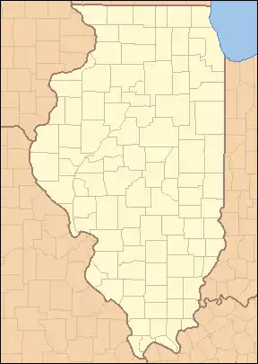
Map of Protected Areas of Illinois
Each dot is linked to the corresponding article:
Parks; Forests; Recreation Areas;
Fish and Wildlife Areas; Natural Areas;
National Historic Sites and Trails

State protected areas

Illinois state-owned protected areas include state parks, state forests, state recreation areas, state fish and wildlife areas, state natural areas and nature preserves, and one state trail. These areas are all administered by the Illinois Department of Natural Resources. In addition, dozens of state historic sites are administered by the Illinois Historic Preservation Division.[2]

State historic sites

State historic sites are typically protected for their historic and cultural importance but may include a nature preservation component, such as at Cahokia Mounds State Historic Site and Lincoln's New Salem. For a list, see Illinois Historic Preservation Division.

State parks

State parks are owned by the state and generally administered by the Illinois Department of Natural Resources.[3]

Park Name   County or Counties   Area (acres)  Area (km2)   Year Established   Water Body(s) Remarks  
Adeline Jay Geo-Karis Illinois Beach State ParkLake 4,160 16.8 1948Lake Michigan
Anderson Lake State Fish & Wildlife AreaFulton 2,247 9.09 1947Anderson Lake
Apple River Canyon State ParkJo Daviess 297 1.20 1932Apple River
Argyle Lake State ParkMcDonough 1,700 6.9 1948Argyle Lake
Baldwin Lake State Fish & Wildlife AreaRandolph 2,018 8.17 ?Baldwin Lake
Banner Marsh State Fish and Wildlife AreaFulton 4,363 17.66 1980s[4]Illinois River
Bartlett Woods Nature PreserveLee 23 0.093 1987Big Bureau Creek
Beall Woods State ParkWabash 635 2.57 1966Coffee Creek
Beaver Dam State ParkMacoupin 750 3.0 1947Beaver Dam Lake
Big River State ForestHenderson 2,900 12 1925Mississippi River
Bohm Woods Nature Preserve[5]Madison 90 0.36 2006[6]
Buffalo Rock State Park & Effigy TumuliLaSalle 298 1.21 November 15, 1928Illinois River
Cache River State Natural AreaJohnson 14,314 57.93 1970Cache River
Cape Bend State Fish and Wildlife Area[7]Alexander 1,380 5.6 ?
Carlyle Lake State Fish and Wildlife AreaFayette 37,000 150 1966Carlyle Lake
Castle Rock State ParkOgle 2,000 8.1 1921Rock River
Cave-in-Rock State ParkHardin 204 0.83 1929Ohio River
Chain O'Lakes State ParkMcHenry 1,700 6.9 1945Bluff Lake, Catherine Lake, Channel Lake, Fox Lake, Fox River, Grass Lake, Marie Lake, Nippersink Lake, Petite Lake, Pistakee Lake, Redhead Lake, Turner Lake
Channahon State ParkWill 20.5 0.083 1932DuPage River, Des Plaines River, Kankakee River
Clinton Lake State Recreation AreaDeWitt 9,300 38 1978Clinton Lake, Salt Creek, Old Creek
Coffeen Lake State Fish and Wildlife AreaMontgomery 297 1.20 1966Coffeen Lake, Shoal Creek
Crawford County State Fish and Wildlife AreaCrawford 1,129 4.57 ?Huston Creek
Delabar State ParkHenderson 89 0.36 1960Mississippi River
Des Plaines Fish and Wildlife AreaWill 5,000 20 1948Kankakee River, Milliken Lake
Dixon Springs State ParkPope 801 3.24 1946Wabash River
Donnelley/Depue State ParkPutnam 3,015 12.20 1982Lake DePue, Spring Lake, Coleman Lake, Illinois River
Double T State Fish and Wildlife AreaFulton 1,961 7.94 2001Double T Lake
Eagle Creek State Recreation AreaShelby 11,100 45 May 1963Lake Shelbyville, Eagle Creek
Edward R. Madigan State Fish and Wildlife AreaLogan 974 3.94 1971Salt Creek
Eldon Hazlet State Recreation AreaClinton 3,000 12 ?Carlyle Lake, Lake Shelbyville
Ferne Clyffe State ParkJohnson 2,430 9.8 1949Ferne Clyffe Lake
Fort Massac State ParkMassac 1,450 5.9 1908Ohio River
Fox Ridge State ParkColes 2,064 8.35 1930sRidge Lake, Embarras River
Frank Holten State Recreation AreaSt. Clair 1,080 4.4 1964Whispering Willow Lake, Grand Marais Lake
Franklin Creek State Natural AreaLee 882 3.57 1982Franklin Creek
Fults Hill Prairie State Natural AreaMonroe 997 4.03 1970Kidd Lake
Gebhard Woods State ParkGrundy 30 0.12 1934Nettle Creek
Giant City State ParkJackson, Union 1,100 4.5 1927Little Grassy Lake, Indian Creek
Golconda Marina State Recreation AreaPope 274 1.11 ?Ohio River
Goose Lake Prairie State Natural AreaGrundy 2,537 10.27 1969Goose Lake, Des Plaines River, Kankakee River, Illinois River
Green River State Wildlife AreaLee 2,565 10.38 1940Green River
Hamilton County State Fish and Wildlife AreaHamilton 1,683 6.81 1962Dolan Lake
Harry "Babe" Woodyard State Natural AreaVermilion 1,104 4.47 ??
Heidecke Lake State Fish & Wildlife AreaGrundy 1,300 5.3 ?Heidecke Lake
Hennepin Canal Parkway State ParkBureau, Lee, Whiteside, Rock Island, Henry60,314 244.08 1970Hennepin Canal104.5-mile (168.2 km) linear park (W To Moline then N to Rock Falls vic.)
Hidden Springs State ForestShelby 1,200 4.9 1960Richland Creek, Possum Creek
Horseshoe Lake State Fish & Wildlife AreaAlexander 10,200 41 ?Horseshoe Lake
Horseshoe Lake State ParkMadison 2,960 12.0 ?Horseshoe Lake
Illini State ParkLaSalle 510 2.1 1934Illinois River
Illinois Caverns State Natural AreaMonroe 120 0.49 1985None9.6 km of the park are passages underground.
Iroquois County State Wildlife AreaIroquois 2,480 10.0 1944NoneOccupies the edge of the former Glacial Lake Watseka.
James "Pate" Philip State ParkDuPage, Kane 3,432 13.89 1991Brewester Creek
Jim Edgar Panther Creek State Fish and Wildlife AreaCass 16,550 67.0 June 1993Gridley Lake, Prairie Lake, Drake Lake
Johnson-Sauk Trail State ParkHenry 1,365 5.52 ?Johnson-Sauk Trail Lake
Jubilee College State ParkPeoria 3,200 13 1933Jubilee Creek
Kankakee River State ParkKankakee, Will 4,000 16 1938Kankakee River
Kaskaskia River State Fish & Wildlife AreaSt. Clair, Monroe, Randolph 20,000 81 ?Kaskaskia River, Baldwin Lake
Kickapoo State Recreation AreaVermilion 2,842 11.50 1939Middle Fork
Kinkaid Lake State Fish and Wildlife AreaJackson 11,750 47.6 1968Kinkaid Lake, Johnson Creek, Reed Creek
Kishwaukee River State Fish and Wildlife AreaDeKalb 570 2.3 2002Kishwaukee River
Lake Le-Aqua-Na State ParkStephenson 715 2.89 1948Lake Le-Aqua-Na
Lake Murphysboro State ParkJackson 1,022 4.14 1948Lake Murphysboro
LaSalle Lake State Fish & Wildlife AreaLaSalle 2,058 8.33 ?LaSalle Lake
Lewis and Clark State Historic SiteMadison 2002None
Lincoln Trail Homestead State MemorialMacon 162 0.66 1957Sangamon River
Lincoln Trail State ParkClark 1,023 4.14 1958Lincoln Trail Lake
Lowden State ParkOgle 207 0.84 1945Rock River
Mackinaw River State Fish and Wildlife AreaTazewell 1,448 5.86 1970Mackinaw River
Marshall State Fish & Wildlife AreaMarshall 6,000 24 1925Illinois River
Matthiessen State ParkLaSalle 1,700 6.9 1943Deer Park Lake, Vermilion River
Mautino State Fish and Wildlife AreaBureau 911 3.69 ?15 lakes
Mazonia/Braidwood State Fish and Wildlife AreaGrundy 1,017 4.12 1981Braidwood Lake
Mermet Lake State Fish and Wildlife AreaMassac 2,630 10.6 1949Mermet Lake
Middle Fork State Fish and Wildlife AreaVermilion 2,700 11 1986Middle Fork
Mississippi Palisades State ParkCarroll 2,500 10 1973Mississippi River, Apple River
Mississippi River State Fish and Wildlife AreaJersey, Calhoun 24,386 98.69 ?Stump Lake, Fuller Lake
Mitchell's Grove Nature PreserveLaSalle 184 0.74 1997Little Vermillion River
Moraine Hills State ParkMcHenry 2,200 8.9 1939Lake Defiance, Fox River
Moraine View State Recreation AreaMcLean 1,687 6.83 1959Dawson Lake, Salt Creek
Morrison-Rockwood State ParkWhiteside 1,164 4.71 1971Rock Creek, Lake Carlton
Nauvoo State ParkHancock 148 0.60 ?Mississippi River, Lake Horton
Newton Lake State Fish and Wildlife AreaJasper 1,775 7.18 1979Newton Lake, Sand Creek, Laws Creek
North Point MarinaLake 297 1.20 ?Lake Michigan
Peabody River State Fish and Wildlife AreaRandolph 2,200 8.9 ?20 lakes
Pekin Lake State Fish and Wildlife AreaTazewell 1,181 4.78 ?Pekin Lake, Worley Lake
Pere Marquette State ParkJersey 8,050 32.6 1931Mississippi River, Illinois River
Piney Creek Ravine State Natural AreaJackson, Randolph 198 0.80 1972Piney Creek
Powerton Lake State Fish and Wildlife AreaTazewell 1,426 5.77 September 18, 1984[8][9][10]Powerton Lake
Prophetstown State Recreation AreaWhiteside 53 0.21 1947Coon Creek, Rock River
Pyramid State Recreation AreaPerry 19,701 79.73 1968Super Lake
Ramsey Lake State Recreation AreaFayette 1,980 8.0 ?Ramsey Lake, Ramsey Creek
Randolph County State Recreation AreaRandolph 1,101 4.46 1958Randolph County Lake
Ray Norbut State Fish and Wildlife AreaPike 1,140 4.6 1970Illinois River
Red Hills State ParkLawrence 967 3.91 1953Muddy Creek
Rend Lake State Fish and Wildlife AreaFranklin, Jefferson 38,900 157 ?Rend Lake
Rice Lake State Fish and Wildlife AreaFulton 5,660 22.9 1945Rice Lake
Rock Cut State ParkWinnebago 3,092 12.51 1957Pierce Lake, Olson Lake
Rock Island Trail State ParkStark, Peoria1989None26-mile (42 km) public rail trail.
Saline County State Fish and Wildlife AreaSaline 1,270 5.1 1959Glen O. Jones Lake
Sam Dale Lake State Fish and Wildlife AreaWayne 1,302 5.27 1959Sam Dale Lake
Sam Parr State Fish and Wildlife AreaJasper 1,180 4.8 1960
Sand Ridge State ForestMason 7,200 29 1939None
Sanganois State Fish and Wildlife AreaCass, Schuyler, Mason 10,360 41.9 1948
Sangchris Lake State Recreation AreaChristian, Sangamon 3,022 12.23 1964Sangchris Lake
Shabbona Lake State ParkDeKalb 1,550 6.3 1978Shabbona Lake
Shelbyville State Fish and Wildlife AreaMoultrie 6,200 25 ?Kaskaskia River, West Okaw River
Sielbeck Forest Natural AreaJohnson 385 1.56 1998
Siloam Springs State ParkAdams, Brown 3,323 13.45 1940
Silver Springs State Fish & Wildlife AreaKendall 1,350 5.5 1969Fox River, Loon Lake, Beaver Lake, Silver Springs
Snakeden Hollow State Fish and Wildlife AreaKnox 2,500 10 1987Snakeden Hollow Lake
South Shore State ParkClinton 26,000 110 ?Carlyle Lake
Spitler Woods State Natural AreaMacon 202.5 0.819 1937Squirrel Creek
Spring Lake Fish and Wildlife AreaTazewell 2,032 8.22 1950Spring Lake
Starved Rock State ParkLaSalle 2,630 10.6 1911Illinois River
Stephen A. Forbes State Recreation AreaMarion 3,103 12.56 1959
Ten Mile Creek State Fish & Wildlife AreaHamilton, Jefferson 6,000 24 1988Ten Mile Creek
Trail of Tears State ForestUnion 5,114 20.70 1929Mississippi River, Clear Creek
Tunnel Hill State TrailJohnson, Pulaski, Saline, WilliamsonNone45-mile (72.4 km) Trail.
Turkey Bluffs State Fish and Wildlife AreaRandolph 2,264 9.16 ?
Union County State Fish and Wildlife AreaUnion 6,202 25.10 1940s
Volo Bog State Natural AreaLake 1,150 4.7 1970Volo Bog
Walnut Point State ParkDouglas 671 2.72 1968
Washington County State Recreation AreaWashington 900 3.6 1959
Wayne Fitzgerrell State Recreation AreaFranklin, Jefferson 3,300 13 1975Rend Lake, Big Muddy River
Weinberg-King State ParkSchuyler 772 3.12 1968?
Weldon Springs State Recreation AreaDeWitt 550 2.2 1948Salt Creek
White Pines Forest State ParkOgle 385 1.56 1927Pine Creek, Spring CreekSouthernmost stand of virgin, native white pine trees in the state of Illinois.[11][12]
Wildlife Prairie ParkPeoria 1,700 6.9 2000Deep Lake, Caboose Lake, Beaver Lake, Horseshoe Lake
William W. Powers State Recreation AreaCook 580 2.3 1947Wolf Lake
Wolf Creek State ParkShelby 23,500 95 1968Lake Shelbyville, Wolf Creek
Woodford State Fish and Wildlife AreaWoodford 2,900 12 Illinois River, Upper Peoria Lake

Federally protected areas

Illinois contains one national forest, the Shawnee National Forest, one national grassland, Midewin National Tallgrass Prairie, and several other sites administered by the National Park Service, including portions of National Trails. There are also National Wildlife Refuges.

National Forest Service Areas

U.S. Wilderness Areas

The following U.S. Wilderness areas are located within the Shawnee National Forest and are administered by the U.S. Forest Service:

Crab Orchard Wilderness is located within Crab Orchard National Wildlife Refuge

U.S. Fish and Wildlife Service Areas

National Park Service

The National Park Service operates the federally owned Lincoln Home National Historic Site in Springfield, the Pullman National Historical Park in Chicago, and the New Philadelphia National Historic Site in Pike County in rural western Illinois. The Chicago Portage National Historic Site is a National Park Service-affiliated site which is located in the Forest Preserve District of Cook County. In addition, the National Park Service partners with the Abraham Lincoln National Heritage Area.

U.S. Army Corps of Engineers

Internationally recognized protected areas

One UNESCO World Heritage Site in Illinois, Cahokia Mounds State Historic Site, is protected and listed as a state-owned historic site. Two of the eight World Heritage Site structures exemplifying the 20th-Century architecture of Frank Lloyd Wright are also located in Illinois: Unity Temple and the Robie House, and are protected by local and federal schemes.

In addition to cultural sites, Illinois contains five wetland areas designated as wetlands of international importance under the Ramsar Convention:[13]

Local level parks

A variety of county and town protected areas exist in Illinois, including city park districts and county-wide Forest Preserve Districts, as well as land owned by private conservation organizations. One of the largest systems is the Forest Preserve District of Cook County, which includes Brookfield Zoo and the Chicago Botanic Garden as well as 70,000 acres (280 km2) of open land, or 11.6 percent of Cook County's land area. Most counties lack a public landholding agency, but below are the landholdings the districts in Illinois:

  • Boone County Conservation District - 4,000 acres (16 km2)
  • Byron Forest Preserve District - 1,708 acres (6.91 km2)
  • Champaign County Forest Preserve District - 4,000 acres (16 km2)
  • Forest Preserve District of Cook County - 70,000 acres (280 km2)
  • DeKalb County Forest Preserve - 4,000 acres (16 km2)
  • Forest Preserve District of DuPage County - 26,000 acres (110 km2)
  • Forest Preserve District of Kane County - 20,000 acres (81 km2)
  • Forest Preserves of the Kankakee River Valley - 465 acres (1.88 km2)
  • Kendall County Forest Preserve District - 2,663 acres (10.78 km2)
  • Lake County Forest Preserve - 31,000 acres (130 km2)
  • Macon County Conservation District - 3,490 acres (14.1 km2)
  • McHenry County Conservation District - 24,000 acres (97 km2)
  • Putnam Country Conservation District - 1,100-acre (4.5 km2)
  • Rock Island Forest Preserve District - 2,529 acres (10.23 km2)
  • Vermilion County Conservation District - 6,600 acres (27 km2)
  • Forest Preserve District of Will County - 21,966 acres (88.89 km2)
  • Winnebago County Forest Preserve District - 11,500 acres (47 km2)

References

  1. "DeKalb Park District". DeKalb County Convention and Visitors Bureau. Retrieved July 10, 2023.
  2. "State Historic Sites". dnrhistoric.illinois.gov. Retrieved July 11, 2023.
  3. "State Parks & Outdoor Recreation". Illinois Department of Natural Resources. Retrieved July 11, 2023.
  4. "About Banner Marsh SFWA". dnr.illinois.gov. Retrieved October 21, 2023.
  5. "Bohm Woods Nature Preserve". Illinois Department of Natural Resources. Retrieved December 3, 2018.
  6. "Bohm Woods State Nature Preserve". Heartlands Consevancy. Retrieved January 21, 2022.
  7. "Cape Bend State Fish and Wildlife Area". Illinois Department of Natural Resources. Retrieved December 3, 2018.
  8. "Public fishing available". Lemont Metropolitan. September 13, 1984. p. 15. Retrieved October 19, 2023.
  9. Hogan, John (August 25, 1985). "The fishing is great on Edison Lakes". The Life. p. 12. Retrieved October 19, 2023.
  10. McNally, Tom (May 30, 1984). "New lake near Pekin ready soon". Chicago Tribune. p. 48. Retrieved October 19, 2023.
  11. "Conserving the Land: The Rock River Country". Critical Trends Assessment Program. Illinois Department of Natural Resources. 2000. Archived from the original on April 19, 2005. Retrieved January 21, 2022.
  12. "The Rock River Country: An Inventory of the Region's Resources". Critical Trends Assessment Program. Illinois Department of Natural Resources. 2000. Archived from the original on April 19, 2005. Retrieved January 21, 2022.
  13. "The Annotated Ramsar List: United States of America" (PDF). Ramsar.org. Retrieved February 13, 2020.
This article is issued from Wikipedia. The text is licensed under Creative Commons - Attribution - Sharealike. Additional terms may apply for the media files.