Rödinghausen
Rödinghausen is a municipality in the district of Herford, in North Rhine-Westphalia, Germany.
Rödinghausen | |
|---|---|
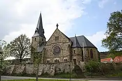 Lutheran Church of St. Bartholomäus in Rödinghausen | |
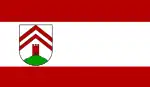 Flag  Coat of arms | |
Location of Rödinghausen within Herford district 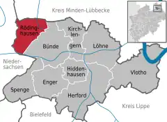 | |
 Rödinghausen  Rödinghausen | |
| Coordinates: 52°15′N 8°28′E | |
| Country | Germany |
| State | North Rhine-Westphalia |
| Admin. region | Detmold |
| District | Herford |
| Subdivisions | 5 |
| Government | |
| • Mayor (2020–25) | Siegfried Lux[1] (SPD) |
| Area | |
| • Total | 36.27 km2 (14.00 sq mi) |
| Elevation | 135 m (443 ft) |
| Population (2021-12-31)[2] | |
| • Total | 9,712 |
| • Density | 270/km2 (690/sq mi) |
| Time zone | UTC+01:00 (CET) |
| • Summer (DST) | UTC+02:00 (CEST) |
| Postal codes | 32289 |
| Dialling codes | 05746 (Norden), 05226 (Bruchmühlen, southeast), 05223 (Bünde, southwest) |
| Vehicle registration | HF |
| Website | www.roedinghausen.de |
Geography
Rödinghausen is situated on the southern slope of the Wiehengebirge, approx. 20 km north-west of Herford and 25 km north of Bielefeld.
Neighbouring municipalities
Division of the municipality
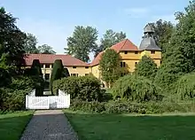
"Gut Böckel", the water castle in the village of Bieren
Rödinghausen consists of 5 villages:
- Bieren (1,299 inhabitants)
- Bruchmühlen (3,378 inhabitants); (named Westkilver until 1969)
- Ostkilver (1,876 inhabitants)
- Rödinghausen (1,644 inhabitants)
- Schwenningdorf (2,356 inhabitants)
Mayors
- since 2020: Siegfried Lux (SPD)
- 2004–2020: Ernst-Wilhelm Vortmeyer (* 1954) (SPD)
- 1999-2004: Kurt Vogt (SPD)
- 1969-1998: Günter Oberpenning (SPD)
References
- Wahlergebnisse in NRW Kommunalwahlen 2020, Land Nordrhein-Westfalen, accessed 21 June 2021.
- "Bevölkerung der Gemeinden Nordrhein-Westfalens am 31. Dezember 2021" (in German). Landesbetrieb Information und Technik NRW. Retrieved 20 June 2022.
External links
![]() Media related to Rödinghausen at Wikimedia Commons
Media related to Rödinghausen at Wikimedia Commons
- Official site (in German)
Towns and municipalities in Herford (district) | ||
|---|---|---|
Coat of Arms of Herford district | ||
This article is issued from Wikipedia. The text is licensed under Creative Commons - Attribution - Sharealike. Additional terms may apply for the media files.