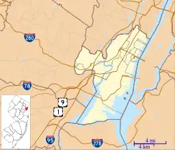
Racetrack Section, North Bergen
The Racetrack Section, also known as Hudson Heights, is a neighborhood of North Bergen Township in Hudson County, in the U.S. state of New Jersey.[2] It is a mostly residential district between Bergenline and Kennedy Boulevard. Its east–west streets follow the numbering of other North Hudson towns while its north–south streets are called avenues and are numbered First, Second, Third, Fourth, and Fifth.[3] Located on the plateau of the Hudson Palisades (which begin their descent at the Boulevard) the Racetrack Section consists of mostly one and two family homes and enjoys convenient public transportation, a stable population, and proximity to North Bergen Public Library,[4] North Bergen High School, North Hudson Park and Woodcliff.
Racetrack, North Bergen | |
|---|---|
 Nungesser's, at the intersection of Bergenline Avenue and Woodcliff Avenue | |
 Racetrack, North Bergen Location of Racetrack in Hudson County Inset: Location of county within the state of New Jersey | |
| Coordinates: 40°48′25″N 74°00′14″W | |
| Country | |
| State | |
| County | Hudson |
| Township | North Bergen |
| Elevation | 217 ft (66 m) |
| Area code | 201 |
| GNIS feature ID | 882893[1] |
The neighborhood takes its name from Nungesser's Guttenberg Racetrack.[5][6] The racetrack located in the area was a popular with day-trippers from New York (who traveled by streetcar from the elevator at the Weehawken Ferry) during the latter part of the 19th century, until gaming was outlawed by the New Jersey legislature in 1893. While the tracks closed, the area remained an amusement park known as Little Coney Island. The "pleasure resort" as it was known, gained a reputation as attracting a similarly rowdy crowd as the racetrack, and reported incidents of alcohol being served to children and women being drugged. The recently invented ice cream cone was popularized at the park.[7] The track was later used as a roadhouse for automobilists until the former clubhouse burned down in 1910.[8] The site became a known landing spot for early aviators.[9][10][11] The land on which the racetrack had been was subdivided in 1919, and later was built upon creating the section which exists today. .[5] White Castle, an early drive-in fast-food chain, has long been located in the neighborhood.[12][13]
The district is still sometimes called Hudson Heights[14][15][16][17] or Nungesser's, which is more commonly used to describe the intersection and transportation hub at the northwest corner of North Hudson Park, at the Bergen line with Fairview border.
References
- "Hudson Heights". Geographic Names Information System. United States Geological Survey, United States Department of the Interior.
- Locality Search, State of New Jersey. Accessed February 7, 2015.
- Hudson County New Jersey Street Map. Hagstrom Map Company, Inc. 2008. ISBN 0-88097-763-9.
- -NBPL
- Ractrack
- Ryall, G.F.T. (December 14, 1957), "The Race Track", The New Yorker, retrieved January 25, 2011
- La Marca, Stephen (September 18, 2011), "Corruption, carousels, and ice cream cones North Bergen was once home to 'Little Coney", Hudson Reporter, retrieved September 20, 2011
- "FIRE ENDS OLD GUTTENBURG.; Blaze Seen from Manhattan Destroys the Clubhouse, Latterly on Inn" (PDF). The New York Times. January 16, 1910.
- "THREE PLANES FALL; ONE BEHEADS A BOY; Former Army Pilots Arrested After Their Propeller Kills Jersey Lad at Play. BIPLANE ENGINE GOES DEAD Lieut. Stinson Lands in Flatbush Lettuce Patch--AConey Island Mishap" (PDF). The New York Times. July 8, 1921.
- "MOROK'S AEROPLANE INTERRUPTS TOILET; Trans-Hudson Flyer's Machine Comes to Grief in a Young Woman's Window". The New York Times. December 27, 1910.
- "BANDIT ROBS A TRAIN.; Gets More Than 100 Wallets and Watches from Passengers" (PDF). The New York Times. December 26, 1910.
- Kennedy, Shawn G. "Real Estate; A New Look For the Old White Castle". The New York Times. December 16, 1987
- Adams, Arthur G. (1996). The Hudson River Guidebook. Fordham University Press. ISBN 978-0-8232-1676-5.
- Adams, Arthur G. (1996). The Hudson Through the Years. Fordham University Press. ISBN 978-0-8232-1679-6.
- Hudson Heights map
- SkateCity:Fort Lee to Hoboken
- NJ State Info Bank: Post Offices and Zip Codes
