Rahim Beyglui-ye Sofla
Rahim Beyglui-ye Sofla (Persian: رحيم بيگلوي سفلي, also Romanized as Raḩīm Beyglūī-ye Soflá); also known as Raḩīm Beyglū-ye Pā’īn (Persian: رحيم بيگلوي پائين)[3] is a village in Arshaq-e Markazi Rural District of Arshaq District of Meshgin Shahr County, Ardabil province, Iran.
Rahim Beyglui-ye Sofla
Persian: رحيم بيگلوي سفلي | |
|---|---|
Village | |
 Rahim Beyglui-ye Sofla | |
| Coordinates: 38°38′51″N 48°06′36″E[1] | |
| Country | |
| Province | Ardabil |
| County | Meshgin Shahr |
| District | Arshaq |
| Rural District | Arshaq-e Markazi |
| Population (2016)[2] | |
| • Total | 376 |
| Time zone | UTC+3:30 (IRST) |
At the 2006 census, its population was 378 in 80 households.[4] The following census in 2011 counted 386 people in 98 households.[5] The latest census in 2016 showed a population of 376 people in 107 households; it was the largest village in its rural district.[2]
References
- OpenStreetMap contributors (28 March 2023). "Rahim Beyglui-ye Sofla, Meshgin Shahr County" (Map). OpenStreetMap. Retrieved 28 March 2023.
- "Census of the Islamic Republic of Iran, 1395 (2016)". AMAR (in Persian). The Statistical Center of Iran. p. 24. Archived from the original (Excel) on 22 March 2019. Retrieved 19 December 2022.
- Rahim Beyglui-ye Pain can be found at GEOnet Names Server, at this link, by opening the Advanced Search box, entering "-3771210" in the "Unique Feature Id" form, and clicking on "Search Database".
- "Census of the Islamic Republic of Iran, 1385 (2006)". AMAR (in Persian). The Statistical Center of Iran. p. 24. Archived from the original (Excel) on 20 September 2011. Retrieved 25 September 2022.
- "Census of the Islamic Republic of Iran, 1390 (2011)" (Excel). Iran Data Portal (in Persian). The Statistical Center of Iran. p. 24. Retrieved 19 December 2022.
| Capital | 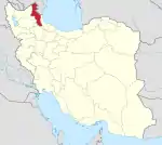 | ||||||||||||||||||||||
|---|---|---|---|---|---|---|---|---|---|---|---|---|---|---|---|---|---|---|---|---|---|---|---|
| Counties and cities |
| ||||||||||||||||||||||
| Landmarks |
| ||||||||||||||||||||||
| Places | |||||||||||||||||||||||
This article is issued from Wikipedia. The text is licensed under Creative Commons - Attribution - Sharealike. Additional terms may apply for the media files.