Rakri, Punjab
Rakri is a census town in Mukerian tahsil of Hoshiarpur district, Punjab. It contains the site of Datarpur, capital of the former Datarpur State. As of 2011, it has a population of 5,722, in 1,196 households.
Rakri | |
|---|---|
Village | |
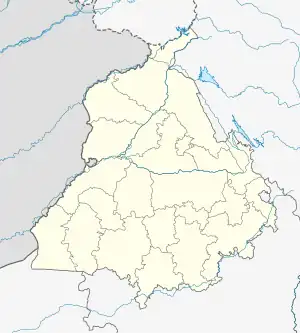
 Rakri Location in Punjab, India | |
| Coordinates: 31.9250193°N 75.7928829°E | |
| Country | India |
| State | Punjab |
| District | Hoshiarpur |
| Tahsil | Mukerian |
| Area | |
| • Total | 5.47 km2 (2.11 sq mi) |
| Population (2011)[1] | |
| • Total | 5,722 |
| • Density | 1,000/km2 (2,700/sq mi) |
| Time zone | UTC+5:30 (IST) |
History
Rakri contains the site of Datarpur, which was capital of the former Datarpur State.[1]: 75 Datarpur is said to have been founded around the year 1500.[2]: 18
Rakri was first reclassified as a non-statutory census town for the 2011 census (previously it had been designated as a village).[3]: 10
Demographics
As of 2011, Rakri had a population of 5,722, in 1,196 households. This population was 50.8% male (2,908) and 49.2% female (2,814). The 0-6 age group numbered 566 (286 male and 280 female), or 9.9% of the total population. 1,265 residents were members of Scheduled Castes, or 22.1% of the total.[3]: 22–3
The 1981 census recorded Rakri as having a population of 4,270 people (2,813 male and 2,087 female), in 710 households and 710 physical houses.[4]: 258
The 1961 census recorded Rakri (as "Rakri maruf Datarpur") with a total population of 3,029 people (1,548 male and 1,481 female), in 577 households and 577 physical houses. It then had 2 hospitals and a post office.[5]: xxiv
Economy
Among the most important commodities produced in Rakri are shoes and wooden products. As of 2009, Rakri had 1 nationalised bank, 0 private commercial banks, 1 cooperative bank, and 1 agricultural credit society.[1]: 406–7
Infrastructure
As of 2011, Rakri has 1 hospital with 8 beds, 5 medicine shops, 10 schools teaching at the primary level and 3 teaching at the secondary level, and 1 public library. Water is stored in overhead tank(s), with a total capacity of 500 kilolitres. The town does not have a local fire department; the nearest one is at Talwara, 10 km away.[1]: 403–7
References
- "Census of India 2011: Punjab District Census Handbook - Hoshiarpur, Part A (Village and Town Directory)" (PDF). Census of India. Retrieved 7 September 2023.
- Puunjab District Gazetteers, Volume XIII-A: Hoshiarpur District (PDF). Lahore: Punjab Government Press. 1904. Retrieved 7 September 2023.
- "Census of India 2011: Punjab District Census Handbook - Hoshiarpur, Part B (Village and Town Wise Primary Census Abstract)" (PDF). Census of India. Retrieved 7 September 2023.
- Census 1981 Punjab: District Census Handbook Part XIII-A & B: Village & Town Directory, District Hoshiarpur (PDF). 1982. Retrieved 7 September 2023.
- Census 1961: Punjab District Census Handbook No. 9: Hoshiarpur District (PDF). Government of Punjab. 1968. Retrieved 7 September 2023.