Ramaroshan Rural Municipality
Ramaroshan (Nepali: रामारोशन ) is a Gaupalika(Nepali: गाउपालिका ; gaupalika) in Achham District in the Sudurpashchim Province of far-western Nepal.[1]
Ramaroshan Rural Municipality
रामारोशन गाउँपालिका | |
|---|---|
 Ramaroshan Rural Municipality नेपालको नक्शामा रामारोशन गाउँपालिका | |
| Coordinates: 29.2035°N 81.4214°E | |
| Country | |
| Province | Sudurpashchim Province |
| District | Achham District |
| Government | |
| • Type | Local government |
| • Chairperson | Jhankar B. Saud |
| • Administrative Head | Ram Bahadur Bhandari |
| Area | |
| • Total | 173.33 km2 (66.92 sq mi) |
| Population | |
| • Total | 25,166 |
| • Density | 150/km2 (380/sq mi) |
| Time zone | UTC+05:45 (Nepal Standard Time) |
| Website | http://ramaroshanmun.gov.np |
Ramaroshan has a population of 25166.The land area is 173.33 km2.[2]
It was formed by merging Malatiko, Chafamandu, Shantada, Batulasain, Samroshan, Bhatakatiya and Sutar VDCs.[3]
Demographics
At the time of the 2011 Nepal census, Ramaroshan Rural Municipality had a population of 25,172. Of these, 95.5% spoke Nepali, 3.4% Achhami, 1.1% Magar and 0.1% other languages as their first language.[4]
In terms of ethnicity/caste, 62.1% were Chhetri, 15.8% other Dalit, 7.3% Hill Brahmin, 5.3% Kami, 3.7% Damai/Dholi, 1.7% Lohar, 1.5% Thakuri, 1.4% Bengali, 1.1% Magar, 0.1% other Terai and 0.1% others.[5]
In terms of religion, 99.4% were Hindu and 0.6% Christian.[6]
In terms of literacy, 55.8% could read and write, 3.7% could only read and 39.7% could neither read nor write.[7]
References
- "Ministry of Federal Affairs". Retrieved 6 July 2020.
- "National Population and Housing Census 2011(National Report)" (PDF). Central Bureau of Statistics. Government of Nepal. 2012. Archived from the original (PDF) on 2013-04-18. Retrieved 2012-01-01.
- "रामारोशन गाउँपालिका गाउँकार्यपालिकाकाे कार्यालय सुदूरपश्चिम प्रदेश,नेपाल | कृषि,पर्यटन प्रवर्द्धन तथा माैलिक संस्कृति हाम्राे पहिचान ! आर्थिक,सामाजिक तथा समृद्ध विकास रामाराेशन गाउँपालिकाकाे अभियान !". ramaroshanmun.gov.np.
- NepalMap Language
- NepalMap Caste
- NepalMap Religion
- NepalMap Literacy
Headquarters: Mangalsen | ||
| Urban municipalities | 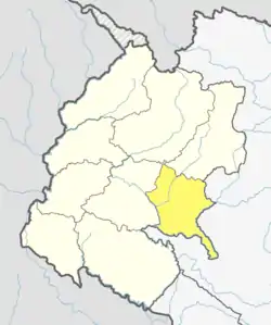 | |
| Rural municipalities | ||
For former VDCs See here | ||