Reşadiye District
Reşadiye District is a district of the Tokat Province of Turkey. Its seat is the town of Reşadiye.[1] Its area is 1,102 km2,[2] and its population is 32,600 (2022).[3]
Reşadiye District | |
|---|---|
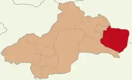 Map showing Reşadiye District in Tokat Province | |
 Reşadiye District Location in Turkey | |
| Coordinates: 40°23′N 37°20′E | |
| Country | Turkey |
| Province | Tokat |
| Seat | Reşadiye |
| Government | |
| • Kaymakam | Talat Tabur |
| Area | 1,102 km2 (425 sq mi) |
| Population (2022) | 32,600 |
| • Density | 30/km2 (77/sq mi) |
| Time zone | TRT (UTC+3) |
| Website | www |
Geography
The highest hill of Reşadiye District is Erdem Baba Hill with 2,183 meters. This is followed by Küçük Erdem Hill (2,113 meters), Kabaktepe (2,037 meters), Çal Hill (2,022 meters), Mektep Hill, Tömbül Hill and Lalelik Hill. All of these heights are located in Günüş Mountain. Zinav Lake is located within the boundaries of the district.
Composition
There are 6 municipalities in Reşadiye District:[1][4]
There are 76 villages in Reşadiye District:[5]
- Abdurrahmanlı
- Akdoğmuş
- Bağdatlı
- Bayırbaşı
- Beşdere
- Bostankolu
- Büşürüm
- Çakırlı
- Çakmak
- Çambalı
- Çamlıkaya
- Çatköy
- Çavuşbeyli
- Çayırpınar
- Cemel
- Çevrecik
- Çınarcık
- Dalpınar
- Danişment
- Darıdere
- Demircili
- Doğantepe
- Dolay
- Döllük
- Dutdibi
- Elmacık
- Esenköy
- Eymir
- Eyüp
- Gökköy
- Gölburnu
- Göllüköy
- Gülkonak
- Güllüce
- Güneygölcük
- Gurbetli
- Güvenlik
- Güzeldere
- Hebüllü
- İbrahimşeyh
- İslamlı
- İsmailiye
- Kabalı
- Kapaklı
- Karacaağaç
- Karataş
- Karlıyayla
- Karşıkent
- Kaşpınar
- Keteniği
- Kızılcaören
- Köklü
- Konakköy
- Kuyucak
- Kuzbağı
- Kuzgölcük
- Muratkaya
- Nebişeyh
- Özen
- Özlüce
- Saraykışla
- Sarıyayla
- Sazak
- Soğukpınar
- Taşlıca
- Toklar
- Tozanlıfındıcak
- Uğurlu
- Umurca
- Yağsiyan
- Yeni Darıderesi
- Yenituraç
- Yeşilyurt
- Yoğunpelit
- Yolüstü
- Yuvacık
References
- İlçe Belediyesi, Turkey Civil Administration Departments Inventory. Retrieved 22 May 2023.
- "İl ve İlçe Yüz ölçümleri". General Directorate of Mapping. Retrieved 22 May 2023.
- "Address-based population registration system (ADNKS) results dated 31 December 2022, Favorite Reports" (XLS). TÜİK. Retrieved 22 May 2023.
- Belde Belediyesi, Turkey Civil Administration Departments Inventory. Retrieved 22 May 2023.
- Köy, Turkey Civil Administration Departments Inventory. Retrieved 22 May 2023.
Reşadiye District in Tokat Province of Turkey | |||||||||||||||||||||||||||
|---|---|---|---|---|---|---|---|---|---|---|---|---|---|---|---|---|---|---|---|---|---|---|---|---|---|---|---|
| Districts |  Districts of Tokat | ||||||||||||||||||||||||||
| |||||||||||||||||||||||||||
Metropolitan municipalities are bolded. | |||||||||||||||||||||||||||
| Municipalities | |
|---|---|
| Villages |
|
This article is issued from Wikipedia. The text is licensed under Creative Commons - Attribution - Sharealike. Additional terms may apply for the media files.