Riverlands
Riverlands is a locality in Marlborough, New Zealand. State Highway 1 runs through the settlement, and the Ōpaoa River flows past to the northeast. Blenheim is about 2.5 km to the northwest.[3][4]
Riverlands | |
|---|---|
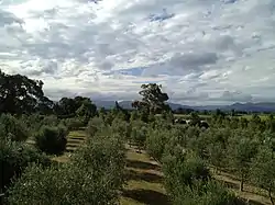 An olive garden in Riverlands | |
| Coordinates: 41°31′20″S 173°58′57″E | |
| Country | New Zealand |
| Region | Marlborough |
| Ward |
|
| Electorates | |
| Government | |
| • Territorial Authority | Marlborough District Council |
| • Marlborough District Mayor | Nadine Taylor |
| • Kaikōura MP | Stuart Smith |
| • Te Tai Tonga MP | Tākuta Ferris |
| Area | |
| • Total | 6.26 km2 (2.42 sq mi) |
| Population (June 2022)[2] | |
| • Total | 550 |
| • Density | 88/km2 (230/sq mi) |
According to the 2013 New Zealand census, Riverlands has a population of 471, an increase of 9 people since the 2006 census. There were 231 males and 240 females.[5]
Demographics
Riverlands covers 6.28 km2 (2.42 sq mi).[1]> It had an estimated population of 550 as of June 2022,[2] with a population density of 88 people per km2.
| Year | Pop. | ±% p.a. |
|---|---|---|
| 2006 | 390 | — |
| 2013 | 405 | +0.54% |
| 2018 | 465 | +2.80% |
| Source: [6] | ||
Riverlands had a population of 465 at the 2018 New Zealand census, an increase of 60 people (14.8%) since the 2013 census, and an increase of 75 people (19.2%) since the 2006 census. There were 150 households, comprising 267 males and 198 females, giving a sex ratio of 1.35 males per female. The median age was 42.2 years (compared with 37.4 years nationally), with 93 people (20.0%) aged under 15 years, 66 (14.2%) aged 15 to 29, 234 (50.3%) aged 30 to 64, and 72 (15.5%) aged 65 or older.
Ethnicities were 84.5% European/Pākehā, 10.3% Māori, 9.7% Pasifika, 0.6% Asian, and 3.9% other ethnicities. People may identify with more than one ethnicity.
The percentage of people born overseas was 18.7, compared with 27.1% nationally.
Although some people chose not to answer the census's question about religious affiliation, 53.5% had no religion, 39.4% were Christian and 1.3% had other religions.
Of those at least 15 years old, 63 (16.9%) people had a bachelor's or higher degree, and 66 (17.7%) people had no formal qualifications. The median income was $40,900, compared with $31,800 nationally. 102 people (27.4%) earned over $70,000 compared to 17.2% nationally. The employment status of those at least 15 was that 207 (55.6%) people were employed full-time, 78 (21.0%) were part-time, and 6 (1.6%) were unemployed.[6]
Education
Riverlands School is a coeducational full primary (years 1-8) school with a roll of 226 students as of April 2023.[7][8] The school celebrated its centenary in 2006.[9]
References
- "ArcGIS Web Application". statsnz.maps.arcgis.com. Retrieved 23 August 2021.
- "Population estimate tables - NZ.Stat". Statistics New Zealand. Retrieved 25 October 2022.
- Peter Dowling, ed. (2004). Reed New Zealand Atlas. Reed Books. pp. map 61. ISBN 0-7900-0952-8.
- Roger Smith, GeographX (2005). The Geographic Atlas of New Zealand. Robbie Burton. pp. map 139. ISBN 1-877333-20-4.
- 2013 Census QuickStats about a place : Riverlands
- "Statistical area 1 dataset for 2018 Census". Statistics New Zealand. March 2020. Riverlands (308500). 2018 Census place summary: Riverlands
- "New Zealand Schools Directory". New Zealand Ministry of Education. Retrieved 12 December 2022.
- Education Counts: Riverlands School
- "Riverlands School Centennial". Education Gazette New Zealand. 85 (4). 20 March 2006. Archived from the original on 16 October 2008.