Rivière-Saint-Jean, Quebec
Rivière-Saint-Jean is a municipality and village in the Côte-Nord region of the province of Quebec in Canada.
Rivière-Saint-Jean | |
|---|---|
 | |
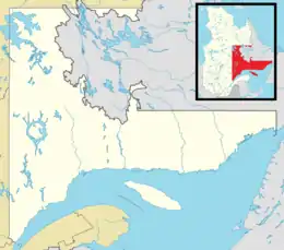
 Rivière-Saint-Jean Location in Côte-Nord region of Quebec. | |
| Coordinates: 50°18′N 64°20′W[1] | |
| Country | |
| Province | |
| Region | Côte-Nord |
| RCM | Minganie |
| Constituted | January 1, 1966 |
| Government | |
| • Mayor | Josée Brunet |
| • Federal riding | Manicouagan |
| • Prov. riding | Duplessis |
| Area | |
| • Total | 734.30 km2 (283.51 sq mi) |
| • Land | 522.92 km2 (201.90 sq mi) |
| Population (2016)[4] | |
| • Total | 215 |
| • Density | 0.4/km2 (1/sq mi) |
| • Pop 2011-2016 | |
| • Dwellings | 151 |
| Time zone | UTC−5 (EST) |
| • Summer (DST) | UTC−4 (EDT) |
| Postal code(s) | |
| Area code | 418 |
| Highways | |
In addition to the village of Rivière-Saint-Jean, the municipality also includes the community of Magpie which is located near the mouth of the Magpie River.
Demographics
Population
Canada census – Rivière-Saint-Jean community profile
| 2016 | 2011 | |
|---|---|---|
| Population | 215 (-10.0% from 2011) | 239 (-8.1% from 2006) |
| Land area | 522.92 km2 (201.90 sq mi) | 522.57 km2 (201.77 sq mi) |
| Population density | 0.4/km2 (1.0/sq mi) | 0.5/km2 (1.3/sq mi) |
| Median age | 55.2 (M: 56.0, F: 53.8) | 50.1 (M: 50.3, F: 49.8) |
| Private dwellings | 151 (total) | 150 (total) |
| Median household income | $62,208 | $.N/A |
|
|
|
Language
| Canada Census Mother Tongue - Rivière-Saint-Jean, Quebec[9] | ||||||||||||||||||
|---|---|---|---|---|---|---|---|---|---|---|---|---|---|---|---|---|---|---|
| Census | Total | French |
English |
French & English |
Other | |||||||||||||
| Year | Responses | Count | Trend | Pop % | Count | Trend | Pop % | Count | Trend | Pop % | Count | Trend | Pop % | |||||
2016 |
215 |
210 | 97.7% | 5 | 2.3% | 0 | 0.0% | 0 | 0.0% | |||||||||
2011 |
240 |
240 | 100.0% | 0 | 0.0% | 0 | 0.0% | 0 | 0.0% | |||||||||
2006 |
260 |
250 | 96.2% | 0 | 0.0% | 0 | 0.0% | 10 | 3.9% | |||||||||
2001 |
295 |
280 | 94.9% | 15 | 5.1% | 0 | 0.0% | 0 | 0.0% | |||||||||
1996 |
315 |
315 | n/a | 100.0% | 0 | n/a | 0.0% | 0 | n/a | 0.0% | 0 | n/a | 0.0% | |||||
See also
References
- "Reference number 53657 in Banque de noms de lieux du Québec". toponymie.gouv.qc.ca (in French). Commission de toponymie du Québec.
- "Rivière-Saint-Jean". Répertoire des municipalités (in French). Ministère des Affaires municipales, des Régions et de l'Occupation du territoire. Retrieved 2012-05-07.
- "Census Profile, 2016 Census - Rivière-Saint-Jean, Municipalité [Census subdivision], Quebec and Brome-Missisquoi, Municipalité régionale de comté [Census division], Quebec". 8 February 2017.
- "Census Profile, 2016 Census - Rivière-Saint-Jean, Municipalité [Census subdivision], Quebec and Brome-Missisquoi, Municipalité régionale de comté [Census division], Quebec". 8 February 2017.
- "2016 Community Profiles". 2016 Canadian Census. Statistics Canada. August 12, 2021. Retrieved 2022-07-14.
- "2011 Community Profiles". 2011 Canadian Census. Statistics Canada. March 21, 2019. Retrieved 2014-02-03.
- "2006 Community Profiles". 2006 Canadian Census. Statistics Canada. August 20, 2019.
- "2001 Community Profiles". 2001 Canadian Census. Statistics Canada. July 18, 2021.
- Statistics Canada: 1996, 2001, 2006, 2011, 2016 census
This article is issued from Wikipedia. The text is licensed under Creative Commons - Attribution - Sharealike. Additional terms may apply for the media files.