Rockbridge County, Virginia
Rockbridge County is a county in the Shenandoah Valley on the western edge of the Commonwealth of Virginia. As of the 2020 census, the population was 22,650.[1] Its county seat is the city of Lexington.[2] Rockbridge County completely surrounds the independent cities of Buena Vista and Lexington. The Bureau of Economic Analysis combines the independent cities of Buena Vista and Lexington with Rockbridge County for statistical purposes.
Rockbridge County | |
|---|---|
 | |
 Seal | |
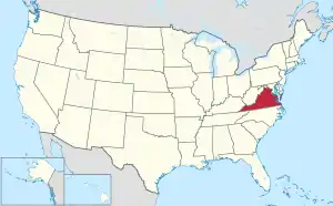
 Location within the U.S. state of Virginia | |
 Virginia's location within the U.S. | |
| Coordinates: 37°49′N 79°27′W | |
| Country | |
| State | |
| Founded | October 1777 (established) 1778 (organized) |
| Named for | Natural Bridge |
| Seat | Lexington |
| Largest town | Lexington |
| Area | |
| • Total | 601 sq mi (1,560 km2) |
| • Land | 598 sq mi (1,550 km2) |
| • Water | 3.4 sq mi (9 km2) 0.6% |
| Population (2020) | |
| • Total | 22,650 |
| • Density | 38/sq mi (15/km2) |
| Time zone | UTC−5 (Eastern) |
| • Summer (DST) | UTC−4 (EDT) |
| Congressional district | 6th |
| Website | www |
History

Rockbridge County was established in October 1777, from parts of now neighboring Augusta and Botetourt counties, and the first county elections were held in May 1778. Rockbridge County was named for Natural Bridge, a notable landmark in the southern portion of the county. Rockbridge County was formed during an act of assembly intended to reduce the amount of travel to the nearest courthouse, and to ensure trials were held fairly, and among friends rather than strangers. The first court session in Rockbridge County was held at the home of Samuel Wallace on April 7, 1778. Slaves were far fewer in Rockbridge County than in many parts of Virginia, and, thus, the anti-slavery movement was stronger in Rockbridge than in other Virginia areas. For instance, several faculty members at Washington College (now Washington and Lee University) vigorously opposed slavery. However, many of the wealthiest residents of Rockbridge County owned slaves and passed down those slaves to their widows and children.[3]
Cyrus McCormick invented the reaper near Steele's Tavern at the northern end of the county.
Geography
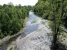
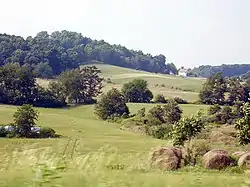
The hilly terrain of Rockbridge County was densely wooded in the eighteenth century. Its more level areas have now been cleared and turned to agriculture. The county is bordered by high ridges along its NW and SE borders, with the crests running NE-SW. The terrain's highest point (4,072 feet/1,241 meters ASL) is Rocky Mountain on its SE border with Amherst County.[4]

According to the US Census Bureau, the county has a total area of 601 square miles (1,560 km2), of which 598 square miles (1,550 km2) is land and 3.4 square miles (8.8 km2) (0.6%) is water.[5]
Adjacent counties
- Bath County – northwest
- Augusta County – northeast
- Nelson County – east
- Amherst County – southeast
- Bedford County – south
- Botetourt County – southwest
- Alleghany County – west
National protected areas
- Blue Ridge Parkway (part)
- George Washington National Forest (part)
- Jefferson National Forest (part)
- United States National Radio Quiet Zone (part)
Demographics
| Census | Pop. | Note | %± |
|---|---|---|---|
| 1790 | 6,548 | — | |
| 1800 | 8,945 | 36.6% | |
| 1810 | 10,318 | 15.3% | |
| 1820 | 11,945 | 15.8% | |
| 1830 | 14,244 | 19.2% | |
| 1840 | 14,284 | 0.3% | |
| 1850 | 16,045 | 12.3% | |
| 1860 | 17,248 | 7.5% | |
| 1870 | 16,058 | −6.9% | |
| 1880 | 20,003 | 24.6% | |
| 1890 | 23,062 | 15.3% | |
| 1900 | 21,799 | −5.5% | |
| 1910 | 21,171 | −2.9% | |
| 1920 | 20,626 | −2.6% | |
| 1930 | 20,902 | 1.3% | |
| 1940 | 22,384 | 7.1% | |
| 1950 | 23,359 | 4.4% | |
| 1960 | 24,039 | 2.9% | |
| 1970 | 16,637 | −30.8% | |
| 1980 | 17,911 | 7.7% | |
| 1990 | 18,350 | 2.5% | |
| 2000 | 20,808 | 13.4% | |
| 2010 | 22,307 | 7.2% | |
| 2020 | 22,650 | 1.5% | |
| U.S. Decennial Census[6] 1790–1960[7] 1900–1990[8] 1990–2000[9] 2010[10] 2020[11] | |||
2020 census
| Race / Ethnicity | Pop 2010[10] | Pop 2020[11] | % 2010 | % 2020 |
|---|---|---|---|---|
| White alone (NH) | 20,915 | 20,357 | 93.76% | 89.88% |
| Black or African American alone (NH) | 585 | 565 | 2.62% | 2.49% |
| Native American or Alaska Native alone (NH) | 99 | 85 | 0.44% | 0.38% |
| Asian alone (NH) | 103 | 181 | 0.46% | 0.80% |
| Pacific Islander alone (NH) | 3 | 6 | 0.01% | 0.03% |
| Some Other Race alone (NH) | 15 | 82 | 0.07% | 0.36% |
| Mixed Race/Multi-Racial (NH) | 291 | 861 | 1.30% | 3.80% |
| Hispanic or Latino (any race) | 296 | 513 | 1.33% | 2.26% |
| Total | 22,307 | 22,650 | 100.00% | 100.00% |
Note: the US Census treats Hispanic/Latino as an ethnic category. This table excludes Latinos from the racial categories and assigns them to a separate category. Hispanics/Latinos can be of any race.
2000 Census
As of the 2000 United States census,[12] there were 20,808 people, 8,486 households, and 6,075 families in the county. The population density was 35 people per square mile (14 people/km2). There were 9,550 housing units at an average density of 16 units per square mile (6.2 units/km2). The racial makeup of the county was 95.42% White, 2.97% Black or African American, 0.26% Native American, 0.44% Asian, 0.12% from other races, and 0.78% from two or more races. 0.58% of the population were Hispanic or Latino of any race.
There were 8,486 households, out of which 29.20% had children under the age of 18 living with them, 57.50% were married couples living together, 9.50% had a female householder with no husband present, and 28.40% were non-families. 23.90% of all households were made up of individuals, and 9.90% had someone living alone who was 65 years of age or older. The average household size was 2.43 and the average family size was 2.84.
The county population contained 22.20% under the age of 18, 7.90% from 18 to 24, 27.20% from 25 to 44, 27.10% from 45 to 64, and 15.70% who were 65 years of age or older. The median age was 40 years. For every 100 females there were 100.40 males. For every 100 females age 18 and over, there were 98.00 males.
The median income for a household in the county was $36,035, and the median income for a family was $41,324. Males had a median income of $28,217 versus $19,946 for females. The per capita income for the county was $18,356. About 6.60% of families and 9.60% of the population were below the poverty line, including 9.40% of those under age 18 and 9.60% of those age 65 or over.
Media
- The Rockbridge Advocate (monthly magazine)
- The News-Gazette (weekly newspaper)
- The Rockbridge Report (weekly broadcast and website, Washington & Lee University journalism students)
- EyeOnVirginia.com (videos and interviews with Rockbridge area newsmakers)
Communities
The independent cities of Buena Vista and Lexington (incorporated 1892 and 1966 respectively) are enclaves within the boundaries of Rockbridge County, and are not a part of the county. Lexington is the county seat, despite its independent status, and shares three constitutional officers with Rockbridge County: Sheriff, Clerk of the Circuit Court and Commonwealth's Attorney. Buena Vista does not share constitutional officers with either Rockbridge County or Lexington.
Census-designated places
Unincorporated communities
Notable people
- Robert H. Adams (1792–1832), born in Rockbridge County, United States Senator from Mississippi[13]
- John Allen (soldier) (1771–1813), born in Rockbridge County, a Kentucky political figure and colonel of militia, killed in the War of 1812
- Adam Rankin Alexander (1781–1848), born in Rockbridge County, United States Congressman from Tennessee[13]
- Archibald Alexander (1772–1851), born in Rockbridge County, noted Presbyterian clergyman, president of Hampden–Sydney College and one of the founders of and the first professor of Princeton Theological Seminary[13]
- Samuel Dale (1772–1841), born in Rockbridge County, American frontiersman, known as the "Daniel Boone of Alabama" and a veteran of the Creek War of 1813–1814
- Pierre Daura (1896–1976), Spanish/Catalan painter, naturalized American
- Jessie Benton Frémont (1824–1902), born in Rockbridge County, American writer and political activist
- William C. Friday (1920–2012), born in Raphine, Rockbridge County, American educator, public servant and President of University of North Carolina
- Sam Houston (1793–1863), born in Rockbridge County, the only person to serve as governor of two U.S. states (Texas and Tennessee), victor at the Battle of San Jacinto, President of the Republic of Texas, and United States Senator
- Stonewall Jackson (1824–1863), one-time resident of Lexington, the county seat, General in the Confederate Army
- Robert E. Lee (1807–1870), former commander of the Confederate Army of Northern Virginia in the U.S. Civil War, who, after the war, accepted the presidency of Washington and Lee University (then Washington College)
- Sally Mann (born 1951), celebrated American photographer
- Charlie Manuel (born 1944), American and Japanese baseball player and World Series champion manager of the Philadelphia Phillies
- Rick Mast (born 1957), Fan-favorite Winston Cup and Busch Series driver
- Cyrus McCormick (1809–1884), inventor of the reaper
- Miles Poindexter (1868-1946), Graduate of Fancy Hill Academy and Washington & Lee University, United States Senator from Washington, 1920 Republican Primary Presidential Candidate, United States Ambassador to Peru, Author, retired to and died in his home in Arnolds Valley
- Samuel B. Pryor (1816–1866), First mayor of Dallas, TX. He was in the first class of the Virginia Military Institute.
- Archibald Roane (1759/60–1819), lived in Rockbridge County in the 1780s, Governor of Tennessee
- A. Willis Robertson (1887–1971), U.S. Senator, father of Pat Robertson
- Pat Robertson (1930–2023), American minister, university president and media figure
- Archibald Stuart (1795–1855), founder of Phi Beta Kappa
- Cy Twombly (1928–2011), born in Lexington, American expatriate painter
Politics
| Year | Republican | Democratic | Third party | |||
|---|---|---|---|---|---|---|
| No. | % | No. | % | No. | % | |
| 2020 | 8,088 | 65.37% | 4,086 | 33.02% | 199 | 1.61% |
| 2016 | 6,680 | 61.88% | 3,508 | 32.50% | 607 | 5.62% |
| 2012 | 5,898 | 57.95% | 4,088 | 40.17% | 191 | 1.88% |
| 2008 | 5,732 | 56.22% | 4,347 | 42.64% | 116 | 1.14% |
| 2004 | 5,412 | 58.95% | 3,627 | 39.51% | 142 | 1.55% |
| 2000 | 4,522 | 57.77% | 2,953 | 37.73% | 352 | 4.50% |
| 1996 | 3,274 | 44.98% | 3,116 | 42.81% | 889 | 12.21% |
| 1992 | 3,228 | 43.02% | 2,908 | 38.76% | 1,367 | 18.22% |
| 1988 | 3,541 | 58.41% | 2,412 | 39.79% | 109 | 1.80% |
| 1984 | 4,067 | 65.66% | 2,098 | 33.87% | 29 | 0.47% |
| 1980 | 2,784 | 49.04% | 2,475 | 43.60% | 418 | 7.36% |
| 1976 | 2,157 | 43.66% | 2,525 | 51.11% | 258 | 5.22% |
| 1972 | 3,009 | 74.28% | 956 | 23.60% | 86 | 2.12% |
| 1968 | 2,280 | 56.80% | 845 | 21.05% | 889 | 22.15% |
| 1964 | 2,200 | 45.78% | 2,599 | 54.08% | 7 | 0.15% |
| 1960 | 2,170 | 60.53% | 1,405 | 39.19% | 10 | 0.28% |
| 1956 | 2,273 | 66.50% | 1,039 | 30.40% | 106 | 3.10% |
| 1952 | 2,068 | 65.90% | 1,059 | 33.75% | 11 | 0.35% |
| 1948 | 1,062 | 46.50% | 994 | 43.52% | 228 | 9.98% |
| 1944 | 961 | 36.85% | 1,638 | 62.81% | 9 | 0.35% |
| 1940 | 902 | 35.58% | 1,618 | 63.83% | 15 | 0.59% |
| 1936 | 868 | 34.50% | 1,635 | 64.98% | 13 | 0.52% |
| 1932 | 811 | 30.97% | 1,764 | 67.35% | 44 | 1.68% |
| 1928 | 1,206 | 47.91% | 1,311 | 52.09% | 0 | 0.00% |
| 1924 | 680 | 31.89% | 1,394 | 65.38% | 58 | 2.72% |
| 1920 | 1,054 | 43.34% | 1,365 | 56.13% | 13 | 0.53% |
| 1916 | 601 | 36.18% | 1,049 | 63.15% | 11 | 0.66% |
| 1912 | 433 | 26.81% | 949 | 58.76% | 233 | 14.43% |
See also
References
- "Rockbridge County, Virginia". United States Census Bureau. Retrieved January 30, 2022.
- "Find a County". National Association of Counties. Archived from the original on May 31, 2011. Retrieved June 7, 2011.
- See, e.g., Alfred L. Brophy & Douglas Thie, "'Land, Slaves, and Bonds': Trust and Probate in the Pre-Civil War Shenandoah Valley," West Virginia Law Review vol. 119 (2016):345. Archived 8 February 2018 at the Wayback Machine
- Rocky Mountain, Virginia (PeakBagger.com, accessed 10 September 2020)
- "US Gazetteer files: 2010, 2000, and 1990". US Census Bureau. February 12, 2011. Retrieved April 23, 2011.
- "Census of Population and Housing from 1790-2000". US Census Bureau. Retrieved January 24, 2022.
- "Historical Census Browser". University of Virginia Library. Archived from the original on August 11, 2012. Retrieved January 5, 2014.
- "Population of Counties by Decennial Census: 1900 to 1990". US Census Bureau. Archived from the original on December 15, 2013. Retrieved January 5, 2014.
- "Census 2000 PHC-T-4. Ranking Tables for Counties: 1990 and 2000" (PDF). US Census Bureau. Archived (PDF) from the original on December 18, 2014. Retrieved January 5, 2014.
- "P2 HISPANIC OR LATINO, AND NOT HISPANIC OR LATINO BY RACE - 2010: DEC Redistricting Data (PL 94-171) - Rockbridge County, Virginia". United States Census Bureau.
- "P2 HISPANIC OR LATINO, AND NOT HISPANIC OR LATINO BY RACE - 2020: DEC Redistricting Data (PL 94-171) - Rockbridge County, Virginia". United States Census Bureau.
- "US Census website". US Census Bureau. Retrieved May 14, 2011.
- Who Was Who in America, Historical Volume, 1607–1896. Marquis Who's Who. 1967.
- David Leip. "Dave Leip's Atlas of U.S. Presidential Elections". Uselectionatlas.org. Retrieved December 8, 2020.
External links
![]() Media related to Rockbridge County, Virginia at Wikimedia Commons
Media related to Rockbridge County, Virginia at Wikimedia Commons
