Route 1 (Paraguay)
National Route 1 (officially PY01, in Spanish, Ruta Nacional Número 1, or simply Ruta Uno) is one of the most important and one of the first highways in Paraguay, which runs from the capital city, Asunción to Itapua Department's capital, Encarnación. Crossing the departments of Central, Paraguarí, Misiones and Itapua. It starts on the intersection of Choferes del Chaco and Fernando de la Mora Avenues, known as Cuatro Mojones, and ends at the San Roque González de Santa Cruz Bridge, on the Paraná River, traversing 382 km (237 mi).
 | |
|---|---|
| Ruta nacional PY01 | |
| Mcal. Francisco Solano López | |
 PY01 highlighted in red | |
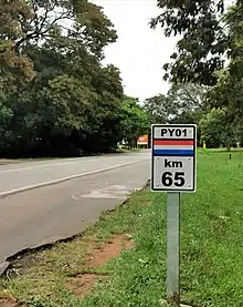 PY01 sign near the city of Paraguarí. | |
| Route information | |
| Length | 382 km (237 mi) |
| Major junctions | |
| North end | Asunción |
| |
| South end | Encarnación |
| Location | |
| Country | Paraguay |
| Highway system | |
Distances and important cities
The following table shows the distances traversed by PY01 in each different department, and important cities that it passes by (or near).
