Rouvray, Eure
Rouvray (French pronunciation: [ʁuvʁɛ]) is a commune in the Eure department in northern France.
Rouvray | |
|---|---|
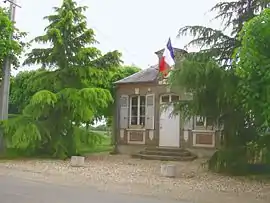 Town hall | |
 Coat of arms | |
Location of Rouvray | |
 Rouvray  Rouvray | |
| Coordinates: 49°03′57″N 1°20′19″E | |
| Country | France |
| Region | Normandy |
| Department | Eure |
| Arrondissement | Les Andelys |
| Canton | Pacy-sur-Eure |
| Intercommunality | Seine Normandie Agglomération |
| Government | |
| • Mayor (2020–2026) | Dominique Desjardins-Brosseau[1] |
| Area 1 | 2.51 km2 (0.97 sq mi) |
| Population | 260 |
| • Density | 100/km2 (270/sq mi) |
| Time zone | UTC+01:00 (CET) |
| • Summer (DST) | UTC+02:00 (CEST) |
| INSEE/Postal code | 27501 /27120 |
| Elevation | 77–127 m (253–417 ft) (avg. 188 m or 617 ft) |
| 1 French Land Register data, which excludes lakes, ponds, glaciers > 1 km2 (0.386 sq mi or 247 acres) and river estuaries. | |
Population
| Year | Pop. | ±% |
|---|---|---|
| 1962 | 53 | — |
| 1968 | 55 | +3.8% |
| 1975 | 59 | +7.3% |
| 1982 | 54 | −8.5% |
| 1990 | 111 | +105.6% |
| 1999 | 166 | +49.5% |
| 2008 | 261 | +57.2% |
Sights
The Rouvray chapel rises along the road to the hamlet of Cocherel. Local tradition suggests that the chapel was part of a bigger church that was demolished. Dedicated to St. Martin, the chapel dates from the late fifteenth or early sixteenth century, but from the eleventh century, a church belonging to the monks of Jumièges is known to have existed at Rouvray.
See also
References
- "Répertoire national des élus: les maires" (in French). data.gouv.fr, Plateforme ouverte des données publiques françaises. 13 September 2022.
- "Populations légales 2020". The National Institute of Statistics and Economic Studies. 29 December 2022.
Wikimedia Commons has media related to Rouvray (Eure).
This article is issued from Wikipedia. The text is licensed under Creative Commons - Attribution - Sharealike. Additional terms may apply for the media files.