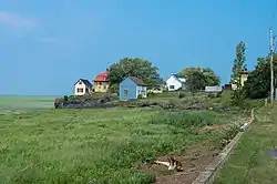
Saint-Antoine-de-l'Isle-aux-Grues
Saint-Antoine-de-l'Isle-aux-Grues is a parish municipality in Quebec, in the Montmagny Regional County Municipality in the administrative region of Chaudière-Appalaches. It is known for bird-watching, goose-hunting and cheeses.
Saint-Antoine-de-l'Isle-aux-Grues | |
|---|---|
 | |
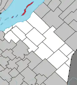 Location within La Matapédia RCM. | |
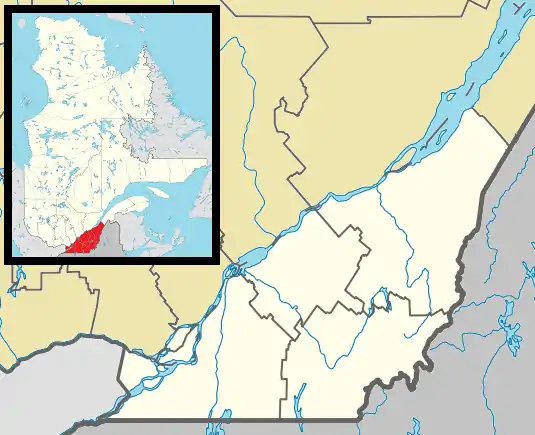 Saint-Antoine-de-l'Isle-aux-Grues Location in province of Quebec. | |
| Coordinates: 47°04′N 70°33′W[1] | |
| Country | |
| Province | |
| Region | Chaudière-Appalaches |
| RCM | Montmagny |
| Constituted | January 1, 1860 |
| Government | |
| • Mayor | Frédéric Poulin |
| • Federal riding | Montmagny—L'Islet— Kamouraska—Rivière- du-Loup |
| • Prov. riding | Côte-du-Sud |
| Area | |
| • Total | 24.10 km2 (9.31 sq mi) |
| • Land | 23.97 km2 (9.25 sq mi) |
| Population | |
| • Total | 122 |
| • Density | 5.1/km2 (13/sq mi) |
| • Pop 2016-2021 | |
| • Dwellings | 102 |
| Time zone | EST |
| • Summer (DST) | EDT |
| Postal code(s) | |
| Area code(s) | 418 and 581 |
| Highways | No major routes |
| Website | www |
Demographics
In the 2021 Census of Population conducted by Statistics Canada, Saint-Antoine-de-l'Isle-aux-Grues had a population of 122 living in 72 of its 102 total private dwellings, a change of -15.3% from its 2016 population of 144. With a land area of 23.97 km2 (9.25 sq mi), it had a population density of 5.1/km2 (13.2/sq mi) in 2021.[4]
Transportation
L'Isle-aux-Grues has a small airstrip, which provides the only access to the island during the winter, with Air Montmagny the main airline. A ferry operates during the summer months.[5]
Education
Children from Isle-aux-Grues attend school in Montmagny, Quebec, travelling by plane each day.[5]
2010 plane crash
On May 19, 2010 at about 3:30 p.m. Eastern time, a Cessna 172 airplane carrying four people crashed on Isle-aux-Grues, killing three people.[5]
References
- "Reference number 55640 in Banque de noms de lieux du Québec". toponymie.gouv.qc.ca (in French). Commission de toponymie du Québec.
- "Geographic code 18070 in the official Répertoire des municipalités". www.mamh.gouv.qc.ca (in French). Ministère des Affaires municipales et de l'Habitation.
- "Tableau de profil, Profil du recensement, Recensement de la population de 2021". 9 February 2022.
- "Population and dwelling counts: Canada, provinces and territories, and census subdivisions (municipalities), Quebec". Statistics Canada. February 9, 2022. Retrieved August 29, 2022.
- White, Marianne (May 19, 2010). "Small plane crashes into Quebec island, 3 dead". The Gazette. Montreal. Canwest News Service. Archived from the original on May 23, 2010. Retrieved May 19, 2010.
External links
Adjacent Municipal Subdivisions | |
|---|---|
| Cities & Towns | |
|---|---|
| Municipalities | |
| Parishes | |
| |