Saint-Floret
Saint-Floret (French pronunciation: [sɛ̃ flɔʁɛ]; Occitan: Sent Floret) is a commune in the Puy-de-Dôme department in Auvergne-Rhône-Alpes in central France.
Saint-Floret | |
|---|---|
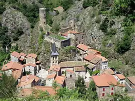 The town of Saint-Floret | |
.svg.png.webp) Coat of arms | |
Location of Saint-Floret | |
 Saint-Floret  Saint-Floret | |
| Coordinates: 45°33′07″N 3°06′28″E | |
| Country | France |
| Region | Auvergne-Rhône-Alpes |
| Department | Puy-de-Dôme |
| Arrondissement | Issoire |
| Canton | Le Sancy |
| Intercommunality | Agglo Pays d'Issoire |
| Government | |
| • Mayor (2020–2026) | Maguy Lagarde[1] |
| Area 1 | 12.16 km2 (4.70 sq mi) |
| Population | 246 |
| • Density | 20/km2 (52/sq mi) |
| Time zone | UTC+01:00 (CET) |
| • Summer (DST) | UTC+02:00 (CEST) |
| INSEE/Postal code | 63342 /63320 |
| Elevation | 476–929 m (1,562–3,048 ft) (avg. 503 m or 1,650 ft) |
| 1 French Land Register data, which excludes lakes, ponds, glaciers > 1 km2 (0.386 sq mi or 247 acres) and river estuaries. | |
History
Saint-Floret is a place of passage on the Way of St. James, a leading Catholic pilgrimage route originated in the 9th century.
During the revolutionary period of the National Convention (1792-1795), the commune took the name Roche-la-Couze.[3]
Population
|
|
References
- "Répertoire national des élus: les maires". data.gouv.fr, Plateforme ouverte des données publiques françaises (in French). 2 December 2020.
- "Populations légales 2020". The National Institute of Statistics and Economic Studies. 29 December 2022.
- Des villages de Cassini aux communes d'aujourd'hui: Commune data sheet Saint-Floret, EHESS (in French).
Wikimedia Commons has media related to Saint-Floret.
This article is issued from Wikipedia. The text is licensed under Creative Commons - Attribution - Sharealike. Additional terms may apply for the media files.