Saint-Norbert, Quebec
Saint-Norbert is a parish municipality in D'Autray Regional County Municipality the Lanaudière region of Quebec, Canada.
Saint-Norbert | |
|---|---|
.JPG.webp) | |
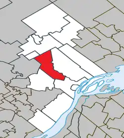 Location within D'Autray RCM | |
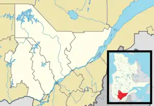 Saint-Norbert Location in central Quebec | |
| Coordinates: 46°10′N 73°19′W[1] | |
| Country | Canada |
| Province | Quebec |
| Region | Lanaudière |
| RCM | D'Autray |
| Constituted | July 1, 1855 |
| Government | |
| • Mayor | André Dauphin |
| • Federal riding | Berthier—Maskinongé |
| • Prov. riding | Berthier |
| Area | |
| • Total | 74.60 km2 (28.80 sq mi) |
| • Land | 75.07 km2 (28.98 sq mi) |
| There is an apparent contradiction between two authoritative sources | |
| Population (2011)[3] | |
| • Total | 1,059 |
| • Density | 14.1/km2 (37/sq mi) |
| • Pop 2006-2011 | |
| • Dwellings | 484 |
| Time zone | UTC−5 (EST) |
| • Summer (DST) | UTC−4 (EDT) |
| Postal code(s) | |
| Area code(s) | 450 and 579 |
| Highways | |
| Website | www |
Demographics
In the 2021 Census of Population conducted by Statistics Canada, Saint-Norbert had a population of 1,060 living in 459 of its 487 total private dwellings, a change of 5.7% from its 2016 population of 1,003. With a land area of 74.6 km2 (28.8 sq mi), it had a population density of 14.2/km2 (36.8/sq mi) in 2021.[4]
Population trend:[5]
- Population in 2011: 1059 (2006 to 2011 population change: -0.7%)
- Population in 2006: 1067
- Population in 2001: 1046
- Population in 1996: 1070
- Population in 1991: 971
Mother tongue:
- English as first language: 0%
- French as first language: 100%
- English and French as first language: 0%
- Other as first language: 0%
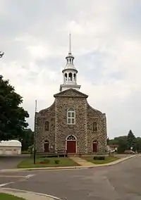
Saint-Norbert's church
Education
Commission scolaire des Samares operates francophone public schools, including:
- École Sainte-Anne[6]
The Sir Wilfrid Laurier School Board operates anglophone public schools, including:
- Joliette Elementary School in Saint-Charles-Borromée[7]
- Joliette High School in Joliette[8]
References
- "Reference number 57325 in Banque de noms de lieux du Québec". toponymie.gouv.qc.ca (in French). Commission de toponymie du Québec.
- "Geographic code 52070 in the official Répertoire des municipalités". www.mamh.gouv.qc.ca (in French). Ministère des Affaires municipales et de l'Habitation.
- Statistics Canada 2011 Census - Saint-Norbert census profile
- "Population and dwelling counts: Canada, provinces and territories, and census subdivisions (municipalities), Quebec". Statistics Canada. February 9, 2022. Retrieved August 29, 2022.
- Statistics Canada: 1996, 2001, 2006, 2011 census
- "Sainte-Anne." Commission scolaire des Samares. Retrieved on September 23, 2017.
- "JOLIETTE ELEMENTARY ZONE." Sir Wilfrid Laurier School Board. Retrieved on September 17, 2017.
- "Joliette High School Zone Sec 1-5." Sir Wilfrid Laurier School Board. Retrieved on September 5, 2017.
External links
 Media related to Saint-Norbert, Quebec at Wikimedia Commons
- Saint-Norbert - MRC d'Autray
Adjacent Municipal Subdivisions | |
|---|---|
| Cities & Towns | |
|---|---|
| Municipalities | |
| Parishes | |
| |
This article is issued from Wikipedia. The text is licensed under Creative Commons - Attribution - Sharealike. Additional terms may apply for the media files.