Saint-Zacharie, Quebec
Saint-Zacharie is a municipality in the Municipalité régionale de comté des Etchemins in Quebec, Canada. It is part of the Chaudière-Appalaches region and the population is 1,684 as of 2021. The new constitution dates from 1990, when the township municipality and the village municipality of Saint-Zacharie amalgamated, but the area was settled as early as 1873. Saint-Zacharie is named after oblate Zacharie Lacasse, a missionary who brought settlers to the area in 1881.
Saint-Zacharie | |
|---|---|
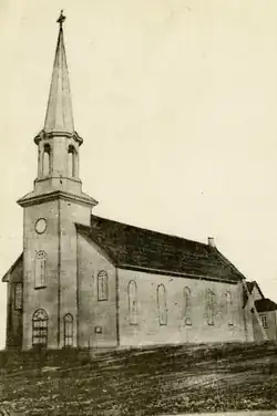 The church in 1910. | |
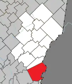 Location within Les Etchemins RCM. | |
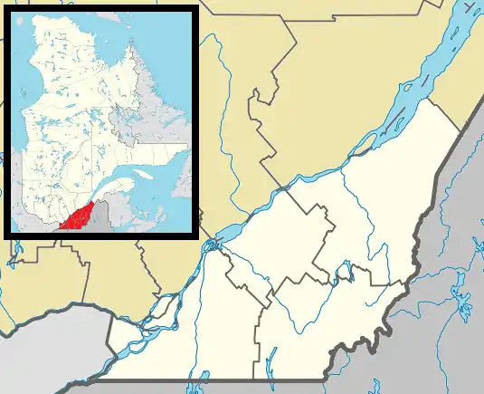 Saint-Zacharie Location in southern Quebec. | |
| Coordinates: 46°08′N 70°22′W[1] | |
| Country | |
| Province | |
| Region | Chaudière-Appalaches |
| RCM | Les Etchemins |
| Constituted | April 18, 1990 |
| Government | |
| • Mayor | Joey Cloutier |
| • Federal riding | Beauce |
| • Prov. riding | Beauce-Sud |
| Area | |
| • Total | 188.80 km2 (72.90 sq mi) |
| • Land | 186.56 km2 (72.03 sq mi) |
| Population (2021)[3] | |
| • Total | 1,684 |
| • Density | 9/km2 (20/sq mi) |
| • Pop 2016-2021 | |
| • Dwellings | 825 |
| Time zone | UTC−5 (EST) |
| • Summer (DST) | UTC−4 (EDT) |
| Postal code(s) | |
| Area code(s) | 418 and 581 |
| Highways | |
| Website | www |
Saint-Zacharie is located on the Canada–United States border and has a small border crossing for traffic coming from the United States, St. Zacharie Crossing.
References
- "Reference number 57783 in Banque de noms de lieux du Québec". toponymie.gouv.qc.ca (in French). Commission de toponymie du Québec.
- "Geographic code 28005 in the official Répertoire des municipalités". www.mamh.gouv.qc.ca (in French). Ministère des Affaires municipales et de l'Habitation.
- "Census Profile, 2021 Census, Statistics Canada - Validation Error".
- Commission de toponymie du Québec
- Ministère des Affaires municipales, des Régions et de l'Occupation du territoire
- Canada Border Services Agency
- U.S. Customs and Border Protection
Places adjacent to Saint-Zacharie, Quebec | ||||||||||||||||
|---|---|---|---|---|---|---|---|---|---|---|---|---|---|---|---|---|
| ||||||||||||||||
| Municipalities | |
|---|---|
| Parishes | |
| |
This article is issued from Wikipedia. The text is licensed under Creative Commons - Attribution - Sharealike. Additional terms may apply for the media files.