Sainte-Florine
Sainte-Florine (French pronunciation: [sɛ̃t flɔʁin]) is a commune in the Haute-Loire department in south-central France.[3]
Sainte-Florine | |
|---|---|
Commune | |
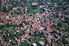 | |
Location of Sainte-Florine | |
 Sainte-Florine  Sainte-Florine | |
| Coordinates: 45°24′21″N 3°19′05″E | |
| Country | France |
| Region | Auvergne-Rhône-Alpes |
| Department | Haute-Loire |
| Arrondissement | Brioude |
| Canton | Sainte-Florine |
| Government | |
| • Mayor (2020–2026) | Raymond Fouret[1] |
| Area 1 | 7.67 km2 (2.96 sq mi) |
| Population | 3,226 |
| • Density | 420/km2 (1,100/sq mi) |
| Time zone | UTC+01:00 (CET) |
| • Summer (DST) | UTC+02:00 (CEST) |
| INSEE/Postal code | 43185 /43250 |
| Elevation | 400–511 m (1,312–1,677 ft) (avg. 430 m or 1,410 ft) |
| 1 French Land Register data, which excludes lakes, ponds, glaciers > 1 km2 (0.386 sq mi or 247 acres) and river estuaries. | |
Population
|
|
References
- "Répertoire national des élus: les maires" (in French). data.gouv.fr, Plateforme ouverte des données publiques françaises. 13 September 2022.
- "Populations légales 2020". The National Institute of Statistics and Economic Studies. 29 December 2022.
- INSEE commune file
Wikimedia Commons has media related to Sainte-Florine.
This article is issued from Wikipedia. The text is licensed under Creative Commons - Attribution - Sharealike. Additional terms may apply for the media files.