Madison Charter Township, Michigan
Madison Charter Township is a charter township of Lenawee County in the U.S. state of Michigan. The population was 8,439 at the 2020 census.[2]
Madison Township, Michigan | |
|---|---|
| Charter Township of Madison | |
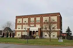
 Madison Township Hall | |
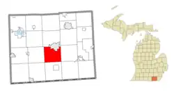 Location within Lenawee County | |
 Madison Township Location within the state of Michigan  Madison Township Location within the United States | |
| Coordinates: 41°52′02″N 84°03′14″W | |
| Country | United States |
| State | Michigan |
| County | Lenawee |
| Established | 1834 |
| Government | |
| • Supervisor | Gary Griewahn |
| • Clerk | Janet Moden |
| Area | |
| • Total | 30.65 sq mi (79.38 km2) |
| • Land | 30.39 sq mi (78.71 km2) |
| • Water | 0.26 sq mi (0.67 km2) |
| Elevation | 781 ft (238 m) |
| Population | |
| • Total | 8,439 |
| • Density | 277.7/sq mi (107.2/km2) |
| Time zone | UTC-5 (Eastern (EST)) |
| • Summer (DST) | UTC-4 (EDT) |
| ZIP code(s) | 49221 (Adrian) 49279 (Sand Creek) |
| Area code | 517 |
| FIPS code | 26-50540[3] |
| GNIS feature ID | 1626662[4] |
| Website | Official website |
Communities
- Gorman is a former settlement located within the township. A post office operated here from March 3, 1893 until October 13, 1902.[5]
- Madison Center is an unincorporated community located in the center of the township at 41°51′36″N 84°02′33″W.[6]
- Sand Creek is an unincorporated community located in the southwest portion of the township at 41°49′33″N 84°06′05″W.[7] Joshua and Rebecca Thurber received a land grant in 1820 and settled in the area. The Wabash Railroad opened a station here in 1881, and a post office began operating on September 27, 1881. The post office as named Thurber after the first settlers. The name was changed to Sand Creek on March 5, 1891 and then respelled as Sandcreek on June 11, 1894. It was named after a nearby creek. The post office was respelled back to Sand Creek in 1957.[8] The post office remains in operation and uses the 49279 ZIP Code, which serves a portion of Madison Township and the surrounding area.[9][10]
Geography
According to the U.S. Census Bureau, the township has a total area of 30.65 square miles (79.38 km2), of which 30.39 square miles (78.71 km2) is land and 0.26 square miles (0.67 km2) (0.85%) is water.[11]
The south branch of the River Raisin flows through the township. The Lenawee County Airport is located in the northern portion of the township near the city of Adrian.
Demographics
As of the census[3] of 2000, there were 8,200 people, 2,191 households, and 1,676 families residing in the township. The population density was 267.4 inhabitants per square mile (103.2/km2). There were 2,399 housing units at an average density of 78.2 per square mile (30.2/km2). The racial makeup of the township was 81.63% White, 13.05% African American, 0.27% Native American, 0.35% Asian, 3.33% from other races, and 1.37% from two or more races. Hispanic or Latino of any race were 7.35% of the population.
There were 2,191 households, out of which 34.7% had children under the age of 18 living with them, 61.5% were married couples living together, 11.1% had a female householder with no husband present, and 23.5% were non-families. 19.5% of all households were made up of individuals, and 7.7% had someone living alone who was 65 years of age or older. The average household size was 2.70 and the average family size was 3.07.
In the township the population was spread out, with 20.3% under the age of 18, 8.6% from 18 to 24, 38.4% from 25 to 44, 22.6% from 45 to 64, and 10.2% who were 65 years of age or older. The median age was 36 years. For every 100 females, there were 165.8 males. For every 100 females age 18 and over, there were 185.8 males.
The median income for a household in the township was $47,114, and the median income for a family was $52,642. Males had a median income of $33,941 versus $23,103 for females. The per capita income for the township was $17,749. About 1.0% of families and 2.1% of the population were below the poverty line, including 2.1% of those under age 18 and 3.1% of those age 65 or over.
Education
Madison Township is served by three separate public school districts. The northeast portion of the township is served by Madison School District. The south and southwestern portion of the township is served by Sand Creek Community Schools, and the northwest corner is served by Adrian Public Schools.[12]
References
- Michigan Townships Association (2023). "Madison Township, Lenawee County, Michigan". Retrieved June 15, 2023.
- United States Census Bureau (June 16, 2023). "Madison Township; Lenawee County; Michigan".
- "U.S. Census website". United States Census Bureau. Retrieved 2008-01-31.
- U.S. Geological Survey Geographic Names Information System: Madison Charter Township, Michigan
- Romig 1986, p. 230.
- U.S. Geological Survey Geographic Names Information System: Madison Center, Michigan
- U.S. Geological Survey Geographic Names Information System: Sand Creek, Michigan
- Romig 1986, p. 498.
- Google (June 14, 2023). "49279 ZIP Code map" (Map). Google Maps. Google. Retrieved June 14, 2023.
- UnitedStatesZipCodes.org (2023). "ZIP Code 49279: Sand Creek". Retrieved June 14, 2023.
- "Michigan: 2010 Population and Housing Unit Counts 2010 Census of Population and Housing" (PDF). 2010 United States census. United States Census Bureau. September 2012. p. 30 Michigan. Archived (PDF) from the original on 2012-10-19. Retrieved January 13, 2023.
- Michigan Geographic Framework (15 November 2013). "Lenawee County School Districts" (PDF). Retrieved June 11, 2023.
Sources
- Romig, Walter (October 1, 1986) [1973]. Michigan Place Names: The History of the Founding and the Naming of More Than Five Thousand Past and Present Michigan Communities. pp. 230, 498. ISBN 978-0-8143-1838-6.
{{cite book}}:|work=ignored (help)
External links
Municipalities and communities of Lenawee County, Michigan, United States | ||
|---|---|---|
| Cities |  Map of Michigan highlighting Lenawee County.svg | |
| Villages | ||
| Charter townships | ||
| Civil townships | ||
| CDPs | ||
| Other communities | ||
| Footnotes | ‡This populated place also has portions in an adjacent county or counties | |