Sanxiantai
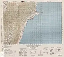
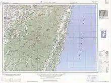
Sanxiantai[1] (Amis: nuwalian; Chinese: 三仙台; pinyin: Sānxiāntái) is an area containing a beach and several islands located on the coast of Chenggong Township, Taitung County, Taiwan. The beach stretches for ten kilometers in length. It is situated at the 112-kilometer mark. A popular tourist attraction for its rocky coastal views, the area is well known for its long footbridge in the shape of a sea dragon that connects the coast to the largest island.[2] It appears on a map dated 1755 as "Sansana".[3]
Sanxiantai
三仙台 | |
|---|---|
Beach | |
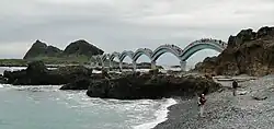 Footbridge at Sanxiantai | |
 Sanxiantai Taiwan | |
| Coordinates: 23°07′29″N 121°24′59″E | |
| Location | Taitung County, Taiwan |
Overview
Sanxiantai means "Platform of the three immortals". Sanxiantai Island has three extremely large rocks on the island. Sanxiantai Island has a unique shape. The area is best known for its long footbridge that connects the eastern coast of the main Island of Taiwan with the outer Island of Sanxiantai.
See also
References
- "WINTER EVENTS SANXIANTAI SUNRISE". Travel in Taiwan. Tourism Bureau, MOTC. November 2019. p. 05.
One of the best locations is Sanxiantai, a small island off the Taitung County coast, connected to the mainland by an iconic eight-arch footbridge.
- "Sansiantai". Tour.taitung.gov.tw. Retrieved 2014-05-14.
- Postlehwayt, Malachy (1707-1767); Boulton, S.; Bolton, Emanuel; Seale, Richard William (1755). The Universal Dictionary Of Trade and Commerce Composite Map (of Asia), Second Part of Asia (Fourth Edition, note: published in 1774, date on map reads 1755 in Roman Numerals ed.). London: W.Strahan, J. & F.Rivington. p. I-VIII. Retrieved 2 Aug 2023.