Pinetown
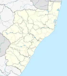
Pinetown is a city that forms part of the eThekwini Metropolitan Municipality, based just inland from Durban in KwaZulu-Natal, South Africa. The town is situated 16 km (10 mi) north-west of Durban and 64 km (40 mi) south-east of Pietermaritzburg.
Pinetown | |
|---|---|
 Pinetown 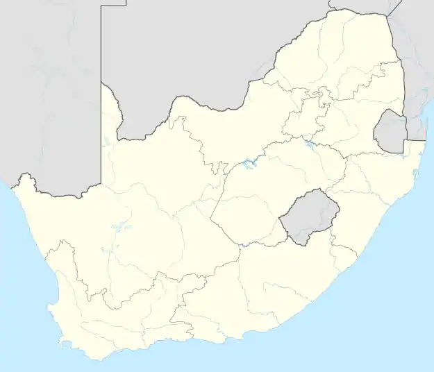 Pinetown | |
| Coordinates: 29°49′S 30°51′E | |
| Country | South Africa |
| Province | KwaZulu-Natal |
| Municipality | eThekwini |
| Established | 1849[1] |
| Area | |
| • Total | 86.15 km2 (33.26 sq mi) |
| Population (2011)[2] | |
| • Total | 144,026 |
| • Density | 1,700/km2 (4,300/sq mi) |
| Racial makeup (2011) | |
| • Black African | 67.8% |
| • Coloured | 4.3% |
| • Indian/Asian | 9.3% |
| • White | 18.0% |
| • Other | 0.6% |
| First languages (2011) | |
| • Zulu | 55.4% |
| • English | 31.4% |
| • Afrikaans | 3.8% |
| • Xhosa | 3.3% |
| • Other | 6.2% |
| Time zone | UTC+2 (SAST) |
| Postal code (street) | 3610 |
| PO box | 3600 |
| Area code | 031 |
Vehicle registrations in Pinetown start with NPN - N for Natal, PN for Pinetown.
History
Pinetown was named after the governor of Natal, Sir Benjamin Pine. The town was established in 1850 around the Wayside Hotel, itself built in 1849 along the main wagon route between Durban and Pietermaritzburg. In the Victorian era Pinetown was known as health resort.[3][4]
During the Second Boer War, the British built a concentration camp in Pinetown to house Boer women and children.
A number of German settlers made Pinetown their base and this accounts for the neighbourhood known as New Germany and the German Lutheran Church. Indeed, to this day imported German cakes and goodies pack the shelves at Christmas time in the Knowles Spar, the largest grocery store of Pinetown. One of the largest monasteries was located south of Pinetown in Mariannhill, home to the Mariannhill monastery founded by Abbott Francis Pfanner. The establishment of this monastery had huge influence in the expansion of the Catholic Church in KwaZulu Natal.
The neighbouring area of Clermont was a solely black residential zone during the apartheid era, with land tenure being on a freehold basis unlike the state-owned townships elsewhere in Greater Durban metropolis. This meant residents enjoyed an atmosphere of freedom and this led to Clermont being a base for some well-known political activists during the apartheid era such as the lawyer Archie Gumede. Other personalities associated with Clermont are relatives of the leader of the world-renowned Ladysmith Black Mambazo musical group.
Geography
Location
Pinetown is situated below Fields Hill, on the uMbilo River and is surrounded by the following towns: Westville to the east, Queensburgh to the south-east and Kloof to the north-west. It is also centrally located to many predominantly Indian and Black townships including: KwaDabeka and Clermont to the north-east, Chatsworth to the south-east, Klaarwater to the south and Luganda, Sgubudwini, Mpola, Tshelimnyama and KwaNdengezi to the south-west.[5]
Topography
Topographically, Pinetown is generally hilly with the exception of the central business district which is relatively flatter by comparison to the surrounding suburban areas. The notable high-lying areas in the eastern parts of Pinetown include Cowies Hill and the New Germany Nature Reserve reaching approximately 400 m (1312 ft) above sea level. In the northern parts, the suburb of Berkshire Downs in New Germany reaches approximately 393 m (1289 ft) above sea level. The lowest elevations of Pinetown are found in the southern parts, which approximately range between 170 m (558 ft) and 300m (984 ft) above sea level.[6]
Boundaries
Pinetown is part of the larger eThekwini Metropolitan Municipality and for voting purposes, falls within the IEC electoral Ward 18. Pinetown covers a large area of 86.15 km2 extending from the New Germany area to the north to Regency Park and Savannah Park to the south and from Paradise Valley and Moseley to the east to the industrial areas of Westmead and Mahogany Ridge that lie on the foot of Fields Hill to the west.[7]
Economy
Major companies
Two large corporations are based in Pinetown including SPAR South Africa (retailer) and Educor (tertiary education). Smaller local companies based in Pinetown include Beier Group (technical textiles and personal protective equipment), Manolis Munchies (snacks retailer), Masscash (wholesaler owned by Massmart) and Powasol (chemicals).[8][9][10][11]
Industries
Pinetown is one of the four main industrial subregions within the Durban-Pinetown core industrial region and is largely favoured by many businesses owing to its central location within the Greater Durban metropolitan area with the city centre less than 20 minutes away, its access to four freeways and several major routes and its relative proximity to Pietermaritzburg, just 50 minutes away.[12]
The Pinetown industrial subregion is well-developed with most industries concentrated west of Pinetown, namely in Alexander Park, Mahogany Ridge, Westmead and Surprise Farm and north of Pinetown in the New Germany area, namely in Falcon Industrial Park, Mountain Ridge, New Germany Industrial Park and Pineside. In the less industrialised south of Pinetown, there are three smaller and scattered industrial areas including Hagart Road Industrial, Southmead and Mariann Industrial Park.
The industrial sectors that dominate Pinetown include the engineering, automotive and logistics industries (most notably the regional distribution centres for large retail companies such as Clicks, Game, PicknPay and Woolworths).[13]
Infrastructure

Road Transport
Pinetown has multiple access roads to four major freeways in the Greater Durban metropolitan area including the N3, M7, M13 and M19. The N3 passes south of the town centre, connecting Pinetown with Durban to the south-east and Pietermaritzburg to the north-west as the Mariannhill Toll Road and is tolled at Mariannhill Toll Plaza on the western outskirts of Pinetown. The M7 connects Pinetown with Queensburgh to the south-west as Solomon Mahlangu Drive. The M13 bypasses south of the town centre, connecting Pinetown with Westville to the east and Kloof to the north-west as King Cetshwayo Highway and is the untolled alternative route to the N3. The M19 passes through the town centre as St Johns Avenue before heading east towards Westville as a freeway.
Pinetown is serviced by a number of smaller metropolitan routes including: The M1 (Henry Pennington Road) connecting Pinetown with Chatsworth to the south-east. The M5 connecting Pinetown with KwaDabeka and KwaMashu to the north and Queensburgh to the south-east. The M32 (Rodger Sishi Road) connecting Pinetown with Westville to the east. The M34 (Hans Dettman Highway) connecting Pinetown with Shallcross to the south. The town is also served internally by the M31 (Josiah Gumede Road) linking the town centre with Cowies Hill and is the main road through the town centre.
Bus
The first phase of a rapid bus system, GO!Durban, was due for implementation in September 2019, but was postponed because the municipality is scared of the Taxi bosses. The first phase envisages a link between Pinetown CBD and KwaMashu’s Bridge City Mall.[14]
Rail
Pinetown lies on the old railway line between Durban and Pietermaritzburg, and the Pinetown railway station marks the western end of the commuter line, Old Main Line, operated by Metrorail. Metrorail currently operates services on this line to Queensburgh and Durban. Pinetown is served by three Metrorail railway stations on the Old Main Line including: Pinetown station, Sarnia station, Glen Park station and Moseley station.
The new main railway line between Durban and Pietermaritzburg now bypasses south of Pinetown through Mariannhill. Metrorail currently operates services on the New Main Line from the Mariannhill station to Durban, Queensburgh, Mpumalanga and Cato Ridge.
Shopping mall
Pine Crest Centre, situated at 17 Kings Road, is the biggest retail center in town. It opened around 1988 as the Sanlam Center. In 2017 it was acquired by the JSE-listed company Vukile, and was upgraded to offer over 100 stores.[15]
Education
One of five campuses of the University of KwaZulu-Natal is in Pinetown, on the corner of Richmond (now renamed to Henry Pennington Road) and Mariannhill Roads. The Edgewood campus was originally established in the 1970s as a college to train (mostly white) students as teachers for the apartheid government's schools serving the white community. The purpose-built facilities were superior to other colleges of education where students of other races were trained as teachers. The specialised facilities enabled the training of art, music, drama, science and physical education teachers, and included rooms with overhead viewing platforms for unobtrusive classroom lesson demonstrations. In 2001, as part of the central government's rationalisation of the higher education landscape, the Edgewood College of Education was incorporated into the University of Natal. Then in 2004, with the merger of the Universities of Natal and Durban-Westville to form the University of KwaZulu-Natal, Edgewood became the new University's 5th campus. Edgewood campus is wholly dedicated to the education of teachers and education professionals and is one of the largest producers of new teachers in South Africa. On this campus the University's School of Education offers a four-year full-time Bachelor of Education (B Ed) degree and one-year full-time Post Graduate Certificate in Education (PGCE) for those wanting a teaching qualification. Various other certificates are also offered as in-service training for teachers, as well as Honours, Masters and Doctoral degrees. The library collection is specially equipped to enable those studying education from undergraduate through to doctoral levels.
Schools
Schools in Pinetown include:
- Pinetown Boys' High School
- Pinetown Girls' High School
- Benjamin Pine Primary School
- Savannah Park Secondary School
- Sarnia Primary School
- Highway College (independent)
- John Wesley School (independent)
- Pinetown Junior & Senior Primary School
- Browns School (special needs education)
- St Benedict School Pinetown (independent)
- Lyndhurst Primary School
- New Germany Primary School
- Ashley Primary School
- St Francis College (independent)
- Gelofte Skool, the only Afrikaans-medium school in the area
- Margot Fonteyn Secondary School
- Kloof High School
- Mariannridge Primary School
- Mariannridge Secondary School
- St Wendolins Primary school
- Kranskloof Primary School
- Ndengetho Secondary School
- Sarnia Primary School
- Mathinta Secondary School
- Thornwood Secondary School
- KwaSanti Public Secondary
- Nonopha Senior Primary school
- IsiZinda Secondary school
- Westmead Secondary school
- Bahlebonke Primary school
- Jubilee Primary school
- Wyebank Primary
- Wyebank Secondary
Pre-Schools
Pre-Schools in Pinetown include:
- Kokkewiet Pre Pimêre Skool - Afrikaans
- Stepping Stones Pre-Primary School - English
- Whizz Kidz Pre-Primary School - English
- Ehlophe Edu-Care School
Sport
Cricket club
Pinetown Cricket Club, established in 1873, is believed to be the oldest cricket club in KwaZulu-Natal and amongst the oldest in South Africa. The club, originally located at the Civic Centre in central Pinetown, has subsequently moved to Lahee Park. Under the chairmanship of former Pinetown mayor Vernon Hall, Lahee Park hosted ten first class games between 1974 and 1979. Former internationals Norman Crookes (twice selected for the Springbok squad) and Tertius Bosch have previously represented the club. Khaya Zondo and Cameron Delport from the 2010 Dolphins team have a close association with the club, as do KZN "B" cricketers Bruce Kruger and Kyle Buckthorp.
Comrades Marathon
Pinetown is situated on the route of the popular Comrades Marathon, which runs along the Old Main Road from Westville, over Cowies Hill past the Civic Centre and on to Fields Hill, and vice versa. This event always attracts hundreds of spectators who line the route every year to catch a glimpse of their friends and loved ones in the marathon.
References
- Robson, Linda Gillian (2011). "Annexure A" (PDF). The Royal Engineers and settlement planning in the Cape Colony 1806–1872: Approach, methodology and impact (PhD thesis). University of Pretoria. pp. xlv–lii. hdl:2263/26503.
- "Main Place Pinetown". Census 2011.
- Matthews, Josiah Wright (1887). Incwadi Yami, Or, Twenty Years' Personal Experience in South Africa. Rogers & Sherwood. p. 55.
- Waddington, Chris (20 March 2011). "Many military heroes 'came together' in Pinetown". The Crest. Retrieved 28 May 2019.
- "Pinetown | South Africa | Britannica". www.britannica.com. Retrieved 2022-07-16.
- "Pinetown topographic map, elevation, terrain". Topographic maps. Retrieved 2023-04-05.
- "Census 2011: Main Place: Pinetown". census2011.adrianfrith.com. Retrieved 2023-04-05.
- "Contact". Beier Group. Retrieved 2023-04-05.
- "Manolis Munchies Head Office". manolis-munchies-head-office.business.site. Retrieved 2023-04-05.
- "Driving directions to Masscash Head Office, 20 Surprise Rd, Pinetown". Waze. Retrieved 2023-04-05.
- "Contact Us | Powasol". www.powasol.co.za. Retrieved 2023-04-05.
- "Industrial Areas In Durban". www.upsideproperties.co.za. Retrieved 2023-04-05.
- "Pinetown in KwaZulu Natal Area Overview". www.propertynerds.co.za. Retrieved 2023-04-05.
- Mngadi, Siboniso (13 September 2020). "R3bn GO!Durban project hits a snag as city locks horns with taxi owners". iol.co.za. IOL. Retrieved 19 September 2020.
- "Pine Crest: About Us". Retrieved 21 September 2020.
- "Crompton Hospital (Life Health) in Pinetown, KwaZulu-Natal". SA Private Hospitals. n.d. Retrieved 28 May 2019.
- "Medicross Pinetown Medical & Dental Centre". medpages.co.za. Retrieved 28 May 2019.
External links
- durban.gov.za Archived 1996-03-29 at the Wayback Machine
- St. Wendolins Ridge, Pinetown
- Official Comrades Marathon Website
.svg.png.webp)