Selim District
Selim District is a district of the Kars Province of Turkey. Its seat is the town of Selim.[1] Its area is 982 km2,[2] and its population is 21,488 (2022).[3]
Selim District | |
|---|---|
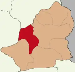 Map showing Selim District in Kars Province | |
 Selim District Location in Turkey | |
| Coordinates: 40°28′N 42°47′E | |
| Country | Turkey |
| Province | Kars |
| Seat | Selim |
| Government | |
| • Kaymakam | Mubin Demirkıran |
| Area | 982 km2 (379 sq mi) |
| Population (2022) | 21,488 |
| • Density | 22/km2 (57/sq mi) |
| Time zone | TRT (UTC+3) |
| Website | www |
Composition
There is one municipality in Selim District:[1]
There are 53 villages in Selim District:[4]
- Akçakale
- Akpınar
- Akyar
- Alisofu
- Aşağıdamlapınar
- Aşağıkotanlı
- Başköy
- Bayburt
- Baykara
- Benliahmet
- Beyköy
- Bölükbaş
- Bozkuş
- Büyük Oluklu
- Büyükdere
- Cavlak
- Çaybaşı
- Çıplaklı
- Darboğaz
- Dölbentli
- Eskigazi
- Eskigeçit
- Gelinalan
- Gürbüzler
- Hasbey
- İğdir
- Kamışlı
- Karaçayır
- Karahamza
- Karakale
- Katranlı
- Kaynarlı
- Kekeç
- Kırkpınar
- Koşapınar
- Koyunyurdu
- Laloğlu
- Mollamustafa
- Oluklu
- Ortakale
- Sarıgün
- Söğütlü
- Tozluca
- Tuygun
- Yalnızçam
- Yamaçlı
- Yassıca
- Yaylacık
- Yenice
- Yeşiltepe
- Yolgeçmez
- Yukarıdamlapınar
- Yukarıkotanlı
References
- İlçe Belediyesi, Turkey Civil Administration Departments Inventory. Retrieved 1 March 2023.
- "İl ve İlçe Yüz ölçümleri". General Directorate of Mapping. Retrieved 1 March 2023.
- "Address-based population registration system (ADNKS) results dated 31 December 2022, Favorite Reports" (XLS). TÜİK. Retrieved 13 March 2023.
- Köy, Turkey Civil Administration Departments Inventory. Retrieved 1 March 2023.
Selim District in Kars Province of Turkey | |||||||||||||||||||||||||||
|---|---|---|---|---|---|---|---|---|---|---|---|---|---|---|---|---|---|---|---|---|---|---|---|---|---|---|---|
| Districts |  Districts of Kars | ||||||||||||||||||||||||||
| |||||||||||||||||||||||||||
Metropolitan municipalities are bolded. | |||||||||||||||||||||||||||
| Municipalities | |
|---|---|
| Villages |
|
This article is issued from Wikipedia. The text is licensed under Creative Commons - Attribution - Sharealike. Additional terms may apply for the media files.