Semizbughy (village)
Semizbughy (Kazakh: Семізбұғы; Russian: Семизбуга) is a village in the Karaganda Region, Kazakhstan. It is part of the Bukhar-Zhyrau rural district (KATO code - 354043200). The village was developed for the operation of a Corundum mine in the Semizbughy mountain.[1] Population: 136 (2009 Census results);[2] 236 (1999 Census results).[2][3]
Semizbughy
Семізбұғы | |
|---|---|
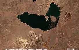 Sentinel-2 image of Rudnichnoye lake and Semizbughy village in the lower left | |
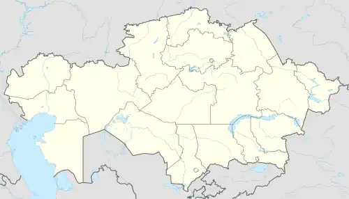 Semizbughy Location in Kazakhstan | |
| Coordinates: 50°11′46″N 74°49′44″E | |
| Country | Kazakhstan |
| Region | Karaganda Region |
| District | Bukhar-Zhyrau District |
| Population (2009) | |
| • Total | 136 |
| Time zone | UTC+6 |
Geography
Semizbughy is located just below of the western slopes of Semizbughy mountain. 80 kilometers (50 mi) to the east of the village lies Botakara, the district center.[4][5]
References
- "База КАТО". Агентство Республики Казахстан по статистике. Archived from the original on 2013-09-27.
- "Население Республики Казахстан" [Population of the Republic of Kazakhstan] (in Russian). Департамент социальной и демографической статистики. Retrieved 8 December 2013.
- "Итоги Национальной переписи населения Республики Казахстан 2009 года" (PDF). Агентство Республики Казахстан по статистике. Archived from the original (PDF) on 2013-02-27.
- "M-43 Topographic Chart (in Russian)". Retrieved 3 October 2022.
- Google Earth.
External links
This article is issued from Wikipedia. The text is licensed under Creative Commons - Attribution - Sharealike. Additional terms may apply for the media files.