Shajapur
Shajapur is a town in Malwa region of Madhya Pradesh state in west-central India. It is the headquarters of Shajapur district.
Shajapur | |
|---|---|
Town | |
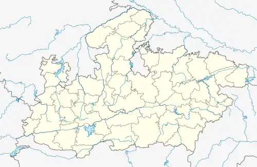 Map showing Shajapur in Madhya Pradesh, India  Shajapur (India) | |
| Coordinates: 23.43°N 76.27°E | |
| Country | |
| State | Madhya Pradesh |
| District | Shajapur |
| Vehicle registration | MP-36 |
| Website | shajapur |
Biaora - Dhule section of National Highway NH 52 passed through Shajapur.
Geography
Shajapur is located at 23.43°N 76.27°E.[1] It has an average elevation of 443 m (1,453 ft). The highest peak is known as Bhairu Dungri. It is located on bank of Chiler river.

Aerial view of Shajapur from Bhairo Dungri
Climate
| Climate data for Shajapur (1981–2010, extremes 1969–2012) | |||||||||||||
|---|---|---|---|---|---|---|---|---|---|---|---|---|---|
| Month | Jan | Feb | Mar | Apr | May | Jun | Jul | Aug | Sep | Oct | Nov | Dec | Year |
| Record high °C (°F) | 33.6 (92.5) |
38.3 (100.9) |
42.1 (107.8) |
45.6 (114.1) |
47.2 (117.0) |
46.1 (115.0) |
40.7 (105.3) |
39.1 (102.4) |
39.8 (103.6) |
39.0 (102.2) |
36.1 (97.0) |
32.7 (90.9) |
47.2 (117.0) |
| Average high °C (°F) | 26.1 (79.0) |
29.1 (84.4) |
34.6 (94.3) |
39.3 (102.7) |
41.4 (106.5) |
38.1 (100.6) |
32.0 (89.6) |
29.7 (85.5) |
32.0 (89.6) |
33.6 (92.5) |
30.5 (86.9) |
27.3 (81.1) |
32.8 (91.0) |
| Average low °C (°F) | 8.8 (47.8) |
10.7 (51.3) |
15.7 (60.3) |
21.6 (70.9) |
26.2 (79.2) |
25.8 (78.4) |
23.9 (75.0) |
23.1 (73.6) |
22.2 (72.0) |
17.8 (64.0) |
12.4 (54.3) |
9.2 (48.6) |
18.1 (64.6) |
| Record low °C (°F) | −0.5 (31.1) |
1.5 (34.7) |
5.1 (41.2) |
9.3 (48.7) |
17.8 (64.0) |
20.3 (68.5) |
19.6 (67.3) |
20.0 (68.0) |
12.1 (53.8) |
9.5 (49.1) |
3.3 (37.9) |
2.1 (35.8) |
−0.5 (31.1) |
| Average rainfall mm (inches) | 8.0 (0.31) |
4.2 (0.17) |
1.6 (0.06) |
3.0 (0.12) |
11.4 (0.45) |
95.1 (3.74) |
239.4 (9.43) |
318.3 (12.53) |
126.8 (4.99) |
24.9 (0.98) |
10.6 (0.42) |
4.5 (0.18) |
847.7 (33.37) |
| Average rainy days | 0.6 | 0.3 | 0.3 | 0.5 | 1.1 | 4.8 | 9.3 | 10.6 | 6.0 | 1.6 | 0.7 | 0.4 | 36.3 |
| Average relative humidity (%) (at 17:30 IST) | 43 | 33 | 24 | 18 | 22 | 43 | 67 | 76 | 65 | 43 | 43 | 46 | 43 |
| Source: India Meteorological Department[2][3] | |||||||||||||
Demographics
As of 2011 India census,[4] Shajapur district had a population of 1,290,685, with 669,852 males and 620,833 females.
In popular media
In the opening scenes of the popular yesteryears Hindi film, Shree 420, the protagonist (Raj Kapoor) finds a road crossing showing the direction to three places, of which one is Shajapur. The other two are Dewas and Bombay.[5]
References
- "Falling Rain Genomics, Inc - Shajapur". Falling Rain Genomics.
- "Station: Shajapur Climatological Table 1981–2010" (PDF). Climatological Normals 1981–2010. India Meteorological Department. January 2015. pp. 695–696. Archived from the original (PDF) on 5 February 2020. Retrieved 6 January 2021.
- "Extremes of Temperature & Rainfall for Indian Stations (Up to 2012)" (PDF). India Meteorological Department. December 2016. p. M130. Archived from the original (PDF) on 5 February 2020. Retrieved 6 January 2021.
- "Census of India 2001: Data from the 2001 Census, including cities, villages and towns (Provisional)". Census Commission of India. Archived from the original on 16 June 2004. Retrieved 1 November 2008.
- "Movie - Shree 420". www.youku.com. You Ku. Retrieved 15 June 2017.
- "Census of India: District Details". censusindia.gov.in. Retrieved 10 June 2014.
- "Shajapur: District Details". District Administration Shajapur. Retrieved 3 March 2016.
This article is issued from Wikipedia. The text is licensed under Creative Commons - Attribution - Sharealike. Additional terms may apply for the media files.