Shannopin's Town
Shannopin's Town, or Shannopintown, was an 18th-century Lenape (Delaware) town located within the site of modern-day Pittsburgh, Pennsylvania, along the Allegheny River, approximately two miles east from its junction with the Monongahela River. In the early 1700s, British colonial settlers began spreading into western Pennsylvania, forcing Lenape and other American Indian tribes to move further west, settling in the Ohio Country. Shannopin's Town was one of several communities established in western Pennsylvania in the 1720s.[1] The town was largely abandoned during the construction of Fort Duquesne in 1754, although a small community still existed when General John Forbes' troops arrived in September 1758. The community was gone by the time construction on Fort Pitt was started in 1759.
Shannopin's Town | |
|---|---|
Historic Native American village | |
 Shannopin's Town Former location of Shannopin's Town in Pennsylvania  Shannopin's Town Shannopin's Town (the United States) | |
| Coordinates: 40°27′55″N 79°57′55″W | |
| State | Pennsylvania |
| Present-day Community | Lawrenceville (Pittsburgh) |
| Founded | before 1730 |
| Abandoned | 1759 |
| Population | |
| • Estimate (1750) | 100−200 |
Establishment and location
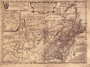
The town or village is believed to have been settled by 1730.[2]: 121 [3]: 753
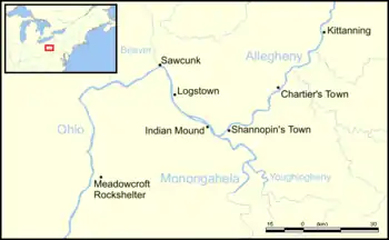
Modern attempts to pinpoint the exact location of Shannopin's Town are based on settler's journals, early maps, and a burial site which was uncovered during building excavations in 1862.[4] The village is believed to have been roughly from where Penn Avenue is today, below the mouth of Two Mile Run, from 30th Street to 39th Street. At this place the Raystown Trail leading from Harris' Ferry (Harrisburg, Pennsylvania) crossed the Allegheny. According to George Croghan, the town was situated on the south bank of the Allegheny, nearly opposite what is now known as Herr's Island, in what is now the Lawrenceville neighborhood in the city of Pittsburgh.[5]: 289
The town was near the western end-point of the Kittanning Path and at the southern terminus of the Venango Path. It was located at a convenient river crossing, within 16 miles of Logstown, about 20 miles from Chartier's Town, and a day's ride from Kittanning, all prominent communities with trading posts. Lewis Evans describes a ford near the town: "At Shannopin's there is a fording place in very dry times and the lowest down the river."[6][7]: 526 William West reported that, on 16 June 1752, Shannopin's Town was found to be at "Forty Degrees twenty-seven minutes North latitude,"[8]: 963 according to a measurement taken by Joshua Fry.[9]: 761
On November 15, 1753, Lewis Montour informed the Governor and the Speaker of the Assembly that "Shanoppin Town" was situated about three miles above the Forks of the Monongahela. John Hogan, who was taken prisoner at the destruction of Fort Granville, and carried to Fort Duquesne in August, 1756, stated in a deposition in June 1757 that, "at about two miles' distance from Fort Duquesne, there was an Indian Town, containing fifty or sixty natives, of whom twenty were able to bear arms."[10]
Shannopin (Shawanoppan)
Little is known about Chief Shannopin, probably the founder of Shannopin's Town, who is also sometimes referred to as "Shawanoppan," "Shawanosson," and other variations of this name.[11]: 218
On 30 April, 1730, Shannopin and five other Lenape leaders, "the chiefs of ye Delewares at Allegaeniny, on the main road," sent a letter, taken down by Edmund Cartledge and interpreted by James Le Tort, to Deputy Governor Patrick Gordon, protesting against the sale of rum in Lenape communities and asking the Governor to "prevent any further misfortunes for the future, we would request that the Governor would please regulate the Traders, and suppress such numbers of them from coming into the woods; and especially from bringing such large quantities of rum."[5]: 294 The letter was to explain the death of two traders named John Hart and John Fisher, who were accidentally shot during a hunting expedition with a group of Lenapes in the fall of 1729. Another trader, David Robeson, was shot and beaten during an altercation. These incidents were blamed on intoxication by rum of those involved. Shannopin and the other signatories wanted to limit the free trade of rum and the numbers of people traveling from the European settlements in the east. The traders also complained that the rum trade had caused Indians in Shannopin's town to go into debt to the traders. Among the names signed to the message is that of "Shawanoppan his X mark."[2][12]: 254–55
On 8 August 1732 Shannopin's name appears signed to a message sent by the Delawares on the Allegheny to Deputy Governor Gordon, promising to come to Philadelphia the following spring.[5]: 300 [9]: 341 [13]: 64–66 At Logstown on September 15, 1748 he made a speech to Conrad Weiser about the recent death of Chief Allumapees (Weiser refers to him as "Shawanasson").[14]: 37 [9]: 355
Shannopin died between 1748 and 1751. The exact date is unknown, but a letter from Governor James Hamilton to George Croghan, dated 25 April 1751, refers to a promise Shannopin and other Lenape leaders made, to meet with colonial authorities following the death of Chief Allumapees in October, 1747. The letter states:
- The Delawares...promised to visit their Brethren in Philadelphia to Consult with them about a new Chief, but those men who made such Promise, viz., Shawanapon and Others, are since dead..."[9]: 519
Senangel's Town
On 29 October 1731, James Le Tort and his colleague Jonas Davenport were called to testify before Governor Patrick Gordon.[15]: 295–96 Le Tort and Davenport had by then traveled to Native American communities across western Pennsylvania and knew them well. At the time of their examination, Davenport and Le Tort provided an estimate of the populations of the Allegheny settlements, and the names of their chiefs,[16]: 49 including "Senangelstown," which has been assumed to be Shannopin's Town,[5]: 289–297 with 16 families, 50 men, and a Delaware Chief named Senangel. Not all sources agree that this is Shannopin's Town, however. William Albert Hunter (1952) proposes that "Senangel's Town" was a separate community[17] and that "Senangel" refers to Chief Sayningoe, mentioned in other colonial documents.[18]: 8
Visit by Peter Chartier, 1743-45
In 1743 Peter Chartier, a half-Shawnee Indian trader whose father was French-Canadian, moved to Shannopin's Town. He established a trading post on the Allegheny River about twenty miles upstream from the forks of the Ohio near the mouth of Chartiers Run, at what became Tarentum, known as Chartier's Town at the time, and Chartier's Old Town after it was abandoned in 1745.[19][20][13] Chartier was in conflict with the Pennsylvania authorities because he opposed the sale of alcohol in Native American communities. In 1745 he declared his allegiance with the French and migrated to Kentucky, along with about 400 Pekowi Shawnees.[3]
Visit by Conrad Weiser, 1748
Conrad Weiser spent the night of August 26, 1748 at Shannopin's Town on his way to Logstown for a meeting with chiefs of the Delaware, Shawnee, Iroquois and Wyandot nations. Among those accompanying Weiser was Benjamin Franklin's illegitimate son, William Franklin, only nineteen at the time, probably sent by his father as a part of his education. William's journey subsequently inspired his father's keen interest in the frontier.[21]
Visit by Céloron de Blainville, 1749

In 1749, the Comte de La Galissonière wanted to strengthen French control over the Ohio Country, and in August he ordered the military commander at Detroit, Pierre Joseph Céloron de Blainville to travel down the Ohio River to demonstrate French dominance. Leading a force of eight officers, six cadets, an armorer, 20 soldiers, 180 Canadians, 30 Iroquois and 25 Abenakis,[22] Céloron moved down the river on a flotilla of 23 large boats and birch-bark canoes, on his "lead plate expedition," burying lead plates at six locations where major tributaries entered the Ohio and nailing copper plates bearing royal arms to trees to claim the territory for New France.[23]
Céloron reached Kittanning on 6 August 1749 and arrived at Shannopin's Town the next day. He writes:
The 7th I passed by a Loup (Mohegan) village in which there were only three men. They had placed a white flag over their cabins, the rest of their people had gone to Chiningue, not hazarding to remain at home. I invited these three men to come along with me to Chiningue in order to hear what I had to say to them.[22]: 28

Visit by Christopher Gist, 1750
Christopher Gist first visited the town in November, 1750.[24][6]: 38 Shannopin's Town was small, containing about twenty wigwams, fifty or sixty natives and twenty warriors. It was much visited by traders.
Gist writes:
- Monday 19.—Set out early in the Morning...travelled very hard about 20 M to a small Indian Town of the Delawares called Shannopin on the SE Side of the River Ohio, where We rested and got Corn for our Horses.
- Tuesday 20 Wednesday 21 Thursday 22 and Friday 23.—I was unwell and stayed in this Town to recover myself; While I was here I took an Opportunity to set my Compass privately, & took the Distance across the River, for I understood it was dangerous to let a Compass be seen among these Indians: The River Ohio is 76 Poles wide at Shannopin Town: There are about twenty Families in this Town: The Land in general from Potomack to this Place is mean stony and broken, here and there good Spots upon the Creeks and Branches but no Body of it.
- Saturday 24.—Set out from Shannopin's Town, and swam our Horses across the River Ohio, & went down the River...all the Land from Shannopin's Town is good along the River, but the Bottoms not broad; At a Distance from the River good Land for Farming, covered with small white and red Oaks and tolerable level; fine Runs for Mills &c .[6]
Meeting of the Virginia Commissioners, 1752
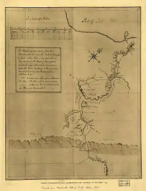
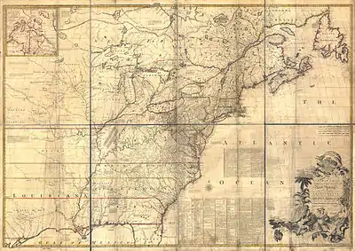
En route to the Logstown Treaty Conference, the Virginia Commissioners paused at Shannopin's Town (which they refer to as "Shonassim's Town") on May 28–30, to meet with the Lenape chiefs Shingas and Tamaqua. Shingas, who was about to be named chief of the western Lenape, may have been living at Shannopin's Town at that time, although he did not attend the conference in Logstown.
The commissioners were Colonel Joshua Fry, James Patton, and Lunsford Lomax,[25] accompanied by Christopher Gist and Andrew Montour, who served as interpreter. The commissioners were greeted by two or three volleys of gunfire, after which they then proceeded to the river bank above the town, where they pitched camp. They spent the following day in conference with the chiefs, and noted that the Lenape had no king, but were represented by Shingas and his brother Tamaqua, both of whom, supplied with coats and hats by the commissioners, "were dressed after the English fashion." Both wore "silver Breast Plates and [had] a great deal of Wampum about them." They made favorable impressions with the commissioners, who informed the Lenape that they were to meet the Six Nations at Logstown to improve relationships between the King’s representatives and the Ohio Indians.[26]: 155
On 30 May the commissioners headed a short distance down river to meet with Queen Alliquippa.[27]: 135 They reached Logstown on 31 May.[26]
Visit by George Washington, 1753
George Washington and Christopher Gist met with Shingas at Shannopin's Town (which Washington refers to as "Shanapins") on 23 November 1753, on their way to Logstown, during Washington's journey to speak with the French commander at Fort Le Boeuf.[28]
It was near Shannopin's Town, as he was returning from his mission to the French, December 29, 1753, that Washington almost drowned in the icy waters of the Allegheny. Washington and Gist were following "The Piney Creek", which meets the Allegheny River at current day Etna, Pennsylvania. The river had not completely frozen, so Gist and Washington had to make a raft to cross the river. As they were crossing, the raft was struck by an ice jam and Washington was thrown into the water, but managed to grab onto the raft with Gist pulling him aboard. Gist writes:
Saturday 29.— We set out early, got to Alleghany, made a raft, and with much difficulty got over to an island, a little above Shannopin's town. The Major having fallen in from off the raft, and my fingers frostbitten, and the sun down, and very cold, we contented ourselves to encamp upon that island. It was deep water between us and the shore; but the cold did us some service, for in the morning it was frozen hard enough for us to pass over on the ice.[29]
They spent the night on Wainwright's Island, an island which has now been absorbed into the southern shore of the Allegheny River.[30] The next day they went to the trading house of John Fraser at the mouth of Turtle Creek, staying overnight and continuing on the next day to Shannopin's Town.[28]
in November, 1753, Lewis Montour reported to James Hamilton that Tanacharison and Scarouady were living in Shannopin's Town.[31][9]: 702
French military landing at Shannopin's Town, 1754
_to_the_Ohio_J._Potts%22_in_the_collection_of_the_LOC_2008620550.jpg.webp)
In January, 1754 British soldiers under the command of William Trent began construction of Fort Prince George at the confluence of the Ohio and the Monongahela rivers, about two miles west of Shannopin's Town. On 4 March 1754, a French detachment under Michel Maray de La Chauvignerie discovered the fort, still under construction.[32][33]: 129 In April, a force of more than 500 men under the command of Captain Claude-Pierre Pécaudy de Contrecœur sailed down the Allegheny River from Venango, landing at Shannopin's Town.[34][35] On 18 April 1754, the French Commander sent a captain, a drummer and an interpreter to present Ensign Edward Ward, the acting commander, with a summons stating that the French Army intended to lay siege to the fort, and that the British had one hour to leave. The British garrison of about forty men withdrew, and the French seized the fort and razed it to build Fort Duquesne.[36]
Abandonment
Shannopin's Town was largely abandoned during the construction of Fort Duquesne, but a small community still existed when John Hogan, a British prisoner, observed it in August, 1756.[5]: 289 In 1758, General Forbes' troops passed through it and observed the decapitated bodies of Scottish highlanders of the 77th Regiment of Foot (Montgomerie's Highlanders) who had been killed on 14 September at the Battle of Fort Duquesne when Major James Grant was defeated. The town had vanished by the time construction of Fort Pitt was begun in 1759.[31]
Archaeological investigations
Archaeological work in the Pittsburgh area sponsored by the Carnegie Museum of Natural History has uncovered relatively little from the 18th century, due to disturbance of sites by construction and industry. A Native American burial site was uncovered during construction on 31st Street in 1862, but no other information was recorded.[37]: 432–436 [4] Some work in the Fort Pitt area has uncovered features including circular house-hearths or fire pits, midden areas, postmolds, cellars, fence lines, remains of fortifications, stone foundations, trash pits, privies, and parts of walls. Artifacts include prehistoric and historic ceramics, debitage, glass, glass trade beads, gunflints, metal, redware, and textiles.[38]
See also
External links
References
- Shannopin's Town, Ohio History Central, Ohio Historical Society
- Chester Hale Sipe, "The Principal Indian Towns of Western Pennsylvania," Western Pennsylvania Historical Magazine, v. 13, no. 2; April 1, 1930; pp. 104-122
- C. Hale Sipe, The Indian Wars of Pennsylvania : an account of the Indian events, in Pennsylvania, of the French and Indian war, Pontiac's war, Lord Dunmore's war, the revolutionary war, and the Indian uprising from 1789 to 1795; tragedies of the Pennsylvania frontier based primarily on the Penna. archives and colonial records, Harrisburg, PA: The Telegraph Press, 1929.
- Shaun Slifer, "The Land that Held the Lenape Settlement of Shannopintown," at Compass Roses: Maps by Artists
- Charles Augustus Hanna, The Wilderness Trail: Or, The Ventures and Adventures of the Pennsylvania Traders on the Allegheny Path, Volume 1, Putnam's sons, 1911
- William M. Darlington, ed. Christopher Gist's Journals, with Historical, Geographical and Ethnological Notes and Biographies of His Contemporaries, Pittsburgh, J. R. Weldin & Co., 1893; Notes to Christopher Gist's Journal of 1750-1
- "Analysis of Map of the Middle Colonies," by Lewis Evans, 1775, p. 25, quoted in Hodge, Frederick Webb, Handbook of American Indians North of Mexico, The Smithsonian Institution, Bureau of American Ethnology Handbook of American Indians. Reprint of 1912 edition. Volume 3 N-S.
- George P. Donehoo, Pennsylvania: A History, Volume 2, Lewis historical publishing Company, Incorporated, 1926
- Samuel Hazard, ed. Colonial Records of Pennsylvania, Volume 5. T. Fenn & Company, 1851
- George P. Donehoo, "The Point: 'Diondega,'" excerpted from A History of the Indian Villages and Place Names in Pennsylvania with Numerous Historical Notes and References, Telegraph Press, 1928
- Schutt, Amy C. Peoples of the River Valleys: The Odyssey of the Delaware Indians. University of Pennsylvania Press, Incorporated, 2013.
- Samuel Hazard, Pennsylvania Archives, Vol. I, Philadelphia: Joseph Severns, 1851
- Pugh, Edwin V., Mulkearn, Lois. A Traveler's Guide to Historic Western Pennsylvania. University of Pittsburgh Press, 1954.
- "Conrad Weiser's journal of a tour to the Ohio, August 11-October 2, 1748," HathiTrust Digital Library, University of Wisconsin, Madison
- Charles Augustus Hanna, The Wilderness Trail: Or, The Ventures and Adventures of the Pennsylvania Traders on the Allegheny Path, Volume 2, Putnam's sons, 1911
- Chance, Hilda, Austin N. Hungerford, Franklin Ellis, and Peck & Richards Everts, History of that part of the Susquehanna and Juniata Valleys: embraced in the counties of Mifflin, Juniata, Perry, Union and Snyder, in the commonwealth of Pennsylvania. Philadelphia: Everts, Peck & Richards, 1886
- William A. Hunter, "Traders on the Ohio, 1730," Western Pennsylvania Historical Magazine, 35: 1952 85-92.
- Alden T. Vaughan, ed. Early American Indian documents: treaties and laws, 1607-1789, Vol 2. "Pennsylvania treaties, 1737-1756," edited by Donald H. Kent. University Publications of America, 1979.
- "History". Borough of Tarentum. Retrieved July 17, 2014.
- Boyd Crumrine, Franklin Ellis, and Austin N. Hungerford, History of Washington County, Pennsylvania: with biographical sketches of many of its pioneers and prominent men, Philadelphia: H.L. Everts & Co., 1882.
- Volwiler, Albert T. George Croghan and the Westward Movement, 1741–1782. Cleveland: The Arthur H. Clark Company, 1926
- O. H. Marshall, "De Celoron's Expedition to the Ohio in 1749, Magazine of American History, March, 1878, p. 146.
- "Celeron de Bienville". Ohio History Central. Ohio Historical Society. Retrieved 2021-11-13.
- William M. Darlington, ed. Christopher Gist's Journals, with Historical, Geographical and Ethnological Notes and Biographies of His Contemporaries, First Journal, October, 31, 1750 to May 19, 1751. Pittsburgh, J. R. Weldin & Co., 1893
- Mulkearn, Lois. "Why the Treaty of Logstown, 1752." The Virginia Magazine of History and Biography vol 59, no. 1 (1951): 3-20. Accessed March 22, 2021
- "The Treaty of Logg's Town, 1752." Virginia Magazine of History and Biography, vol. 13, 1906; Pp 154–174.
- Kenneth P. Bailey, The Ohio Company of Virginia and the Westward Movement, 1748-1792: A chapter in the History of the Colonial Frontier, University of California at Los Angeles. The Arthur H. Clark Co., Glendale, California, 1939
- George Washington, "Journey to the French Commandant: Narrative," Founders Online, National Archives. Original source: The Diaries of George Washington, vol. 1, 11 March 1748 – 13 November 1765, ed. Donald Jackson. Charlottesville: University Press of Virginia, 1976, pp. 130–161.
- William M. Darlington, ed. Christopher Gist's Journals, with Historical, Geographical and Ethnological Notes and Biographies of His Contemporaries, Pittsburgh, J. R. Weldin & Co., 1893; Second Journal - November 4, 1751 to March 29, 1752, Third Journal - November 15, 1753 to January 4, 1754.
- "Is Washington's Landing so named because "Old Wooden Teeth" really landed there?".
- Donehoo, George P. A History of the Indian Villages and Place Names in Pennsylvania with Numerous Historical Notes and References. Papamoa Press, 2019.
- Cherry, Jason A. Pittsburgh's Lost Outpost: Captain Trent's Fort. Charleston, SC: HISTORY Press, 2019.ISBN 1467141623
- PAPIERS CONTRECOEUR Le Conflit Angelo - Francias Sur L' Ohio De 1745 a 1756. English translation of documents in the Quebec Seminary by Donald Kent, 1952
- Charles W. Dahlinger, "The Marquis Duquesne, Sieur de Menneville, Founder of the City of Pittsburgh," part 2, Western Pennsylvania Historical Magazine, 15, August 1932
- "From Benjamin Franklin to Richard Partridge, 8 May 1754," Founders Online, National Archives,The Papers of Benjamin Franklin, vol. 5, July 1, 1753, through March 31, 1755, ed. Leonard W. Labaree. New Haven: Yale University Press, 1962, pp. 272–275.
- "Shannopin Town," Magical History Tour, Posted on November 5, 2019
- Grumet, Robert Steven, Rogers, Jerry, Jennings, Francis. Historic Contact: Indian People and Colonists in Today's Northeastern United States in the Sixteenth Through Eighteenth Centuries. Norman: University of Oklahoma Press, 1995. ISBN 9780806127002
- Kathryn M. Lombardi et al, "Archaeological Survey of the Lower Hill Redevelopment Project, City of Pittsburgh, Allegheny County, Pennsylvania," Report prepared for the Sports and Exhibition Authority of Pittsburgh and Allegheny County by Michael Baker Jr., Inc., June 2013
.svg.png.webp)