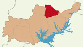
Sincik District
Sincik District is a district of Adıyaman Province of Turkey. Its seat is the town Sincik.[1] Its area is 495 km2,[2] and its population is 16,341 (2021).[3]
Sincik District | |
|---|---|
 Map showing Sincik District in Adıyaman Province | |
 Sincik District Location in Turkey | |
| Coordinates: 38°02′N 38°37′E | |
| Country | Turkey |
| Province | Adıyaman |
| Seat | Sincik |
| Government | |
| • Kaymakam | İbrahim Özkan |
| Area | 495 km2 (191 sq mi) |
| Population (2021) | 16,341 |
| • Density | 33/km2 (86/sq mi) |
| Time zone | TRT (UTC+3) |
The district was established in 1990.[4]
Composition
There are two municipalities in Sincik District:[1][5]
There are 24 villages in Sincik District:[6]
- Aksu (Avêspî)
- Alancık (Lagîn)
- Arıkonak (Qomîk)
- Balkaya (Hecik)
- Çamdere (Palikan)
- Çat
- Çatbahçe (Çavcûk)
- Dilektepe(Kalikan)
- Eskiköy
- Geçitli (Zevîkerê)
- Hasanlı (Hesencûbûr)
- Hüseyinli (Hopan)
- Karaköse (Qereqose)
- Narlı (Pamlî)
- Pınarbaşı (Kiran)
- Sakız (Seqiz)
- Serince (Dud)
- Söğütlübahçe (Sogûtbahçe)
- Subaşı (Serav)
- Şahinbeyler
- Şahkolu (Şahkullî)
- Taşkale (Tixinkar)
- Uğurlu
- Yarpuzlu (Bîrîmşe)
References
- İlçe Belediyesi, Turkey Civil Administration Departments Inventory. Retrieved 12 January 2023.
- "İl ve İlçe Yüz ölçümleri". General Directorate of Mapping. Retrieved 12 January 2023.
- "Address-based population registration system (ADNKS) results dated 31 December 2021" (XLS) (in Turkish). TÜİK. Retrieved 12 January 2023.
- "İl İdaresi ve Mülki Bölümler Şube Müdürlüğü İstatistikleri - İl ve İlçe Kuruluş Tarihleri" (PDF) (in Turkish). p. 3. Retrieved 27 December 2022.
- Belde Belediyesi, Turkey Civil Administration Departments Inventory. Retrieved 15 January 2023.
- Köy, Turkey Civil Administration Departments Inventory. Retrieved 15 January 2023.
- Reşî, Şoreş (September 2002). "Konya - Kolik (Kâhta)". Veger (in Kurdish) (3): 16–17.
This article is issued from Wikipedia. The text is licensed under Creative Commons - Attribution - Sharealike. Additional terms may apply for the media files.
