Sinderen
Sinderen is a village in the municipality of Oude IJsselstreek in the Dutch province of Gelderland. It is situated at the meeting of three roads, to Varsseveld (north), Dinxperlo (south) and Gendringen (south west), and was on the border of the former municipalities of Gendringen and Wisch.
Sinderen | |
|---|---|
 Antonius Chapel | |
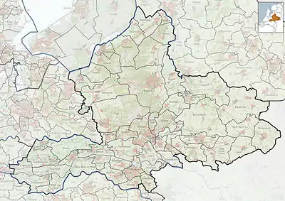 Sinderen Location in the Netherlands  Sinderen Sinderen (Netherlands) | |
| Coordinates: 51°54′16″N 6°27′35″E | |
| Country | Netherlands |
| Province | Gelderland |
| Municipality | Oude IJsselstreek |
| Area | |
| • Total | 17.56 km2 (6.78 sq mi) |
| Elevation | 18 m (59 ft) |
| Population (2021)[1] | |
| • Total | 960 |
| • Density | 55/km2 (140/sq mi) |
| Time zone | UTC+1 (CET) |
| • Summer (DST) | UTC+2 (CEST) |
| Postal code | 7065[1] |
| Dialing code | 0315 |
There used to be a castle in Sinderen. The 12th-century Antonius Chapel survives. The meadow in front of the farm "D'n Huusboer" is surrounded by what was the castle moat, and the remains of underground vaults from the castle can also be found there. To the north of the village, a Reformed church was built between 1884 and 1887. It is now affiliated with the Protestant Church in the Netherlands and called the Keurhorster Church.
References
- "Kerncijfers wijken en buurten 2021". Central Bureau of Statistics. Retrieved 24 March 2022.
Two entries
- "Postcodetool for 7065AA". Actueel Hoogtebestand Nederland (in Dutch). Het Waterschapshuis. Retrieved 24 March 2022.
External links
- Sinderens Belang, village website (in Dutch)
This article is issued from Wikipedia. The text is licensed under Creative Commons - Attribution - Sharealike. Additional terms may apply for the media files.