Sinpyong County
Sinp'yŏng County is a county in North Hwanghae province, North Korea. The Mannyon mine is located at Mannyon-rodongjagu.
Sinp'yŏng County
신평군 | |
|---|---|
| Korean transcription(s) | |
| • Hanja | 新坪郡 |
| • McCune-Reischauer | Sinp‘yŏng-gun |
| • Revised Romanization | Sinpyeong-gun |
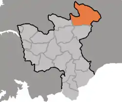 Map of North Hwanghae showing the location of Sinpyong | |
| Country | North Korea |
| Province | North Hwanghae Province |
| Area | |
| • Total | 1,075 km2 (415 sq mi) |
| Population (2008[1]) | |
| • Total | 63,727 |
| • Density | 59/km2 (150/sq mi) |
Administrative divisions
Sinp'yŏng county is divided into 1 ŭp (town), 2 rodongjagu (workers' districts) and 11 ri (villages):
|
|
Transportation
Sinpyong County has a trolleybus line in Mannyon-rodongjagu.[2] The line closed in early 2000s and has been partially dismantled since then, but still has a complete network of poles on the south side of the road.[3]
References
- North Korea: Administrative Division
- "북한지역정보넷". www.cybernk.net. Retrieved 2021-01-24.
- "Mannyŏng-rodongjagu". transphoto.org. Retrieved 2021-03-16.

This article is issued from Wikipedia. The text is licensed under Creative Commons - Attribution - Sharealike. Additional terms may apply for the media files.