Sir, Jenin
Sir (Arabic: صير) is a Palestinian town in the Jenin Governorate of Palestine, in the West Bank, located 18 kilometers south of Jenin. According to the Palestinian Central Bureau of Statistics, the town had a population of 769 inhabitants in mid-year 2006 and 857 by 2017.[1][3]
Sir | |
|---|---|
| Arabic transcription(s) | |
| • Arabic | صير |
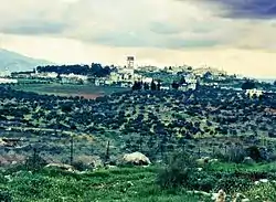 Sir in the winter | |
 Sir Location of Sir within Palestine | |
| Coordinates: 32°21′49″N 35°18′52″E | |
| Palestine grid | 179/196 |
| State | State of Palestine |
| Governorate | Jenin |
| Government | |
| • Type | Village council |
| Population (2017)[1] | |
| • Total | 857 |
| Name meaning | The fold[2] |
Location
Sir is located on the southern part of Marj Sanur, together with Meithalun.[4]
History

SWP noted: "The ruin west of the village has the appearance of an ancient site. Foundations, cisterns cut in the rock, and heaps of stones among bushes."[5]
Pottery sherds from the Persian,[6] early and late Roman,[6] and Byzantine[6][7] eras have been found here.
Sir is identified with Kfar Zir (Hebrew: כפר ציר), mentioned in the 6th-7th century Mosaic of Reḥob as a Jewish village in the region of Sebastia inhabited mostly by non-Jews and, therefore, agricultural produce obtained from the area could be taken by Jews without the normal restrictions imposed during the Sabbatical years, or the need for tithing.[8]
A Crusader estate named Casale Syrorum, whose rights were affirmed in the year 1165/1166 CE by Amalric of Jerusalem, was located here.[9][10]
Ottoman era
Sir, like the rest of Palestine, was incorporated into the Ottoman Empire in 1517, and in the census of 1596 it was a part of the nahiya ("subdistrict") of Jabal Sami which was under the administration of the Nablus Sanjak. The village had a population of 31 households and 4 bachelors, all Muslim. The villagers paid a fixed tax-rate of 33,3% on agricultural products, such as wheat, barley, summer crops, olive trees, beehives and/or goats, in addition to occasional revenues, a tax for people of liwa Nablus, and a press for olive oil or grape syrup; a total of 7,832 akçe.[11]
In 1870, Victor Guérin noted it as a small village on a high hill. There were many cisterns and tombs cut out from the rock, which convinced Guérin that the place was ancient. The inhabitant, which numbered 150, had a mosque.[12]
In 1882, the PEF's Survey of Western Palestine (SWP) described Sir as: "A small village on a knoll amid brushwood, with a large house on the west."[13]
British Mandate era
In the 1922 census of Palestine, conducted by the British Mandate authorities, Sir had 194 Muslims inhabitants,[14] increasing in the 1931 census to 233; 2 Christians and 231 Muslims, in a total of 42 houses.[15]
In the 1945 statistics the population of Sir was 290, all Muslims,[16] with 12,499 dunams of land, according to an official land and population survey.[17] Of this, 1,908 dunams were used for plantations and irrigable land, 6,045 dunams for cereals,[18] while 10 dunams were built-up (urban) land and 4,536 dunams were classified as "non-cultivable".[19]
Jordanian era
In the wake of the 1948 Arab–Israeli War, and after the 1949 Armistice Agreements, Sir came under Jordanian rule.
The Jordanian census of 1961 found 470 inhabitants.[20]
Post-1967
Since the Six-Day War in 1967, Sir has been under Israeli occupation.
References
- Preliminary Results of the Population, Housing and Establishments Census, 2017 (PDF). Palestinian Central Bureau of Statistics (PCBS) (Report). State of Palestine. February 2018. pp. 64–82. Retrieved 2023-10-24.
- Palmer, 1881, p. 207
- Projected Mid -Year Population for Jenin Governorate by Locality 2004- 2006 Archived 2008-09-20 at the Wayback Machine Palestinian Central Bureau of Statistics
- Saulcy, 1854, vol 1, p. 87
- Conder and Kitchener, 1882, SWP II, p. 245
- Zertal, 2007, p. 147
- Dauphin, 1998, pp. 757-8
- Zertal, Adam (2007). The Manasseh Hill Country Survey. Volume 2, The Eastern Valleys and the Fringes of the Desert. Leiden: Brill. p. 105. ISBN 978-90-474-2387-4. OCLC 310354878.
During the Middle Ages a fortress named Casale Syrorum stood here. The name and the finds support the identification of Sir with כפרציר from the Rehov Inscription (line 27); see previous site
- Röhricht, 1904, RRH Ad, pp. 25 -26, #422a
- Zertal, 2007, p. 146
- Hütteroth and Abdulfattah, 1977, p. 125
- Guérin, 1874, p. 353
- Conder and Kitchener, 1882, SWP II, p. 228
- Barron, 1923, Table IX, Sub-district of Jenin, p. 29
- Mills, 1932, p. 71
- Government of Palestine, Department of Statistics, 1945, p. 17
- Government of Palestine, Department of Statistics. Village Statistics, April, 1945. Quoted in Hadawi, 1970, p. 55
- Government of Palestine, Department of Statistics. Village Statistics, April, 1945. Quoted in Hadawi, 1970, p. 99
- Government of Palestine, Department of Statistics. Village Statistics, April, 1945. Quoted in Hadawi, 1970, p. 149
- Government of Jordan, Department of Statistics, 1964, p. 25
Bibliography
- Barron, J.B., ed. (1923). Palestine: Report and General Abstracts of the Census of 1922. Government of Palestine.
- Conder, C.R.; Kitchener, H.H. (1882). The Survey of Western Palestine: Memoirs of the Topography, Orography, Hydrography, and Archaeology. Vol. 2. London: Committee of the Palestine Exploration Fund.
- Dauphin, C. (1998). La Palestine byzantine, Peuplement et Populations. BAR International Series 726 (in French). Vol. III : Catalogue. Oxford: Archeopress. ISBN 0-860549-05-4.
- Government of Jordan, Department of Statistics (1964). First Census of Population and Housing. Volume I: Final Tables; General Characteristics of the Population (PDF).
- Government of Palestine, Department of Statistics (1945). Village Statistics, April, 1945.
- Guérin, V. (1874). Description Géographique Historique et Archéologique de la Palestine (in French). Vol. 2: Samarie, pt. 1. Paris: L'Imprimerie Nationale.
- Hadawi, S. (1970). Village Statistics of 1945: A Classification of Land and Area ownership in Palestine. Palestine Liberation Organization Research Center.
- Hütteroth, Wolf-Dieter; Abdulfattah, Kamal (1977). Historical Geography of Palestine, Transjordan and Southern Syria in the Late 16th Century. Erlanger Geographische Arbeiten, Sonderband 5. Erlangen, Germany: Vorstand der Fränkischen Geographischen Gesellschaft. ISBN 3-920405-41-2.
- Mills, E., ed. (1932). Census of Palestine 1931. Population of Villages, Towns and Administrative Areas. Jerusalem: Government of Palestine.
- Palmer, E.H. (1881). The Survey of Western Palestine: Arabic and English Name Lists Collected During the Survey by Lieutenants Conder and Kitchener, R. E. Transliterated and Explained by E.H. Palmer. Committee of the Palestine Exploration Fund.
- Röhricht, R. (1904). (RRH Ad) Regesta regni Hierosolymitani Additamentum (in Latin). Berlin: Libraria Academica Wageriana.
- Saulcy, L.F. de (1854). Narrative of a journey round the Dead Sea, and in the Bible lands, in 1850 and 1851. Vol. 1, new edition. London: R. Bentley.
- Zertal, A. (2007). The Manasseh Hill Country Survey. Vol. 2. Boston: BRILL. ISBN 978-9004163690.
External links
- Welcome To Sir
- Sir, Welcome to Palestine
- Survey of Western Palestine, Map 12: IAA, Wikimedia commons
| Cities |  | |
|---|---|---|
| Municipalities |
| |
| Villages |
| |
| Refugee camps | ||