Soavinandriana (district)
Soavinandriana district is a district[2][3] of Itasy in Madagascar.
Soavinandriana district | |
|---|---|
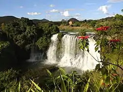
 The Analavory geyser | |
 Soavinandriana district | |
| Coordinates: 19°10′S 46°44′E | |
| Country | |
| Region | Itasy |
| District | Soavinandriana |
| Area | |
| • Land | 1,970 km2 (760 sq mi) |
| Elevation | 1,298 m (4,259 ft) |
| Population | |
| • Ethnicities | Merina |
| Time zone | UTC3 (EAT) |
| Postal code | 118 |
Economy
Tobacco is an important factor of the local economy.[4]
Roads
It is localized on the National Road 43, about 40 km from Analavory and 140 km from the capital Antananarivo.
Nature
The Ramanavy forest (Forêt de Ramanavy, or translated: Bats Forest) at 10km from Soavinandriana, that hosts some 20 endemic species of plants.[5]
Rivers

Lily waterfalls near Ampefy
The district counts 17 rivers and 20 creeks, including the Kelimahery, Mangadona and the Lily Rivers that forms also the Lily falls near Ampefy. Furthermore it borders to the Lake Itasy in the North.
Communes
The district is further divided into 15 communes:
References
- LE TOURISME DURABLE PAR LA VALORISATION DU PATRIMOINE - Cas de la Commune Rurale de MANANASY, District de Soavinandriana
- REPOBLIKAN’I MADAGASIKARA:Tanindrazana – Fahafahana – Fandrosoana (PDF). MINISTERE DE L’AGRICULTURE, DE L’ELEVAGE ET DE LA PECHE. October 2007. pp. 42–44.
- "Madagascar: Administrative Division". citypopulation. Retrieved 10 June 2018.
- La prépondérance de la culture commerciale des tabacs Marylands dit “Paraky gasy” dans la Commune Rurale de Talata-Dondona, District de Soavinandriana, Région Itasy
- Midi-Madagasikara: Destination Itasy - De nombreux circuits touristiques à découvrir
This article is issued from Wikipedia. The text is licensed under Creative Commons - Attribution - Sharealike. Additional terms may apply for the media files.
